
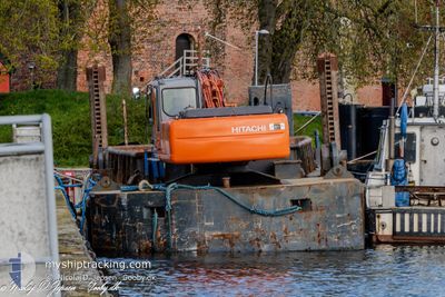
KRIS
Dredging or underwater ops
Current Trip
| Trip Time | 2 h, 11 mins |
|---|---|
| Trip Distance | 3.72 nm |
| AVG Speed | 5.3 Knots |
| MAX Speed | 5.5 Knots |
| Dybgang | --- |
| AVG Wind | 13.6 knots |
| MAX Wind | 14.9 knots |
| MIN Temp | 7.6°C / 45.68°F |
| MAX Temp | 8.1°C / 46.58°F |
| Position Modtaget | 26 m siden |
Current Position
| Longitude | 11.13781° |
|---|---|
| Latitude | 55.33285° |
| Status | Default |
| Fart | |
| Kurs | 219° |
| Område | Kattegat |
| Station | T-AIS |
| Position Modtaget | 26 m siden |
Info
Information
The current position of KRIS is in Kattegat with coordinates 55.33285° / 11.13781° as reported on 2024-04-30 17:25 by AIS to our vessel tracker app. The vessel's current speed is 0 Knots and is currently inside the port of KORSOR.
The vessel KRIS (MMSI: 219021419) is a Dredging or underwater ops It's sailing under the flag of [DK] Denmark.
In this page you can find informations about the vessels current position, last detected port calls, and current voyage information. If the vessels is not in coverage by AIS you will find the latest position.
The current position of KRIS is detected by our AIS receivers and we are not responsible for the reliability of the data. The last position was recorded while the vessel was in Coverage by the Ais receivers of our vessel tracking app.
Weather
| Temperature | 12.3°C / 54.14°F |
|---|---|
| Wind Speed | 15 knots |
| Direction | 98° E |
| Pressure | 1018.5 hPa |
| Humidity | 75.3 % |
| Cloud Coverage | 78 % |
Featured Company
Events
| Tid | Hændelsen | Detaljer | Position / Dest | Info |
|---|---|---|---|---|
| 2024-04-30 17:05 | Indenfor Dækning |
55.33285 / 11.13781
Kattegat
[DK] KORSOR
|
Fart: Kurs: 219.2° |
|
| 2024-04-30 16:05 | Udenfor Dækning |
55.33285 / 11.13779
Kattegat
[DK] KORSOR
|
Fart: 0.1 kn Kurs: 219.2° |
|
| 2024-04-30 10:53 | STOP Sejllads |
55.33286 / 11.13779
[DK] KORSOR
|
Fart: Kurs: 238° |
|
| 2024-04-30 10:42 | Indenfor Dækning |
55.33530 / 11.13559
Kattegat
[DK] KORSOR
|
Fart: 2.7 kn Kurs: 90° |
|
| 2024-04-30 08:50 | Udenfor Dækning |
55.33502 / 11.13305
Kattegat
[DK] KORSOR
|
Fart: 3.2 kn Kurs: 257.7° |
|
| 2024-04-30 08:47 | START Sejllads |
55.33514 / 11.13744
[DK] KORSOR
|
Fart: 3.2 kn Kurs: 298° |
|
| 2024-04-30 08:33 | Indenfor Dækning |
55.33266 / 11.13789
Kattegat
[DK] KORSOR
|
Fart: Kurs: 304.6° |
|
| 2024-04-30 06:06 | Udenfor Dækning |
55.33468 / 11.13149
Kattegat
[DK] KORSOR
|
Fart: 5 kn Kurs: 255.8° |
|
| 2024-04-30 06:05 | Indenfor Dækning |
55.33468 / 11.13149
Kattegat
[DK] KORSOR
|
Fart: 5 kn Kurs: 255.8° |
|
| 2024-04-29 22:02 | Udenfor Dækning |
55.33285 / 11.13778
Kattegat
[DK] KORSOR
|
Fart: Kurs: 196.7° |