
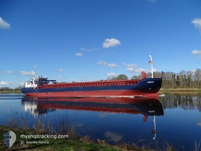
KREETE
General Cargo
Current Trip
| Time Travelled | 15 h, 29 mins |
|---|---|
| Remaining Time | 17 h, 10 mins |
| Distance Travelled | 160.53 nm |
| Remaining Distance | 187.62 nm |
| AVG Speed | 10.5 Knots |
| MAX Speed | 11 Knots |
| AVG Wind | 13.1 knots |
| MAX Wind | 17 knots |
| MIN Temp | 7.1°C / 44.78°F |
| MAX Temp | 9°C / 48.2°F |
| Dybgang | 5.6 m |
| Position Modtaget | Nu |
Current Position
| Longitude | 16.32803° |
|---|---|
| Latitude | 55.61446° |
| Status | Under way using engine |
| Fart | 11 Knots |
| Kurs | 259.4° |
| Område | Baltic Sea |
| Station | T-AIS |
| Position Modtaget | Nu |
Info
Information
The current position of KREETE is in Baltic Sea with coordinates 55.61446° / 16.32803° as reported on 2024-04-28 15:09 by AIS to our vessel tracker app. The vessel's current speed is 11 Knots and is heading at the port of ROSTOCK. The estimated time of arrival as calculated by MyShipTracking vessel tracking app is 2024-04-29 08:20 LT
The vessel KREETE (IMO: 9279408, MMSI: 305967000) is a General Cargo that was built in 2003 ( 21 år gamle ). It's sailing under the flag of [AG] Antigua Barbuda.
In this page you can find informations about the vessels current position, last detected port calls, and current voyage information. If the vessels is not in coverage by AIS you will find the latest position.
The current position of KREETE is detected by our AIS receivers and we are not responsible for the reliability of the data. The last position was recorded while the vessel was in Coverage by the Ais receivers of our vessel tracking app.
The current draught of KREETE as reported by AIS is 5.6 meters
Weather
| Temperature | 8.8°C / 47.84°F |
|---|---|
| Wind Speed | 13 knots |
| Direction | 122° ESE |
| Pressure | 1016.6 hPa |
| Humidity | 80.5 % |
| Cloud Coverage | 95 % |
Featured Company
Last Port Calls
| Port | Arrival | Departure | Time In Port |
|---|---|---|---|
| 2024-04-27 08:28 | 2024-04-27 23:41 | 15 h | |
| 2024-04-26 07:28 | 2024-04-26 16:01 | 8 h | |
| 2024-04-24 06:57 | 2024-04-25 12:34 | 1 d | |
| 2024-04-21 13:04 | 2024-04-23 13:42 | 2 d | |
| 2024-04-16 17:27 | 2024-04-18 07:28 | 1 d | |
| 2024-04-13 06:40 | 2024-04-14 11:44 | 1 d | |
| 2024-04-10 08:04 | 2024-04-11 14:45 | 1 d | |
| 2024-04-06 06:09 | 2024-04-09 17:03 | 3 d | |
| 2024-04-02 09:34 | 2024-04-04 04:41 | 1 d | |
| 2024-03-28 15:20 | 2024-03-30 08:42 | 1 d |
Last Trips
| Origin | Departure | Destination | Arrival | Distance | |
|---|---|---|---|---|---|
| 2024-04-26 18:01 | 2024-04-27 11:28 | 174.92 nm | |||
| 2024-04-25 14:34 | 2024-04-26 09:28 | 186.52 nm | |||
| 2024-04-23 15:42 | 2024-04-24 08:57 | 158.33 nm | |||
| 2024-04-18 09:28 | 2024-04-21 15:04 | 172.03 nm | |||
| 2024-04-14 14:44 | 2024-04-16 19:27 | 455.67 nm | |||
| 2024-04-11 16:45 | 2024-04-13 09:40 | 428.51 nm | |||
| 2024-04-09 19:03 | 2024-04-10 10:04 | 153.52 nm | |||
| 2024-04-04 06:41 | 2024-04-06 08:09 | 177.37 nm | |||
| 2024-03-30 11:42 | 2024-04-02 11:34 | 708.65 nm | |||
| 2024-03-22 23:04 | 2024-03-28 18:20 | 875.78 nm |
Events
| Tid | Hændelsen | Detaljer | Position / Dest | Info |
|---|---|---|---|---|
| 2024-04-28 13:24 | ETA er ændret | 2024/04/29 09:00 2024/04/29 11:00 |
55.67324 / 16.88507
DE RSK
|
Fart: 10.8 kn Kurs: 258.6° |
| 2024-04-28 12:44 | Status er ændret | Under way using engine Default |
55.69429 / 17.09023
DE RSK
|
Fart: 10.9 kn Kurs: 261° |
| 2024-04-28 12:36 | Status er ændret | Default Under way using engine |
55.69828 / 17.13341
DE RSK
|
Fart: 10.9 kn Kurs: 260.4° |
| 2024-04-28 12:30 | Status er ændret | Under way using engine Default |
55.70145 / 17.16863
DE RSK
|
Fart: 10.8 kn Kurs: 261° |
| 2024-04-28 12:24 | Status er ændret | Default Under way using engine |
55.70393 / 17.19598
DE RSK
|
Fart: 10.8 kn Kurs: 261.1° |
| 2024-04-28 12:24 | Status er ændret | Under way using engine Default |
55.70408 / 17.19773
DE RSK
|
Fart: 10.8 kn Kurs: 261° |
| 2024-04-28 12:24 | Fundet i havområde | Swedish part of the Baltic Sea |
55.70408 / 17.19773
Baltic Sea
DE RSK
|
Fart: 10.8 kn Kurs: 261.1° |
| 2024-04-28 12:16 | Indenfor Dækning |
55.70408 / 17.19773
Baltic Sea
DE RSK
|
Fart: 10.8 kn Kurs: 261.1° |
|
| 2024-04-28 09:53 | Status er ændret | Default Under way using engine |
55.77419 / 17.99025
DE RSK
|
Fart: 10.7 kn Kurs: 262.4° |
| 2024-04-28 09:51 | Udenfor Dækning |
55.77476 / 17.99728
Baltic Sea
DE RSK
|
Fart: 10.7 kn Kurs: 262.4° |