
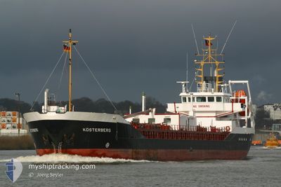
KOESTERBERG
Oil Products Tanker
Current Trip
JAMAICA
| Time Travelled | 3 days |
|---|---|
| Remaining Time | --- |
| Distance Travelled | 13.28 nm |
| Remaining Distance | --- |
| AVG Speed | 3.2 Knots |
| MAX Speed | 3.2 Knots |
| AVG Wind | 2.9 knots |
| MAX Wind | 5 knots |
| MIN Temp | 21.3°C / 70.34°F |
| MAX Temp | 31.6°C / 88.88°F |
| Dybgang | 5 m |
| Position Modtaget | 7 d siden |
Current Position
| Longitude | -76.84473° |
|---|---|
| Latitude | 17.96223° |
| Status | Under way using engine |
| Fart | 6 Knots |
| Kurs | 44° |
| Område | Caribbean Sea |
| Station | T-AIS |
| Position Modtaget | 7 d siden |
Info
Information
The current position of KOESTERBERG is in Caribbean Sea with coordinates 17.96223° / -76.84473° as reported on 2024-04-22 16:52 by AIS to our vessel tracker app. The vessel's current speed is 6 Knots
The vessel KOESTERBERG (IMO: 9184677, MMSI: 339301180) is a Oil Products Tanker that was built in 1998 ( 26 år gamle ). It's sailing under the flag of [JM] Jamaica.
In this page you can find informations about the vessels current position, last detected port calls, and current voyage information. If the vessels is not in coverage by AIS you will find the latest position.
The current position of KOESTERBERG is detected by our AIS receivers and we are not responsible for the reliability of the data. The last position was recorded while the vessel was in Coverage by the Ais receivers of our vessel tracking app.
The current draught of KOESTERBERG as reported by AIS is 5 meters
Weather
| Temperature | 21.3°C / 70.34°F |
|---|---|
| Wind Speed | 2 knots |
| Direction | 54° NE |
| Pressure | 1013.9 hPa |
| Humidity | 88.8 % |
| Cloud Coverage | --- |
Featured Company
Last Port Calls
| Port | Arrival | Departure | Time In Port |
|---|---|---|---|
| 2024-04-26 21:10 | 2024-04-26 21:22 | 12 m | |
| 2024-04-26 12:30 | 2024-04-26 12:42 | 12 m | |
| 2024-04-24 23:34 | 2024-04-24 23:50 | 16 m | |
| 2024-04-23 20:01 | 2024-04-24 13:46 | 17 h | |
| 2024-04-23 03:10 | 2024-04-23 03:22 | 12 m | |
| 2024-04-22 16:58 | 2024-04-22 17:14 | 16 m | |
| 2024-04-22 09:18 | 2024-04-22 09:34 | 15 m | |
| 2024-04-15 13:40 | 2024-04-18 16:38 | 3 d | |
| 2024-04-15 03:16 | 2024-04-15 03:27 | 11 m | |
| 2024-04-12 23:44 | 2024-04-13 09:36 | 9 h |
Most Visited Ports (Last year)
| Port | Arrivals | |
|---|---|---|
| 88 | ||
| 30 | ||
| 18 | ||
| 9 | ||
| 1 |
Last Trips
| Origin | Departure | Destination | Arrival | Distance | |
|---|---|---|---|---|---|
| 2024-04-26 07:42 | 2024-04-26 16:10 | 19.77 nm | |||
| 2024-04-24 18:50 | 2024-04-26 07:30 | 8.64 nm | |||
| 2024-04-24 08:46 | 2024-04-24 18:34 | 44.18 nm | |||
| 2024-04-22 22:22 | 2024-04-23 15:01 | 30.70 nm | |||
| 2024-04-22 12:14 | 2024-04-22 22:10 | 5.60 nm | |||
| 2024-04-22 04:34 | 2024-04-22 11:58 | 20.19 nm | |||
| 2024-04-18 11:38 | 2024-04-22 04:18 | 56.19 nm | |||
| 2024-04-14 22:27 | 2024-04-15 08:40 | 31.20 nm | |||
| 2024-04-13 04:36 | 2024-04-14 22:16 | 18.98 nm | |||
| 2024-04-05 21:27 | 2024-04-12 18:44 | 42.35 nm |
Events
| Tid | Hændelsen | Detaljer | Position / Dest | Info |
|---|---|---|---|---|
| 2024-04-27 05:14 | STOP Sejllads | 0.7 nm, South East of KINGSTON (JM) |
17.95495 / -76.80067
JAMAICA
|
Fart: 0.3 kn Kurs: 94° |
| 2024-04-27 05:02 | START Sejllads | 0.37 nm, South of KINGSTON (JM) |
17.95815 / -76.80850
JAMAICA
|
Fart: 3.1 kn Kurs: -1° |
| 2024-04-26 21:38 | STOP Sejllads | 0.66 nm, South East of KINGSTON (JM) |
17.95563 / -76.80077
JAMAICA
|
Fart: 0.1 kn Kurs: -1° |
| 2024-04-26 21:22 | Afsejlet fra sidste havn |
|
17.96143 / -76.81129
JAMAICA
|
Fart: 5.9 kn Kurs: -1° |
| 2024-04-26 21:10 | Skibe i havn |
|
17.96858 / -76.83054
[JM] KINGSTON (JM)
|
Fart: 6.9 kn Kurs: 65° |
| 2024-04-26 19:42 | START Sejllads | 5.37 nm, South East of PORT ROYAL |
17.86563 / -76.79022
JAMAICA
|
Fart: 3.8 kn Kurs: 15° |
| 2024-04-26 14:30 | STOP Sejllads | 4.81 nm, South of PORT ROYAL |
17.86552 / -76.81112
JAMAICA
|
Fart: 0.3 kn Kurs: -1° |
| 2024-04-26 12:42 | Afsejlet fra sidste havn |
|
17.96445 / -76.84116
JAMAICA
|
Fart: 6.1 kn Kurs: -1° |
| 2024-04-26 12:30 | Skibe i havn |
|
17.96635 / -76.82117
[JM] KINGSTON (JM)
|
Fart: 6.1 kn Kurs: 302° |
| 2024-04-26 12:06 | START Sejllads | 1.53 nm, East of KINGSTON (JM) |
17.95568 / -76.78284
JAMAICA
|
Fart: 3.9 kn Kurs: -1° |