
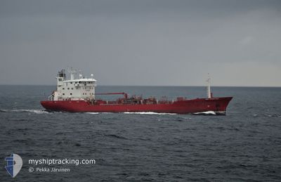
KEY FIGHTER
Oil/Chemical Tanker
Current Trip
| Time Travelled | 1 day |
|---|---|
| Remaining Time | 23 h, 21 mins |
| Distance Travelled | 375.54 nm |
| Remaining Distance | 325.56 nm |
| AVG Speed | 12.6 Knots |
| MAX Speed | 14.9 Knots |
| AVG Wind | 8.4 knots |
| MAX Wind | 12 knots |
| MIN Temp | 6.5°C / 43.7°F |
| MAX Temp | 11.2°C / 52.16°F |
| Dybgang | 6.4 m |
| Position Modtaget | 1 m siden |
Current Position
| Longitude | 12.30978° |
|---|---|
| Latitude | 56.45798° |
| Status | Under way using engine |
| Fart | 13 Knots |
| Kurs | 346.8° |
| Område | Kattegat |
| Station | T-AIS |
| Position Modtaget | 1 m siden |
Info
Information
The current position of KEY FIGHTER is in Kattegat with coordinates 56.45798° / 12.30978° as reported on 2024-05-13 04:37 by AIS to our vessel tracker app. The vessel's current speed is 13 Knots and is heading at the port of STAVANGER. The estimated time of arrival as calculated by MyShipTracking vessel tracking app is 2024-05-14 04:00 LT
The vessel KEY FIGHTER (IMO: 8712166, MMSI: 215211000) is a Oil/Chemical Tanker that was built in 1989 ( 35 år gamle ). It's sailing under the flag of [MT] Malta.
In this page you can find informations about the vessels current position, last detected port calls, and current voyage information. If the vessels is not in coverage by AIS you will find the latest position.
The current position of KEY FIGHTER is detected by our AIS receivers and we are not responsible for the reliability of the data. The last position was recorded while the vessel was in Coverage by the Ais receivers of our vessel tracking app.
The current draught of KEY FIGHTER as reported by AIS is 6.4 meters
Weather
| Temperature | 10.9°C / 51.62°F |
|---|---|
| Wind Speed | 12 knots |
| Direction | 130° SE |
| Pressure | 1022.1 hPa |
| Humidity | 59.3 % |
| Cloud Coverage | 63 % |
Featured Company
Last Port Calls
| Port | Arrival | Departure | Time In Port |
|---|---|---|---|
| 2024-05-10 21:55 | 2024-05-11 23:02 | 1 d | |
| 2024-05-08 08:03 | 2024-05-09 08:13 | 1 d | |
| 2024-05-04 13:56 | 2024-05-05 18:19 | 1 d | |
| 2024-05-01 20:45 | 2024-05-02 12:20 | 15 h | |
| 2024-04-29 11:48 | 2024-04-30 08:12 | 20 h | |
| 2024-04-26 20:40 | 2024-04-27 03:42 | 7 h | |
| 2024-04-22 21:45 | 2024-04-23 21:23 | 23 h | |
| 2024-04-15 09:16 | 2024-04-16 05:34 | 20 h | |
| 2024-04-10 09:47 | 2024-04-11 22:00 | 1 d | |
| 2024-04-06 07:55 | 2024-04-06 22:56 | 15 h |
Last Trips
| Origin | Departure | Destination | Arrival | Distance | |
|---|---|---|---|---|---|
| 2024-05-09 10:13 | 2024-05-11 00:55 | 500.00 nm | |||
| 2024-05-05 20:19 | 2024-05-08 10:03 | 648.32 nm | |||
| 2024-05-02 14:20 | 2024-05-04 15:56 | 625.12 nm | |||
| 2024-04-30 11:12 | 2024-05-01 22:45 | 480.13 nm | |||
| 2024-04-27 05:42 | 2024-04-29 14:48 | 726.59 nm | |||
| 2024-04-24 00:23 | 2024-04-26 22:40 | 719.46 nm | |||
| 2024-04-16 07:34 | 2024-04-23 00:45 | 1060.09 nm | |||
| 2024-04-12 01:00 | 2024-04-15 11:16 | 1022.47 nm | |||
| 2024-04-06 23:56 | 2024-04-10 12:47 | 1022.83 nm | |||
| 2024-04-02 21:00 | 2024-04-06 08:55 | 637.96 nm |
Events
| Tid | Hændelsen | Detaljer | Position / Dest | Info |
|---|---|---|---|---|
| 2024-05-13 03:20 | Ændre havområde | Swedish part of the Kattegat Danish part of the Kattegat |
56.18019 / 12.43388
Kattegat
NO SVG
|
Fart: 13.8 kn Kurs: 340.7° |
| 2024-05-13 02:53 | Ændre havområde | Danish part of the Kattegat Swedish part of the Kattegat |
56.10218 / 12.56853
Kattegat
NO SVG
|
Fart: 15 kn Kurs: 313.5° |
| 2024-05-12 23:23 | Ændre havområde | Swedish part of the Kattegat Danish part of the Kattegat |
55.50356 / 12.72006
Kattegat
NO SVG
|
Fart: 7.7 kn Kurs: 43.4° |
| 2024-05-12 23:17 | Ændre havområde | Danish part of the Kattegat Swedish part of the Kattegat |
55.48806 / 12.71309
Kattegat
NO SVG
|
Fart: 11.3 kn Kurs: 9.5° |
| 2024-05-12 22:35 | Ændre havområde | Swedish part of the Kattegat Swedish part of the Baltic Sea |
55.33947 / 12.66636
Kattegat
NO SVG
|
Fart: 13 kn Kurs: 8.9° |
| 2024-05-12 16:29 | Ændre havområde | Swedish part of the Baltic Sea Danish part of the Kattegat |
55.50214 / 14.74869
Baltic Sea
NO SVG
|
Fart: 12.8 kn Kurs: 242.6° |
| 2024-05-12 15:02 | Ændre havområde | Danish part of the Kattegat Swedish part of the Baltic Sea |
55.63784 / 15.24754
Kattegat
NO SVG
|
Fart: 13 kn Kurs: 250.6° |
| 2024-05-12 11:47 | START Sejllads |
55.76812 / 16.44439
NO SVG
|
Fart: 6.5 kn Kurs: 273.3° |
|
| 2024-05-12 11:42 | STOP Sejllads |
55.76770 / 16.44775
NO SVG
|
Fart: 0.3 kn Kurs: 271° |
|
| 2024-05-12 09:34 | Status er ændret | Under way using engine Default |
55.75427 / 17.11988
NO SVG
|
Fart: 12.8 kn Kurs: 273° |