
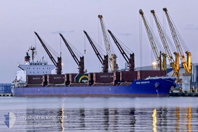
KEN MOONYS
Cargo
Current Trip
| Time Travelled | 6 days |
|---|---|
| Remaining Time | --- |
| Distance Travelled | 876.47 nm |
| Remaining Distance | --- |
| AVG Speed | 11.2 Knots |
| MAX Speed | 16.1 Knots |
| AVG Wind | 11.1 knots |
| MAX Wind | 18.8 knots |
| MIN Temp | 13.5°C / 56.3°F |
| MAX Temp | 23.3°C / 73.94°F |
| Dybgang | 8.4 m |
| Position Modtaget | 12 d siden |
Current Position
| Longitude | 130.50170° |
|---|---|
| Latitude | 34.27973° |
| Status | Under way using engine |
| Fart | 8.6 Knots |
| Kurs | 137.9° |
| Område | Japan Sea |
| Station | T-AIS |
| Position Modtaget | 12 d siden |
Info
Information
The current position of KEN MOONYS is in Japan Sea with coordinates 34.27973° / 130.50170° as reported on 2024-04-19 23:06 by AIS to our vessel tracker app. The vessel's current speed is 8.6 Knots and is heading at the port of SAGANOSEKI.
The vessel KEN MOONYS (IMO: 9748382, MMSI: 636017305) is a Cargo It's sailing under the flag of [LR] Liberia.
In this page you can find informations about the vessels current position, last detected port calls, and current voyage information. If the vessels is not in coverage by AIS you will find the latest position.
The current position of KEN MOONYS is detected by our AIS receivers and we are not responsible for the reliability of the data. The last position was recorded while the vessel was in Coverage by the Ais receivers of our vessel tracking app.
The current draught of KEN MOONYS as reported by AIS is 8.4 meters
Weather
| Temperature | 15.3°C / 59.54°F |
|---|---|
| Wind Speed | 9 knots |
| Direction | 93° E |
| Pressure | 1018.7 hPa |
| Humidity | 88.1 % |
| Cloud Coverage | 27 % |
Featured Company
Last Port Calls
| Port | Arrival | Departure | Time In Port |
|---|---|---|---|
| 2024-04-25 01:50 | 2024-04-26 02:37 | 1 d | |
| 2024-04-21 23:15 | 2024-04-24 05:12 | 2 d | |
| 2024-04-15 07:56 | 2024-04-16 11:59 | 1 d |
Most Visited Ports (Last year)
| Port | Arrivals | |
|---|---|---|
| 2 | ||
| 2 | ||
| 1 | ||
| 1 | ||
| 1 | ||
| 1 |
Last Trips
| Origin | Departure | Destination | Arrival | Distance | |
|---|---|---|---|---|---|
| 2024-04-24 14:12 | 2024-04-25 10:50 | 136.57 nm | |||
| 2024-04-16 19:59 | 2024-04-22 08:15 | 720.77 nm |
Events
| Tid | Hændelsen | Detaljer | Position / Dest | Info |
|---|---|---|---|---|
| 2024-05-01 01:19 | STOP Sejllads | 11.2 nm, North East of JINTANG |
30.15138 / 122.03563
JP SAG
|
Fart: 0.1 kn Kurs: 95° |
| 2024-05-01 00:40 | START Sejllads | 10.51 nm, North East of JINTANG |
30.16006 / 122.01438
JP SAG
|
Fart: 3.9 kn Kurs: 94° |
| 2024-04-30 03:52 | STOP Sejllads | 10.31 nm, North East of JINTANG |
30.15733 / 122.01176
JP SAG
|
Fart: 0.1 kn Kurs: 296° |
| 2024-04-27 20:13 | START Sejllads |
31.26083 / 133.54181
JP SAG
|
Fart: 9.7 kn Kurs: 264° |
|
| 2024-04-27 01:17 | STOP Sejllads |
31.12752 / 133.56966
JP SAG
|
Fart: 0.2 kn Kurs: 218° |
|
| 2024-04-26 02:44 | START Sejllads | 4.6 nm, East of SAIJO |
33.96901 / 133.23366
JP SAG
|
Fart: 6.4 kn Kurs: 338° |
| 2024-04-26 02:37 | Afsejlet fra sidste havn |
|
33.96901 / 133.23366
JP SAG
|
Fart: 0.1 kn Kurs: 83° |
| 2024-04-25 01:50 | STOP Sejllads |
33.95672 / 133.23695
[JP] NIIHAMA
|
Fart: 0.1 kn Kurs: 83° |
|
| 2024-04-25 01:50 | Skibe i havn |
|
33.95672 / 133.23695
[JP] NIIHAMA
|
Fart: 1.3 kn Kurs: 117° |
| 2024-04-24 14:00 | START Sejllads | 8.23 nm, South East of MISAKI |
33.28161 / 132.21890
JP SAG
|
Fart: 6.6 kn Kurs: 249° |