
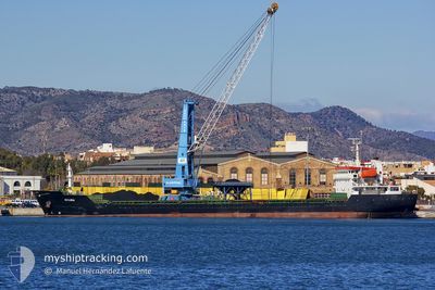
KAAN DEVAL
Bulk Carrier
Current Trip
ORDER
| Time Travelled | 4 days |
|---|---|
| Remaining Time | --- |
| Distance Travelled | 395.36 nm |
| Remaining Distance | --- |
| AVG Speed | 7.3 Knots |
| MAX Speed | 9.3 Knots |
| AVG Wind | 14.2 knots |
| MAX Wind | 20 knots |
| MIN Temp | 13.2°C / 55.76°F |
| MAX Temp | 20.2°C / 68.36°F |
| Dybgang | 4.4 m |
| Position Modtaget | 3 m siden |
Current Position
| Longitude | --- |
|---|---|
| Latitude | --- |
| Status | At anchor |
| Fart | 0.5 Knots |
| Kurs | 173° |
| Område | Mediterranean Sea - Eastern Basin |
| Station | T-AIS |
| Position Modtaget | 3 m siden |
Info
Information
The current position of KAAN DEVAL is in Mediterranean Sea - Eastern Basin with coordinates 32.89509° / 35.00767° as reported on 2025-12-10 00:37 by AIS to our vessel tracker app. The vessel's current speed is 0.5 Knots
The vessel KAAN DEVAL (IMO: 9488499, MMSI: 372103000) is a Bulk Carrier that was built in 2008 ( 17 år gamle ). It's sailing under the flag of [PA] Panama.
In this page you can find informations about the vessels current position, last detected port calls, and current voyage information. If the vessels is not in coverage by AIS you will find the latest position.
The current position of KAAN DEVAL is detected by our AIS receivers and we are not responsible for the reliability of the data. The last position was recorded while the vessel was in Coverage by the Ais receivers of our vessel tracking app.
The current draught of KAAN DEVAL as reported by AIS is 4.4 meters
Weather
| Temperature | 18.3°C / 64.94°F |
|---|---|
| Wind Speed | 15 knots |
| Direction | 197° SSW |
| Pressure | 1012.1 hPa |
| Humidity | 75.6 % |
| Cloud Coverage | 100 % |
Featured Company
Last Port Calls
| Port | Arrival | Departure | Time In Port |
|---|---|---|---|
| 2025-12-04 09:37 | 2025-12-05 18:17 | 1 d | |
| 2025-12-03 07:45 | 2025-12-03 20:36 | 12 h | |
| 2025-11-26 00:10 | 2025-11-27 16:22 | 1 d | |
| 2025-11-18 10:08 | 2025-11-18 17:36 | 7 h | |
| 2025-11-18 06:00 | 2025-11-18 06:36 | 36 m | |
| 2025-11-13 08:08 | 2025-11-14 15:45 | 1 d | |
| 2025-11-08 09:44 | 2025-11-11 05:41 | 2 d |
Last Trips
| Origin | Departure | Destination | Arrival | Distance | |
|---|---|---|---|---|---|
| 2025-12-03 20:36 | 2025-12-04 09:37 | 100.63 nm | |||
| 2025-11-27 16:22 | 2025-12-03 07:45 | 488.73 nm | |||
| 2025-11-18 17:36 | 2025-11-26 00:10 | 428.75 nm | |||
| 2025-11-18 06:36 | 2025-11-18 10:08 | 3.10 nm | |||
| 2025-11-14 15:45 | 2025-11-18 06:00 | 111.14 nm | |||
| 2025-11-11 05:41 | 2025-11-13 08:08 | 463.16 nm | |||
| 2025-09-30 17:07 | 2025-11-08 09:44 | 678.53 nm |
Events
| Tid | Hændelsen | Detaljer | Position / Dest | Info |
|---|---|---|---|---|
| 2025-12-07 15:52 | STOP Sejllads | 3.47 nm, South West of ACRE |
32.89343 / 35.00941
ORDER
|
Fart: 0.2 kn Kurs: 262° |
| 2025-12-07 15:40 | Status er ændret | At anchor Under way using engine |
32.89337 / 35.00720
ORDER
|
Fart: 3.7 kn Kurs: 162° |
| 2025-12-07 13:43 | Fundet i havområde | Israeli part of the Mediterranean Sea - Eastern Basin |
32.92379 / 34.71766
Mediterranean Sea - Eastern Basin
|
Fart: 8.6 kn Kurs: 99.4° |
| 2025-12-07 13:43 | Status er ændret | Under way using engine Default |
32.92412 / 34.71527
ORDER
|
Fart: 8.5 kn Kurs: 100° |
| 2025-12-07 13:34 | Indenfor Dækning |
32.92379 / 34.71766
Mediterranean Sea - Eastern Basin
|
Fart: 8.6 kn Kurs: 99.4° |
|
| 2025-12-06 00:23 | Status er ændret | Default Under way using engine |
35.82500 / 29.63500
ORDER
|
Fart: 7.1 kn Kurs: 133.8° |
| 2025-12-05 23:51 | Udenfor Dækning |
35.86765 / 29.58513
Mediterranean Sea - Eastern Basin
|
Fart: 7.1 kn Kurs: 133.8° |
|
| 2025-12-05 23:48 | Ændre havområde | Greek part of the Mediterranean Sea - Eastern Basin Turkish part of the Mediterranean Sea - Eastern Basin |
35.87248 / 29.57922
Mediterranean Sea - Eastern Basin
|
Fart: 7.1 kn Kurs: 135.6° |
| 2025-12-05 23:47 | Status er ændret | Under way using engine Default |
35.87413 / 29.57727
ORDER
|
Fart: 7 kn Kurs: 135° |
| 2025-12-05 23:47 | Indenfor Dækning |
35.87248 / 29.57922
Mediterranean Sea - Eastern Basin
|
Fart: 7.1 kn Kurs: 135.6° |