
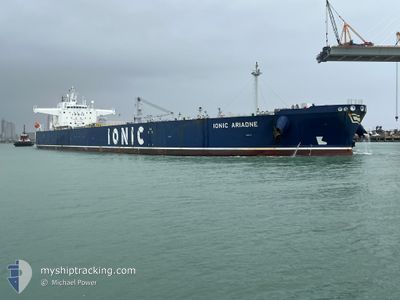
IONIC ARIADNE
Tanker
Current Trip
| Time Travelled | 18 h, 9 mins |
|---|---|
| Remaining Time | 2 days |
| Distance Travelled | 217.32 nm |
| Remaining Distance | 540.74 nm |
| AVG Speed | 12.2 Knots |
| MAX Speed | 13.8 Knots |
| AVG Wind | 6.3 knots |
| MAX Wind | 11.9 knots |
| MIN Temp | 10.9°C / 51.62°F |
| MAX Temp | 12.4°C / 54.32°F |
| Dybgang | 8.3 m |
| Position Modtaget | 1 m siden |
Current Position
| Longitude | -5.53300° |
|---|---|
| Latitude | 52.61970° |
| Status | Moored |
| Fart | 10.3 Knots |
| Kurs | 195.6° |
| Område | Irish Sea and St. George's Channel |
| Station | T-AIS |
| Position Modtaget | 1 m siden |
Info
Information
The current position of IONIC ARIADNE is in Irish Sea and St. George's Channel with coordinates 52.61970° / -5.53300° as reported on 2024-05-16 17:39 by AIS to our vessel tracker app. The vessel's current speed is 10.3 Knots and is heading at the port of VLISSINGEN. The estimated time of arrival as calculated by MyShipTracking vessel tracking app is 2024-05-19 02:11 LT
The vessel IONIC ARIADNE (IMO: 9856555, MMSI: 538008944) is a Tanker It's sailing under the flag of [MH] Marshall Is.
In this page you can find informations about the vessels current position, last detected port calls, and current voyage information. If the vessels is not in coverage by AIS you will find the latest position.
The current position of IONIC ARIADNE is detected by our AIS receivers and we are not responsible for the reliability of the data. The last position was recorded while the vessel was in Coverage by the Ais receivers of our vessel tracking app.
The current draught of IONIC ARIADNE as reported by AIS is 8.3 meters
Weather
| Temperature | 12.5°C / 54.5°F |
|---|---|
| Wind Speed | 9 knots |
| Direction | 20° NNE |
| Pressure | 1006.4 hPa |
| Humidity | 90.6 % |
| Cloud Coverage | 100 % |
Featured Company
Last Port Calls
| Port | Arrival | Departure | Time In Port |
|---|---|---|---|
| 2024-05-14 12:57 | 2024-05-15 23:32 | 1 d | |
| 2024-04-25 14:10 | 2024-04-27 14:01 | 1 d | |
| 2024-04-10 08:46 | 2024-04-12 03:35 | 1 d | |
| 2024-04-09 07:51 | 2024-04-09 23:03 | 15 h | |
| 2024-04-02 15:44 | 2024-04-02 16:29 | 45 m | |
| 2024-03-20 02:36 | 2024-03-22 09:08 | 2 d | |
| 2024-03-14 14:40 | 2024-03-16 12:42 | 1 d | |
| 2024-03-11 11:37 | 2024-03-11 13:10 | 1 h |
Most Visited Ports (Last year)
| Port | Arrivals | |
|---|---|---|
| 6 | ||
| 6 | ||
| 2 | ||
| 2 | ||
| 2 | ||
| 1 |
Last Trips
| Origin | Departure | Destination | Arrival | Distance | |
|---|---|---|---|---|---|
| 2024-04-27 09:01 | 2024-05-14 13:57 | 4926.11 nm | |||
| 2024-04-11 23:35 | 2024-04-25 09:10 | 2400.97 nm | |||
| 2024-04-09 19:03 | 2024-04-10 04:46 | 48.62 nm | |||
| 2024-04-02 12:29 | 2024-04-09 03:51 | 1556.26 nm | |||
| 2024-03-22 05:08 | 2024-04-02 11:44 | 1600.10 nm | |||
| 2024-03-16 08:42 | 2024-03-19 22:36 | 52.37 nm | |||
| 2024-03-11 09:10 | 2024-03-14 10:40 | 68.08 nm | |||
| 2024-02-13 21:04 | 2024-03-11 07:37 | 3769.50 nm |
Events
| Tid | Hændelsen | Detaljer | Position / Dest | Info |
|---|---|---|---|---|
| 2024-05-16 17:31 | Status er ændret | Moored Default |
52.64076 / -5.52328
NL VLI
|
Fart: 10.3 kn Kurs: 196° |
| 2024-05-16 17:31 | Status er ændret | Default Moored |
52.64305 / -5.52222
NL VLI
|
Fart: 10.3 kn Kurs: 195.8° |
| 2024-05-16 14:23 | Fundet i havområde | Irish part of the Irish Sea and St. George's Channel |
53.13096 / -5.29524
Irish Sea and St. George's Channel
NL VLI
|
Fart: 9.8 kn Kurs: 196.4° |
| 2024-05-16 10:50 | Status er ændret | Moored Default |
53.83577 / -5.12423
NL VLI
|
Fart: 13.5 kn Kurs: 181° |
| 2024-05-16 10:47 | Status er ændret | Default Moored |
53.84896 / -5.12370
NL VLI
|
Fart: 13.6 kn Kurs: 181.4° |
| 2024-05-16 10:38 | Status er ændret | Moored Default |
53.88295 / -5.12223
NL VLI
|
Fart: 13.6 kn Kurs: 181° |
| 2024-05-16 10:27 | Status er ændret | Default Moored |
53.92365 / -5.12061
NL VLI
|
Fart: 13.4 kn Kurs: 181.3° |
| 2024-05-16 07:43 | Ændre havområde | United Kingdom part of the Irish Sea and St. George's Channel United Kingdom part of the Inner Seas off the West Coast of Scotland |
54.52331 / -5.11489
Irish Sea and St. George's Channel
NL VLI
|
Fart: 12.7 kn Kurs: 157° |
| 2024-05-16 06:04 | Status er ændret | Moored Default |
54.84804 / -5.30342
NL VLI
|
Fart: 13.3 kn Kurs: 157° |
| 2024-05-16 05:34 | Status er ændret | Default Moored |
54.94821 / -5.36941
NL VLI
|
Fart: 13.4 kn Kurs: 198.1° |