
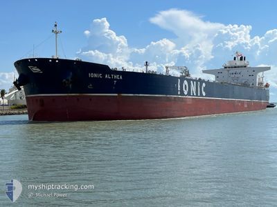
IONIC ALTHEA
Tanker
Current Trip
ITTRS-EGSKT
| Time Travelled | 14 days |
|---|---|
| Remaining Time | --- |
| Distance Travelled | 1792.16 nm |
| Remaining Distance | --- |
| AVG Speed | 11.9 Knots |
| MAX Speed | 14.2 Knots |
| AVG Wind | 12.3 knots |
| MAX Wind | 25.3 knots |
| MIN Temp | 6.2°C / 43.16°F |
| MAX Temp | 19.6°C / 67.28°F |
| Dybgang | 8.2 m |
| Position Modtaget | 12 d siden |
Current Position
| Longitude | --- |
|---|---|
| Latitude | --- |
| Status | Under way using engine |
| Fart | 13 Knots |
| Kurs | 143.9° |
| Område | Ionian Sea |
| Station | T-AIS |
| Position Modtaget | 12 d siden |
Info
Information
The current position of IONIC ALTHEA is in Ionian Sea with coordinates 37.20319° / 20.57098° as reported on 2025-12-09 02:07 by AIS to our vessel tracker app. The vessel's current speed is 13 Knots
The vessel IONIC ALTHEA (IMO: 9728435, MMSI: 538007953) is a Tanker It's sailing under the flag of [MH] Marshall Is.
In this page you can find informations about the vessels current position, last detected port calls, and current voyage information. If the vessels is not in coverage by AIS you will find the latest position.
The current position of IONIC ALTHEA is detected by our AIS receivers and we are not responsible for the reliability of the data. The last position was recorded while the vessel was in Coverage by the Ais receivers of our vessel tracking app.
The current draught of IONIC ALTHEA as reported by AIS is 8.2 meters
Weather
| Temperature | 17°C / 62.6°F |
|---|---|
| Wind Speed | 6 knots |
| Direction | 6° N |
| Pressure | 1012.2 hPa |
| Humidity | 57 % |
| Cloud Coverage | --- |
Featured Company
Last Port Calls
| Port | Arrival | Departure | Time In Port |
|---|---|---|---|
| 2025-12-05 17:19 | 2025-12-07 00:01 | 1 d | |
| 2025-11-16 12:08 | 2025-11-17 07:56 | 19 h | |
| 2025-10-31 23:12 | 2025-11-01 20:28 | 21 h | |
| 2025-10-19 11:00 | 2025-10-20 22:20 | 1 d | |
| 2025-10-15 01:12 | 2025-10-15 20:32 | 19 h | |
| 2025-10-08 09:07 |
Last Trips
| Origin | Departure | Destination | Arrival | Distance | |
|---|---|---|---|---|---|
| 2025-11-17 07:56 | 2025-12-05 17:19 | 1528.72 nm | |||
| 2025-11-01 20:28 | 2025-11-16 12:08 | 3457.88 nm | |||
| 2025-10-20 22:20 | 2025-10-31 23:12 | 1258.61 nm | |||
| 2025-10-15 20:32 | 2025-10-19 11:00 | 1065.24 nm | |||
| 2025-10-08 09:07 | 2025-10-15 01:12 | 822.87 nm |
Events
| Tid | Hændelsen | Detaljer | Position / Dest | Info |
|---|---|---|---|---|
| 2025-12-19 18:16 | START Sejllads | 8.02 nm, West of EL DEKHEILA |
31.12167 / 29.65298
ITTRS-EGSKT
|
Fart: 3.1 kn Kurs: 353° |
| 2025-12-18 22:08 | STOP Sejllads | 8.88 nm, West of EL DEKHEILA |
31.12332 / 29.63577
ITTRS-EGSKT
|
Fart: 0.3 kn Kurs: 341° |
| 2025-12-18 21:22 | START Sejllads | 10.4 nm, West of EL DEKHEILA |
31.12245 / 29.60599
ITTRS-EGSKT
|
Fart: 4.1 kn Kurs: 122° |
| 2025-12-18 20:25 | STOP Sejllads | 10.71 nm, West of EL DEKHEILA |
31.12746 / 29.59927
ITTRS-EGSKT
|
Fart: 0.3 kn Kurs: 187° |
| 2025-12-18 19:10 | START Sejllads | 9.67 nm, West of EL DEKHEILA |
31.17666 / 29.62164
ITTRS-EGSKT
|
Fart: 3.4 kn Kurs: 35° |
| 2025-12-14 20:25 | STOP Sejllads | 9.45 nm, West of EL DEKHEILA |
31.17160 / 29.62484
ITTRS-EGSKT
|
Fart: 0.2 kn Kurs: 343° |
| 2025-12-14 15:06 | START Sejllads |
31.73996 / 28.95531
ITTRS-EGSKT
|
Fart: 7.9 kn Kurs: 152° |
|
| 2025-12-13 12:23 | STOP Sejllads |
31.99167 / 28.64833
ITTRS-EGSKT
|
Fart: Kurs: -1° |
|
| 2025-12-13 00:47 | STOP Sejllads |
32.07834 / 28.48667
ITTRS-EGSKT
|
Fart: Kurs: -1° |
|
| 2025-12-12 08:33 | START Sejllads |
31.78406 / 27.95666
ITTRS-EGSKT
|
Fart: 3.2 kn Kurs: 20° |