
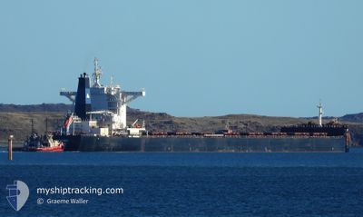
IOANNIS
Cargo
Current Trip
| Time Travelled | 23 days |
|---|---|
| Remaining Time | 1 day |
| Distance Travelled | 5621.58 nm |
| Remaining Distance | 428.44 nm |
| AVG Speed | 9.7 Knots |
| MAX Speed | 13 Knots |
| AVG Wind | 16.5 knots |
| MAX Wind | 43 knots |
| MIN Temp | 2.7°C / 36.86°F |
| MAX Temp | 19.8°C / 67.64°F |
| Dybgang | 18.1 m |
| Position Modtaget | 59 m siden |
Current Position
| Longitude | 124.80170° |
|---|---|
| Latitude | 34.45430° |
| Status | Under way using engine |
| Fart | 12.5 Knots |
| Kurs | 318.3° |
| Område | Yellow Sea |
| Station | T-AIS |
| Position Modtaget | 59 m siden |
Info
Information
The current position of IOANNIS is in Yellow Sea with coordinates 34.45430° / 124.80170° as reported on 2024-05-23 16:12 by AIS to our vessel tracker app. The vessel's current speed is 12.5 Knots and is heading at the port of CAOFEIDIAN. The estimated time of arrival as calculated by MyShipTracking vessel tracking app is 2024-05-25 10:33 LT
The vessel IOANNIS (IMO: 9696096, MMSI: 311000131) is a Cargo It's sailing under the flag of [BS] Bahamas.
In this page you can find informations about the vessels current position, last detected port calls, and current voyage information. If the vessels is not in coverage by AIS you will find the latest position.
The current position of IOANNIS is detected by our AIS receivers and we are not responsible for the reliability of the data. The last position was recorded while the vessel was in Coverage by the Ais receivers of our vessel tracking app.
The current draught of IOANNIS as reported by AIS is 18.1 meters
Weather
| Temperature | 18.1°C / 64.58°F |
|---|---|
| Wind Speed | 5 knots |
| Direction | 356° N |
| Pressure | 1011.8 hPa |
| Humidity | 76.5 % |
| Cloud Coverage | 2 % |
Featured Company
Last Port Calls
| Port | Arrival | Departure | Time In Port |
|---|---|---|---|
| 2024-04-29 06:36 | 2024-04-29 15:51 | 9 h | |
| 2024-04-11 23:38 | 2024-04-14 12:30 | 2 d | |
| 2024-03-01 20:16 | 2024-03-05 17:52 | 3 d |
Most Visited Ports (Last year)
| Port | Arrivals | |
|---|---|---|
| 1 | ||
| 1 | ||
| 1 | ||
| 1 | ||
| 1 | ||
| 1 |
Last Trips
| Origin | Departure | Destination | Arrival | Distance | |
|---|---|---|---|---|---|
| 2024-04-14 12:30 | 2024-04-29 06:36 | 3919.55 nm | |||
| 2024-03-05 17:52 | 2024-04-11 23:38 | 8402.71 nm | |||
| 2024-02-28 07:23 | 2024-03-01 20:16 | 743.73 nm |
Events
| Tid | Hændelsen | Detaljer | Position / Dest | Info |
|---|---|---|---|---|
| 2024-05-23 16:13 | Status er ændret | Default Under way using engine |
34.45776 / 124.79823
CN CFD
|
Fart: 12.5 kn Kurs: 318.3° |
| 2024-05-23 15:57 | Status er ændret | Under way using engine Default |
34.42108 / 124.85231
CN CFD
|
Fart: 12.9 kn Kurs: 307° |
| 2024-05-23 15:37 | Status er ændret | Default Under way using engine |
34.37843 / 124.91933
CN CFD
|
Fart: 13 kn Kurs: 306.3° |
| 2024-05-23 15:32 | Status er ændret | Under way using engine Default |
34.36675 / 124.93772
CN CFD
|
Fart: 13 kn Kurs: 307° |
| 2024-05-23 14:44 | Status er ændret | Default Under way using engine |
34.26595 / 125.10601
CN CFD
|
Fart: 12.8 kn Kurs: 304.3° |
| 2024-05-23 14:41 | Status er ændret | Under way using engine Default |
34.26024 / 125.11606
CN CFD
|
Fart: 12.9 kn Kurs: 308° |
| 2024-05-23 14:24 | Status er ændret | Default Under way using engine |
34.22407 / 125.17336
CN CFD
|
Fart: 12.8 kn Kurs: 307.5° |
| 2024-05-23 13:13 | ETA er ændret | 2024/05/25 07:00 2024/05/25 05:00 |
34.07485 / 125.41407
CN CFD
|
Fart: 12.4 kn Kurs: 313.8° |
| 2024-05-23 12:59 | Status er ændret | Under way using engine Default |
34.04248 / 125.45406
CN CFD
|
Fart: 12.2 kn Kurs: 313° |
| 2024-05-23 12:20 | Status er ændret | Default Under way using engine |
33.95969 / 125.57836
CN CFD
|
Fart: 12 kn Kurs: 306.7° |