
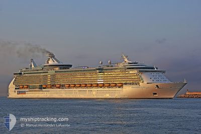
INDEPENDENCE OTS
Passengers Ship
Current Trip
| Time Travelled | 8 h, 53 mins |
|---|---|
| Remaining Time | 1 day |
| Distance Travelled | 148.23 nm |
| Remaining Distance | 448.64 nm |
| AVG Speed | 12.9 Knots |
| MAX Speed | 18 Knots |
| AVG Wind | 21.6 knots |
| MAX Wind | 24 knots |
| MIN Temp | 22.7°C / 72.86°F |
| MAX Temp | 24.3°C / 75.74°F |
| Dybgang | 9 m |
| Position Modtaget | Nu |
Current Position
| Longitude | -77.51335° |
|---|---|
| Latitude | 25.82646° |
| Status | Under way using engine |
| Fart | 16.7 Knots |
| Kurs | 104.8° |
| Område | North Atlantic Ocean |
| Station | T-AIS |
| Position Modtaget | Nu |
Info
Information
The current position of INDEPENDENCE OTS is in North Atlantic Ocean with coordinates 25.82646° / -77.51335° as reported on 2024-04-28 11:23 by AIS to our vessel tracker app. The vessel's current speed is 16.7 Knots and is heading at the port of GRAND TURK. The estimated time of arrival as calculated by MyShipTracking vessel tracking app is 2024-04-29 12:55 LT
The vessel INDEPENDENCE OTS (IMO: 9349681, MMSI: 309374000) is a Passengers Ship that was built in 2008 ( 16 år gamle ). It's sailing under the flag of [BS] Bahamas.
In this page you can find informations about the vessels current position, last detected port calls, and current voyage information. If the vessels is not in coverage by AIS you will find the latest position.
The current position of INDEPENDENCE OTS is detected by our AIS receivers and we are not responsible for the reliability of the data. The last position was recorded while the vessel was in Coverage by the Ais receivers of our vessel tracking app.
The current draught of INDEPENDENCE OTS as reported by AIS is 9 meters
Weather
| Temperature | 22.7°C / 72.86°F |
|---|---|
| Wind Speed | 19 knots |
| Direction | 85° E |
| Pressure | 1020 hPa |
| Humidity | 63.9 % |
| Cloud Coverage | 96 % |
Featured Company
Last Port Calls
| Port | Arrival | Departure | Time In Port |
|---|---|---|---|
| 2024-04-27 08:55 | 2024-04-28 02:31 | 17 h | |
| 2024-04-25 10:42 | 2024-04-25 21:14 | 10 h | |
| 2024-04-22 09:03 | 2024-04-22 20:29 | 11 h | |
| 2024-04-20 11:41 | 2024-04-20 21:29 | 9 h | |
| 2024-04-18 09:25 | 2024-04-18 20:54 | 11 h | |
| 2024-04-15 12:31 | 2024-04-15 22:16 | 9 h | |
| 2024-04-13 09:22 | 2024-04-13 20:37 | 11 h | |
| 2024-04-09 10:15 | 2024-04-09 20:29 | 10 h | |
| 2024-04-08 09:08 | 2024-04-08 20:37 | 11 h | |
| 2024-04-06 11:39 | 2024-04-06 20:57 | 9 h |
Most Visited Ports (Last year)
| Port | Arrivals | |
|---|---|---|
| 62 | ||
| 53 | ||
| 41 | ||
| 16 | ||
| 10 | ||
| 3 |
Last Trips
| Origin | Departure | Destination | Arrival | Distance | |
|---|---|---|---|---|---|
| 2024-04-25 17:14 | 2024-04-27 04:55 | 339.73 nm | |||
| 2024-04-22 16:29 | 2024-04-25 06:42 | 480.02 nm | |||
| 2024-04-20 17:29 | 2024-04-22 05:03 | 594.68 nm | |||
| 2024-04-18 16:54 | 2024-04-20 07:41 | 594.85 nm | |||
| 2024-04-15 17:16 | 2024-04-18 05:25 | 874.71 nm | |||
| 2024-04-13 16:37 | 2024-04-15 07:31 | 740.12 nm | |||
| 2024-04-09 16:29 | 2024-04-13 05:22 | 1473.88 nm | |||
| 2024-04-08 16:37 | 2024-04-09 06:15 | 193.77 nm | |||
| 2024-04-06 16:57 | 2024-04-08 05:08 | 595.08 nm | |||
| 2024-04-04 16:45 | 2024-04-06 07:39 | 594.89 nm |
Events
| Tid | Hændelsen | Detaljer | Position / Dest | Info |
|---|---|---|---|---|
| 2024-04-28 09:51 | Status er ændret | Under way using engine Default |
25.93848 / -77.98774
TCGDT
|
Fart: 17 kn Kurs: 105° |
| 2024-04-28 09:48 | Status er ændret | Default Under way using engine |
25.94333 / -78.00500
TCGDT
|
Fart: 17.4 kn Kurs: 104° |
| 2024-04-28 09:37 | Status er ændret | Under way using engine Default |
25.95559 / -78.06147
TCGDT
|
Fart: 17 kn Kurs: 103° |
| 2024-04-28 09:30 | Indenfor Dækning |
25.95559 / -78.06147
North Atlantic Ocean
TCGDT
|
Fart: 17.3 kn Kurs: 103.3° |
|
| 2024-04-28 07:30 | Status er ændret | Default Under way using engine |
26.10019 / -78.72166
TCGDT
|
Fart: 17.3 kn Kurs: 102.9° |
| 2024-04-28 07:24 | Udenfor Dækning |
26.10736 / -78.75553
North Atlantic Ocean
TCGDT
|
Fart: 17.3 kn Kurs: 102.9° |
|
| 2024-04-28 06:57 | Status er ændret | Under way using engine Default |
26.13646 / -78.89611
TCGDT
|
Fart: 17.2 kn Kurs: 104° |
| 2024-04-28 06:50 | Indenfor Dækning |
26.13523 / -78.89032
North Atlantic Ocean
TCGDT
|
Fart: 17.2 kn Kurs: 102.6° |
|
| 2024-04-28 04:45 | Status er ændret | Default Under way using engine |
25.98333 / -79.55334
TCGDT
|
Fart: 17.5 kn Kurs: 66.2° |
| 2024-04-28 04:38 | Udenfor Dækning |
25.97077 / -79.58616
North Atlantic Ocean
TCGDT
|
Fart: 17.5 kn Kurs: 66.2° |