
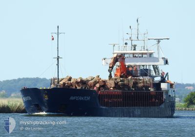
IMPERATOR
General Cargo
Current Trip
| Time Travelled | 3 days |
|---|---|
| Remaining Time | 1 day |
| Distance Travelled | 640.02 nm |
| Remaining Distance | 273.11 nm |
| AVG Speed | 9.3 Knots |
| MAX Speed | 12.5 Knots |
| AVG Wind | 10.5 knots |
| MAX Wind | 24 knots |
| MIN Temp | -13.1°C / 8.42°F |
| MAX Temp | 1.9°C / 35.42°F |
| Dybgang | 5.4 m |
| Position Modtaget | 1 m siden |
Current Position
| Longitude | --- |
|---|---|
| Latitude | --- |
| Status | Under way using engine |
| Fart | 8.5 Knots |
| Kurs | 93.2° |
| Område | Skaggerak |
| Station | T-AIS |
| Position Modtaget | 1 m siden |
Info
Information
The current position of IMPERATOR is in Skaggerak with coordinates 57.81035° / 10.25871° as reported on 2026-01-09 06:39 by AIS to our vessel tracker app. The vessel's current speed is 8.5 Knots and is heading at the port of WISMAR. The estimated time of arrival as calculated by MyShipTracking vessel tracking app is 2026-01-10 16:04 LT
The vessel IMPERATOR (IMO: 9014690, MMSI: 257141000) is a General Cargo that was built in 1992 ( 34 år gamle ). It's sailing under the flag of [NO] Norway.
In this page you can find informations about the vessels current position, last detected port calls, and current voyage information. If the vessels is not in coverage by AIS you will find the latest position.
The current position of IMPERATOR is detected by our AIS receivers and we are not responsible for the reliability of the data. The last position was recorded while the vessel was in Coverage by the Ais receivers of our vessel tracking app.
The current draught of IMPERATOR as reported by AIS is 5.4 meters
Weather
| Temperature | 0.8°C / 33.44°F |
|---|---|
| Wind Speed | 23 knots |
| Direction | 111° ESE |
| Pressure | 1010.7 hPa |
| Humidity | 71.9 % |
| Cloud Coverage | 96 % |
Featured Company
Last Port Calls
| Port | Arrival | Departure | Time In Port |
|---|---|---|---|
| 2026-01-05 06:19 | 2026-01-05 20:24 | 14 h | |
| 2026-01-01 11:25 | 2026-01-03 14:22 | 2 d | |
| 2025-12-27 19:44 | 2025-12-27 20:32 | 48 m | |
| 2025-12-26 14:16 | 2025-12-26 22:05 | 7 h | |
| 2025-12-23 05:52 | 2025-12-24 08:19 | 1 d | |
| 2025-12-20 22:12 | 2025-12-21 16:52 | 18 h | |
| 2025-12-18 16:14 | 2025-12-19 07:43 | 15 h | |
| 2025-12-16 17:38 | 2025-12-17 18:06 | 1 d | |
| 2025-12-14 12:13 | 2025-12-15 02:06 | 13 h | |
| 2025-12-13 17:36 | 2025-12-14 01:43 | 8 h |
Last Trips
| Origin | Departure | Destination | Arrival | Distance | |
|---|---|---|---|---|---|
| 2026-01-03 14:22 | 2026-01-05 06:19 | 261.72 nm | |||
| 2025-12-27 20:32 | 2026-01-01 11:25 | 649.65 nm | |||
| 2025-12-26 22:05 | 2025-12-27 19:44 | 201.15 nm | |||
| 2025-12-24 08:19 | 2025-12-26 14:16 | 185.05 nm | |||
| 2025-12-21 16:52 | 2025-12-23 05:52 | 264.23 nm | |||
| 2025-12-19 07:43 | 2025-12-20 22:12 | 314.27 nm | |||
| 2025-12-17 18:06 | 2025-12-18 16:14 | 157.55 nm | |||
| 2025-12-15 02:06 | 2025-12-16 17:38 | 284.42 nm | |||
| 2025-12-14 01:43 | 2025-12-14 12:13 | 96.11 nm | |||
| 2025-12-13 11:57 | 2025-12-13 17:36 | 53.56 nm |
Events
| Tid | Hændelsen | Detaljer | Position / Dest | Info |
|---|---|---|---|---|
| 2026-01-09 02:29 | Ændre havområde | Danish part of the Skaggerak Norwegian part of the Skaggerak |
57.86311 / 9.17591
Skaggerak
WISMAR
|
Fart: 8.3 kn Kurs: 93.1° |
| 2026-01-08 18:09 | Fundet i havområde | Norwegian part of the Skaggerak |
57.94457 / 7.08990
Skaggerak
WISMAR
|
Fart: 7.3 kn Kurs: 96.3° |
| 2026-01-08 12:20 | START Sejllads | 0.95 nm, South of EGERSUND |
58.43568 / 5.98882
WISMAR
|
Fart: 5.8 kn Kurs: 172.5° |
| 2026-01-08 11:51 | Status er ændret | Under way using engine Moored |
58.44008 / 5.98205
WISMAR
|
Fart: Kurs: 285° |
| 2026-01-08 11:51 | Dybgangen er ændret | 5.4 5.1 |
58.44008 / 5.98206
WISMAR
|
Fart: Kurs: 285° |
| 2026-01-08 08:27 | Status er ændret | Moored Under way using engine |
58.43997 / 5.98264
WISMAR
|
Fart: Kurs: 286° |
| 2026-01-08 08:27 | Destination er ændret | WISMAR EGERSUND |
58.43998 / 5.98264
WISMAR
|
Fart: Kurs: 286° |
| 2026-01-08 08:27 | ETA er ændret | 2026/01/10 07:00 2026/01/08 09:00 |
58.43998 / 5.98264
WISMAR
|
Fart: Kurs: 286° |
| 2026-01-08 07:01 | STOP Sejllads | 0.8 nm, South West of EGERSUND |
58.43919 / 5.98400
EGERSUND
|
Fart: 0.1 kn Kurs: 314° |
| 2026-01-07 22:43 | START Sejllads | 3.58 nm, South of SKIBAVIGA - OMBO |
59.19498 / 6.06775
EGERSUND
|
Fart: 4.1 kn Kurs: 272° |