
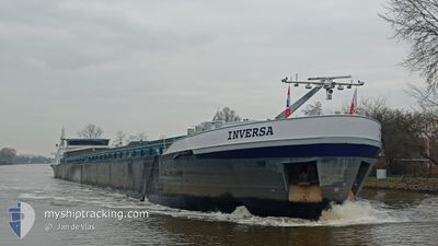
INVERSA
Cargo
Current Trip
PONT TTE AVAL PETITE
| Time Travelled | 14 h, 1 mins |
|---|---|
| Remaining Time | --- |
| Distance Travelled | 58.04 nm |
| Remaining Distance | --- |
| AVG Speed | 6.4 Knots |
| MAX Speed | 8.1 Knots |
| AVG Wind | 6.6 knots |
| MAX Wind | 8 knots |
| MIN Temp | -4.1°C / 24.62°F |
| MAX Temp | 0.9°C / 33.62°F |
| Dybgang | 1 m |
| Position Modtaget | 5 h, 1 m siden |
Current Position
| Longitude | --- |
|---|---|
| Latitude | --- |
| Status | Under way using engine |
| Fart | 5.8 Knots |
| Kurs | 105.7° |
| Område | North Sea |
| Station | T-AIS |
| Position Modtaget | 5 h, 1 m siden |
Info
Information
The current position of INVERSA is in North Sea with coordinates 51.82745° / 6.24573° as reported on 2026-01-06 20:56 by AIS to our vessel tracker app. The vessel's current speed is 5.8 Knots
The vessel INVERSA (MMSI: 244660002) is a Cargo It's sailing under the flag of [NL] Netherlands.
In this page you can find informations about the vessels current position, last detected port calls, and current voyage information. If the vessels is not in coverage by AIS you will find the latest position.
The current position of INVERSA is detected by our AIS receivers and we are not responsible for the reliability of the data. The last position was recorded while the vessel was in Coverage by the Ais receivers of our vessel tracking app.
The current draught of INVERSA as reported by AIS is 1 meters
Weather
| Temperature | -3.7°C / 25.34°F |
|---|---|
| Wind Speed | 8 knots |
| Direction | 211° SSW |
| Pressure | 1015.4 hPa |
| Humidity | 94.5 % |
| Cloud Coverage | 7 % |
Featured Company
Last Port Calls
| Port | Arrival | Departure | Time In Port |
|---|---|---|---|
| 2026-01-06 08:27 | 2026-01-06 12:57 | 4 h | |
| 2026-01-03 10:14 | 2026-01-05 14:53 | 2 d | |
| 2025-12-19 13:22 | 2025-12-19 13:43 | 21 m | |
| 2025-12-15 01:14 | 2025-12-15 16:10 | 14 h | |
| 2025-12-12 23:43 | 2025-12-13 03:40 | 3 h | |
| 2025-12-11 22:44 | 2025-12-12 21:20 | 22 h | |
| 2025-12-11 16:23 | 2025-12-11 20:17 | 3 h | |
| 2025-12-08 10:33 | 2025-12-08 10:58 | 25 m | |
| 2025-12-04 11:25 | 2025-12-06 19:17 | 2 d | |
| 2025-12-04 08:26 | 2025-12-04 09:09 | 43 m |
Most Visited Ports (Last year)
| Port | Arrivals | |
|---|---|---|
| 12 | ||
| 11 | ||
| 10 | ||
| 9 | ||
| 8 | ||
| 8 |
Last Trips
| Origin | Departure | Destination | Arrival | Distance | |
|---|---|---|---|---|---|
| 2026-01-05 14:53 | 2026-01-06 08:27 | 66.59 nm | |||
| 2025-12-19 13:43 | 2026-01-03 10:14 | 73.53 nm | |||
| 2025-12-15 16:10 | 2025-12-19 13:22 | 287.72 nm | |||
| 2025-12-13 03:40 | 2025-12-15 01:14 | 106.26 nm | |||
| 2025-12-12 21:20 | 2025-12-12 23:43 | 18.19 nm | |||
| 2025-12-11 20:17 | 2025-12-11 22:44 | 21.86 nm | |||
| 2025-12-08 10:58 | 2025-12-11 16:23 | 87.14 nm | |||
| 2025-12-06 19:17 | 2025-12-08 10:33 | 91.69 nm | |||
| 2025-12-04 09:09 | 2025-12-04 11:25 | 12.47 nm | |||
| 2025-12-03 20:26 | 2025-12-04 08:26 | 27.29 nm |
Events
| Tid | Hændelsen | Detaljer | Position / Dest | Info |
|---|---|---|---|---|
| 2026-01-06 20:56 | Udenfor Dækning |
51.82745 / 6.24573
North Sea
PONT TTE AVAL PETITE
|
Fart: 5.8 kn Kurs: 105.7° |
|
| 2026-01-06 12:04 | Indenfor Dækning |
51.82067 / 4.89553
North Sea
PONT TTE AVAL PETITE
|
Fart: 8.3 kn Kurs: 58.4° |
|
| 2026-01-06 11:57 | Afsejlet fra sidste havn |
|
51.82067 / 4.89553
PONT TTE AVAL PETITE
|
Fart: Kurs: 511° |
| 2026-01-06 08:43 | Udenfor Dækning |
51.81066 / 4.87743
North Sea
[NL] WERKENDAM
|
Fart: Kurs: 49.5° |
|
| 2026-01-06 07:27 | STOP Sejllads |
51.81072 / 4.87746
[NL] WERKENDAM
|
Fart: 0.1 kn Kurs: 511° |
|
| 2026-01-06 07:27 | Skibe i havn |
|
51.81072 / 4.87746
[NL] WERKENDAM
|
Fart: 0.9 kn Kurs: 511° |
| 2026-01-06 03:58 | Indenfor Dækning |
51.70623 / 4.44243
North Sea
PONT TTE AVAL PETITE
|
Fart: 1.3 kn Kurs: 60° |
|
| 2026-01-05 20:28 | Udenfor Dækning |
51.68917 / 4.40861
North Sea
PONT TTE AVAL PETITE
|
Fart: Kurs: 88.7° |
|
| 2026-01-05 20:28 | STOP Sejllads | 1.21 nm, West of WILLEMSTAD |
51.68917 / 4.40861
PONT TTE AVAL PETITE
|
Fart: Kurs: 511° |
| 2026-01-05 18:50 | START Sejllads | 2.82 nm, North of SINT PHILIPSLAND |
51.66194 / 4.16554
PONT TTE AVAL PETITE
|
Fart: 7.1 kn Kurs: 91.8° |