
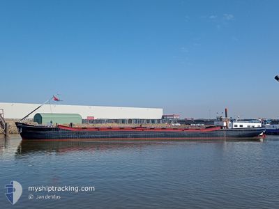
ILSE-MARIE
Cargo
Current Trip
LEEUWARDEN
| Time Travelled | 2 days |
|---|---|
| Remaining Time | --- |
| Distance Travelled | 209.72 nm |
| Remaining Distance | --- |
| AVG Speed | 7.8 Knots |
| MAX Speed | 10.9 Knots |
| AVG Wind | 12.3 knots |
| MAX Wind | 16.2 knots |
| MIN Temp | 7.8°C / 46.04°F |
| MAX Temp | 14.1°C / 57.38°F |
| Dybgang | 0.2 m |
| Position Modtaget | 1 m siden |
Current Position
| Longitude | --- |
|---|---|
| Latitude | --- |
| Status | Under way using engine |
| Fart | 4.8 Knots |
| Kurs | 122.2° |
| Område | North Sea |
| Station | T-AIS |
| Position Modtaget | 1 m siden |
Info
Information
The current position of ILSE-MARIE is in North Sea with coordinates 53.18679° / 6.64543° as reported on 2025-12-11 06:13 by AIS to our vessel tracker app. The vessel's current speed is 4.8 Knots
The vessel ILSE-MARIE (MMSI: 244750324) is a Cargo It's sailing under the flag of [NL] Netherlands.
In this page you can find informations about the vessels current position, last detected port calls, and current voyage information. If the vessels is not in coverage by AIS you will find the latest position.
The current position of ILSE-MARIE is detected by our AIS receivers and we are not responsible for the reliability of the data. The last position was recorded while the vessel was in Coverage by the Ais receivers of our vessel tracking app.
The current draught of ILSE-MARIE as reported by AIS is 0.2 meters
Weather
| Temperature | 7.8°C / 46.04°F |
|---|---|
| Wind Speed | 11 knots |
| Direction | 231° SW |
| Pressure | 1019.5 hPa |
| Humidity | 93.4 % |
| Cloud Coverage | 66 % |
Featured Company
Last Port Calls
| Port | Arrival | Departure | Time In Port |
|---|---|---|---|
| 2025-12-05 16:14 | 2025-12-08 08:29 | 2 d | |
| 2025-12-03 10:46 | 2025-12-03 13:48 | 3 h | |
| 2025-12-01 16:57 | 2025-12-02 08:01 | 15 h | |
| 2025-11-28 08:18 | 2025-11-28 12:13 | 3 h | |
| 2025-11-25 08:32 | 2025-11-25 11:05 | 2 h | |
| 2025-11-20 20:08 | 2025-11-21 08:45 | 12 h | |
| 2025-11-19 20:36 | 2025-11-20 07:01 | 10 h | |
| 2025-11-19 10:58 | 2025-11-19 13:52 | 2 h | |
| 2025-11-18 09:44 | 2025-11-18 11:24 | 1 h | |
| 2025-11-14 15:12 | 2025-11-17 12:49 | 2 d |
Last Trips
| Origin | Departure | Destination | Arrival | Distance | |
|---|---|---|---|---|---|
| 2025-12-03 13:48 | 2025-12-05 16:14 | 119.96 nm | |||
| 2025-12-02 08:01 | 2025-12-03 10:46 | 49.76 nm | |||
| 2025-11-28 12:13 | 2025-12-01 16:57 | 43.99 nm | |||
| 2025-11-25 11:05 | 2025-11-28 08:18 | 121.93 nm | |||
| 2025-11-21 08:45 | 2025-11-25 08:32 | 14.64 nm | |||
| 2025-11-20 07:01 | 2025-11-20 20:08 | 13.54 nm | |||
| 2025-11-19 13:52 | 2025-11-19 20:36 | 48.69 nm | |||
| 2025-11-18 11:24 | 2025-11-19 10:58 | 49.49 nm | |||
| 2025-11-17 12:49 | 2025-11-18 09:44 | 12.05 nm | |||
| 2025-11-14 09:41 | 2025-11-14 15:12 | 46.85 nm |
Events
| Tid | Hændelsen | Detaljer | Position / Dest | Info |
|---|---|---|---|---|
| 2025-12-11 05:58 | Status er ændret | Under way using engine Default |
53.19869 / 6.61796
LEEUWARDEN
|
Fart: 4.8 kn Kurs: -1° |
| 2025-12-11 05:54 | Status er ændret | Default Under way using engine |
53.20237 / 6.61047
LEEUWARDEN
|
Fart: 5 kn Kurs: 129.3° |
| 2025-12-11 05:35 | Indenfor Dækning |
53.22306 / 6.59639
North Sea
|
Fart: 3.3 kn Kurs: 180° |
|
| 2025-12-10 22:55 | Status er ændret | Default Under way using engine |
53.22868 / 6.59050
LEEUWARDEN
|
Fart: 6.4 kn Kurs: 93.6° |
| 2025-12-10 22:13 | Udenfor Dækning |
53.26021 / 6.47826
North Sea
|
Fart: 6.4 kn Kurs: 93.6° |
|
| 2025-12-10 21:17 | START Sejllads | 2.8 nm, West of BRILTIL |
53.24912 / 6.31346
LEEUWARDEN
|
Fart: 4.2 kn Kurs: 82.4° |
| 2025-12-10 21:06 | STOP Sejllads | 2.93 nm, West of BRILTIL |
53.24874 / 6.31014
LEEUWARDEN
|
Fart: Kurs: 511° |
| 2025-12-10 19:57 | Indenfor Dækning |
53.22114 / 6.13292
North Sea
|
Fart: 6.6 kn Kurs: 82.5° |
|
| 2025-12-10 09:29 | Udenfor Dækning |
52.82774 / 5.64118
North Sea
|
Fart: 7.2 kn Kurs: 50.7° |
|
| 2025-12-10 09:10 | Status er ændret | Under way using engine Default |
52.79458 / 5.60557
LEEUWARDEN
|
Fart: 7.6 kn Kurs: 34° |