
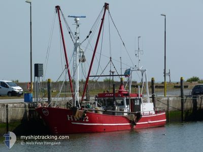
HV42 JANNI
Fishing
Current Trip
HV42 JANNI is out of coverage. Learn how you can join the community and extend the coverage to your area by clicking here!
-KK LTILOHVJ. ECSL
Unknown Port
ETA*
---
| Time Travelled | 20 days |
|---|---|
| Remaining Time | --- |
| Distance Travelled | 752.61 nm |
| Remaining Distance | --- |
| AVG Speed | 5 Knots |
| MAX Speed | 10.4 Knots |
| AVG Wind | 11.4 knots |
| MAX Wind | 27.6 knots |
| MIN Temp | 1.7°C / 35.06°F |
| MAX Temp | 17.2°C / 62.96°F |
| Dybgang | 0 m |
| Position Modtaget | 8 h, 6 m siden |
Current Position
| Longitude | 8.56612° |
|---|---|
| Latitude | 55.08852° |
| Status | Default |
| Fart | |
| Kurs | 253° |
| Område | North Sea |
| Station | T-AIS |
| Position Modtaget | 8 h, 6 m siden |
Info
info
Information
The current position of HV42 JANNI is in North Sea with coordinates 55.08852° / 8.56612° as reported on 2024-05-14 05:56 by AIS to our vessel tracker app. The vessel's current speed is 0 Knots
The vessel HV42 JANNI (MMSI: 219013708) is a Fishing It's sailing under the flag of [DK] Denmark.
In this page you can find informations about the vessels current position, last detected port calls, and current voyage information. If the vessels is not in coverage by AIS you will find the latest position.
The current position of HV42 JANNI is detected by our AIS receivers and we are not responsible for the reliability of the data. The last position was recorded while the vessel was in Coverage by the Ais receivers of our vessel tracking app.
Weather
| Temperature | 12.9°C / 55.22°F |
|---|---|
| Wind Speed | 17 knots |
| Direction | 109° ESE |
| Pressure | 1011.9 hPa |
| Humidity | 79.8 % |
| Cloud Coverage | 8 % |
Featured Company
Limited time offer - Install a base station receiver to your area and list your company on MyShipTracking Free forever!
Last Port Calls
| Port | Arrival | Departure | Time In Port |
|---|---|---|---|
| 2024-04-23 07:23 | 2024-04-23 19:42 | 12 h | |
| 2024-04-17 06:21 | 2024-04-17 09:51 | 3 h |
Most Visited Ports (Last year)
| Port | Arrivals | |
|---|---|---|
| 3 | ||
| 1 |
Last Trips
| Origin | Departure | Destination | Arrival | Distance | |
|---|---|---|---|---|---|
| 2024-04-17 11:51 | 2024-04-23 09:23 | 286.87 nm |
Events
| Tid | Hændelsen | Detaljer | Position / Dest | Info |
|---|---|---|---|---|
| 2024-05-14 05:56 | Udenfor Dækning |
55.08852 / 8.56612
North Sea
|
Fart: Kurs: 296.2° |
|
| 2024-05-14 05:56 | STOP Sejllads | 6.15 nm, North East of LIST SYLT |
55.08852 / 8.56618
-KK LTILOHVJ. ECSL
|
Fart: 0.1 kn Kurs: 253° |
| 2024-05-14 04:20 | START Sejllads | 7.34 nm, North of LIST SYLT |
55.13772 / 8.45412
-KK LTILOHVJ. ECSL
|
Fart: 6.4 kn Kurs: 169.6° |
| 2024-05-14 04:04 | STOP Sejllads | 7.9 nm, North of LIST SYLT |
55.14724 / 8.44095
-KK LTILOHVJ. ECSL
|
Fart: 0.2 kn Kurs: 141° |
| 2024-05-13 23:51 | START Sejllads | 11.72 nm, North of LIST SYLT |
55.20635 / 8.36896
-KK LTILOHVJ. ECSL
|
Fart: 4.8 kn Kurs: 115° |
| 2024-05-13 23:47 | STOP Sejllads | 11.82 nm, North of LIST SYLT |
55.20778 / 8.36680
-KK LTILOHVJ. ECSL
|
Fart: 0.3 kn Kurs: 136° |
| 2024-05-13 20:31 | Indenfor Dækning |
55.22908 / 8.37064
North Sea
|
Fart: 3.1 kn Kurs: 309.6° |
|
| 2024-05-13 19:08 | Udenfor Dækning |
55.16454 / 8.41094
North Sea
|
Fart: 5.6 kn Kurs: 303.3° |
|
| 2024-05-13 17:51 | START Sejllads | 6.2 nm, North East of LIST SYLT |
55.08684 / 8.57082
-KK LTILOHVJ. ECSL
|
Fart: 5.2 kn Kurs: 119.2° |
| 2024-05-13 16:31 | Fundet i havområde | Danish part of the North Sea |
55.08805 / 8.56494
North Sea
|
Fart: Kurs: 8.7° |