
HOLLY REICH
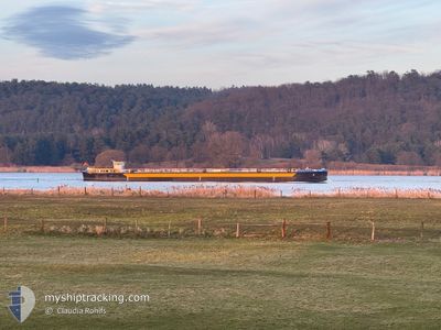
Tanker
Current Trip
| Trip Time | 16 h, 19 mins |
|---|---|
| Trip Distance | 69.68 nm |
| AVG Speed | 5.9 Knots |
| MAX Speed | 7.1 Knots |
| Dybgang | 2.4 m |
| AVG Wind | 13.7 knots |
| MAX Wind | 15.5 knots |
| MIN Temp | 5.5°C / 41.9°F |
| MAX Temp | 9.3°C / 48.74°F |
| Position Modtaget | 3 h, 31 m siden |
Current Position
| Longitude | --- |
|---|---|
| Latitude | --- |
| Status | Under way using engine |
| Fart | 5.3 Knots |
| Kurs | 87.6° |
| Område | North Sea |
| Station | T-AIS |
| Position Modtaget | 3 h, 31 m siden |
Info
Information
The current position of HOLLY REICH is in North Sea with coordinates 51.64881° / 6.78751° as reported on 2025-12-06 17:51 by AIS to our vessel tracker app. The vessel's current speed is 5.3 Knots and is currently inside the port of MARL.
The vessel HOLLY REICH (IMO: 4813540, MMSI: 211395020) is a Tanker It's sailing under the flag of [DE] Germany.
In this page you can find informations about the vessels current position, last detected port calls, and current voyage information. If the vessels is not in coverage by AIS you will find the latest position.
The current position of HOLLY REICH is detected by our AIS receivers and we are not responsible for the reliability of the data. The last position was recorded while the vessel was in Coverage by the Ais receivers of our vessel tracking app.
The current draught of HOLLY REICH as reported by AIS is 2.4 meters
Weather
| Temperature | 9.4°C / 48.92°F |
|---|---|
| Wind Speed | 12 knots |
| Direction | 215° SW |
| Pressure | 1004.5 hPa |
| Humidity | 84.4 % |
| Cloud Coverage | 100 % |
Featured Company
Last Port Calls
| Port | Arrival | Departure | Time In Port |
|---|---|---|---|
| 2025-12-06 22:01 | |||
| 2025-12-05 17:28 | 2025-12-06 05:42 | 12 h | |
| 2025-12-05 15:22 | 2025-12-05 15:54 | 31 m | |
| 2025-11-29 20:00 | 2025-12-05 10:46 | 5 d | |
| 2025-11-29 18:04 | 2025-11-29 19:25 | 1 h | |
| 2025-11-29 14:22 | 2025-11-29 14:50 | 28 m | |
| 2025-11-28 08:30 | 2025-11-29 06:46 | 22 h | |
| 2025-11-27 23:25 | 2025-11-28 06:19 | 6 h | |
| 2025-11-27 21:16 | 2025-11-27 22:32 | 1 h | |
| 2025-11-25 12:29 | 2025-11-26 14:42 | 1 d |
Most Visited Ports (Last year)
| Port | Arrivals | |
|---|---|---|
| 27 | ||
| 20 | ||
| 20 | ||
| 15 | ||
| 14 | ||
| 10 |
Last Trips
| Origin | Departure | Destination | Arrival | Distance | |
|---|---|---|---|---|---|
| 2025-12-06 05:42 | 2025-12-06 22:01 | 69.68 nm | |||
| 2025-12-05 15:54 | 2025-12-05 17:28 | 8.31 nm | |||
| 2025-12-05 10:46 | 2025-12-05 15:22 | 31.20 nm | |||
| 2025-11-29 19:25 | 2025-11-29 20:00 | 5.01 nm | |||
| 2025-11-29 14:50 | 2025-11-29 18:04 | 30.20 nm | |||
| 2025-11-29 06:46 | 2025-11-29 14:22 | 75.64 nm | |||
| 2025-11-28 06:19 | 2025-11-28 08:30 | 10.56 nm | |||
| 2025-11-27 22:32 | 2025-11-27 23:25 | 3.54 nm | |||
| 2025-11-26 14:42 | 2025-11-27 21:16 | 100.23 nm | |||
| 2025-11-23 16:24 | 2025-11-25 12:29 | 112.22 nm |
Events
| Tid | Hændelsen | Detaljer | Position / Dest | Info |
|---|---|---|---|---|
| 2025-12-06 21:01 | STOP Sejllads |
51.69833 / 7.10500
[DE] MARL
|
Fart: Kurs: -1° |
|
| 2025-12-06 21:01 | Skibe i havn |
|
51.69833 / 7.10500
[DE] MARL
|
Fart: 1 kn Kurs: -1° |
| 2025-12-06 17:51 | Udenfor Dækning |
51.64881 / 6.78751
North Sea
HAMM
|
Fart: 5.3 kn Kurs: 87.6° |
|
| 2025-12-06 17:46 | START Sejllads | 6.59 nm, East of WESEL |
51.64843 / 6.77842
HAMM
|
Fart: 3.5 kn Kurs: 93° |
| 2025-12-06 17:39 | Status er ændret | Under way using engine Default |
51.64831 / 6.77448
HAMM
|
Fart: 3 kn Kurs: -1° |
| 2025-12-06 17:10 | Status er ændret | Default Under way using engine |
51.64834 / 6.76833
HAMM
|
Fart: Kurs: 92° |
| 2025-12-06 16:57 | Status er ændret | Under way using engine Default |
51.64840 / 6.76904
HAMM
|
Fart: 1 kn Kurs: -1° |
| 2025-12-06 16:57 | STOP Sejllads | 6.24 nm, East of WESEL |
51.64840 / 6.76904
HAMM
|
Fart: Kurs: 92° |
| 2025-12-06 16:43 | Status er ændret | Default Under way using engine |
51.64834 / 6.76833
HAMM
|
Fart: 2.4 kn Kurs: 85° |
| 2025-12-06 15:56 | Status er ændret | Under way using engine Default |
51.63495 / 6.66375
HAMM
|
Fart: 5 kn Kurs: 76° |