
HALAS 71
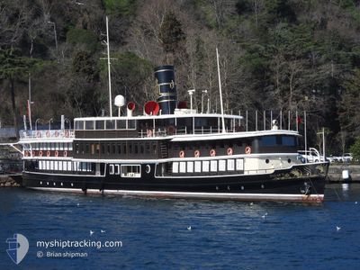
Passengers Ship
Current Trip
Current Position
| Longitude | --- |
|---|---|
| Latitude | --- |
| Status | Under way using engine |
| Fart | |
| Kurs | --- |
| Område | Sea of Marmara |
| Station | T-AIS |
| Position Modtaget | 22 m siden |
Info
Information
The current position of HALAS 71 is in Sea of Marmara with coordinates 41.11033° / 29.05900° as reported on 2026-01-10 20:02 by AIS to our vessel tracker app. The vessel's current speed is 0 Knots and is currently inside the port of ISTANBUL.
The vessel HALAS 71 (IMO: 5140697, MMSI: 271002624) is a Passengers Ship that was built in 1915 ( 111 år gamle ). It's sailing under the flag of [TR] Turkey.
In this page you can find informations about the vessels current position, last detected port calls, and current voyage information. If the vessels is not in coverage by AIS you will find the latest position.
The current position of HALAS 71 is detected by our AIS receivers and we are not responsible for the reliability of the data. The last position was recorded while the vessel was in Coverage by the Ais receivers of our vessel tracking app.
The current draught of HALAS 71 as reported by AIS is 2.6 meters
Weather
| Temperature | 13.9°C / 57.02°F |
|---|---|
| Wind Speed | 27 knots |
| Direction | 214° SW |
| Pressure | 997.4 hPa |
| Humidity | 63.4 % |
| Cloud Coverage | 43 % |
Featured Company
Most Visited Ports (Last year)
| Port | Arrivals | |
|---|---|---|
| 13 | ||
| 7 | ||
| 5 | ||
| 2 | ||
| 1 |
Events
| Tid | Hændelsen | Detaljer | Position / Dest | Info |
|---|---|---|---|---|
| 2026-01-10 20:02 | Indenfor Dækning |
41.11033 / 29.05900
Sea of Marmara
[TR] ISTANBUL
|
Fart: Kurs: 338° |
|
| 2026-01-09 10:11 | Udenfor Dækning |
41.11050 / 29.05917
Sea of Marmara
[TR] ISTANBUL
|
Fart: Kurs: 511° |
|
| 2026-01-09 10:11 | Indenfor Dækning |
41.11050 / 29.05917
Sea of Marmara
[TR] ISTANBUL
|
Fart: Kurs: 511° |
|
| 2026-01-09 02:05 | Udenfor Dækning |
41.11050 / 29.05900
Sea of Marmara
[TR] ISTANBUL
|
Fart: Kurs: 511° |
|
| 2026-01-09 02:05 | Indenfor Dækning |
41.11050 / 29.05900
Sea of Marmara
[TR] ISTANBUL
|
Fart: Kurs: 511° |
|
| 2026-01-09 00:05 | Udenfor Dækning |
41.11050 / 29.05900
Sea of Marmara
[TR] ISTANBUL
|
Fart: Kurs: 176° |
|
| 2026-01-08 23:08 | Indenfor Dækning |
41.11050 / 29.05900
Sea of Marmara
[TR] ISTANBUL
|
Fart: Kurs: 511° |
|
| 2026-01-08 20:49 | Udenfor Dækning |
41.11050 / 29.05900
Sea of Marmara
[TR] ISTANBUL
|
Fart: Kurs: 511° |
|
| 2026-01-08 20:01 | Indenfor Dækning |
41.11033 / 29.05900
Sea of Marmara
[TR] ISTANBUL
|
Fart: Kurs: 148° |
|
| 2026-01-08 10:25 | Udenfor Dækning |
41.11050 / 29.05917
Sea of Marmara
[TR] ISTANBUL
|
Fart: Kurs: 511° |