
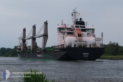
HAAGA
Cargo
Current Trip
DE HAM VIA NOK
| Time Travelled | 3 days |
|---|---|
| Remaining Time | --- |
| Distance Travelled | 815.13 nm |
| Remaining Distance | --- |
| AVG Speed | 10.5 Knots |
| MAX Speed | 12.4 Knots |
| AVG Wind | 18.5 knots |
| MAX Wind | 29 knots |
| MIN Temp | -17.9°C / -0.22°F |
| MAX Temp | 2.7°C / 36.86°F |
| Dybgang | 9.5 m |
| Position Modtaget | 1 m siden |
Current Position
| Longitude | --- |
|---|---|
| Latitude | --- |
| Status | Under way using engine |
| Fart | 10.1 Knots |
| Kurs | 201.9° |
| Område | Baltic Sea |
| Station | T-AIS |
| Position Modtaget | 1 m siden |
Info
Information
The current position of HAAGA is in Baltic Sea with coordinates 54.55792° / 12.25305° as reported on 2026-01-05 20:45 by AIS to our vessel tracker app. The vessel's current speed is 10.1 Knots
The vessel HAAGA (IMO: 9797632, MMSI: 230683000) is a Cargo It's sailing under the flag of [FI] Finland.
In this page you can find informations about the vessels current position, last detected port calls, and current voyage information. If the vessels is not in coverage by AIS you will find the latest position.
The current position of HAAGA is detected by our AIS receivers and we are not responsible for the reliability of the data. The last position was recorded while the vessel was in Coverage by the Ais receivers of our vessel tracking app.
The current draught of HAAGA as reported by AIS is 9.5 meters
Weather
| Temperature | 0.5°C / 32.9°F |
|---|---|
| Wind Speed | 13 knots |
| Direction | 214° SW |
| Pressure | 1010.3 hPa |
| Humidity | 89 % |
| Cloud Coverage | 100 % |
Featured Company
Last Port Calls
| Port | Arrival | Departure | Time In Port |
|---|---|---|---|
| 2026-01-01 07:55 | 2026-01-02 17:48 | 1 d | |
| 2025-12-28 17:39 | 2025-12-30 12:21 | 1 d | |
| 2025-12-27 06:51 | 2025-12-28 08:43 | 1 d | |
| 2025-12-24 14:41 | 2025-12-27 00:25 | 2 d | |
| 2025-12-16 15:56 | 2025-12-17 11:22 | 19 h | |
| 2025-12-10 18:13 | 2025-12-13 17:17 | 2 d | |
| 2025-12-05 04:22 | 2025-12-07 18:31 | 2 d | |
| 2025-11-26 20:13 | 2025-11-27 16:44 | 20 h | |
| 2025-11-26 06:00 | 2025-11-26 07:01 | 1 h | |
| 2025-11-21 15:11 | 2025-11-23 00:41 | 1 d |
Last Trips
| Origin | Departure | Destination | Arrival | Distance | |
|---|---|---|---|---|---|
| 2025-12-30 12:21 | 2026-01-01 07:55 | 80.88 nm | |||
| 2025-12-28 08:43 | 2025-12-28 17:39 | 79.60 nm | |||
| 2025-12-27 00:25 | 2025-12-27 06:51 | 78.39 nm | |||
| 2025-12-17 11:22 | 2025-12-24 14:41 | 1768.43 nm | |||
| 2025-12-13 17:17 | 2025-12-16 15:56 | 877.25 nm | |||
| 2025-12-07 18:31 | 2025-12-10 18:13 | 210.33 nm | |||
| 2025-11-27 16:44 | 2025-12-05 04:22 | 392.38 nm | |||
| 2025-11-26 07:01 | 2025-11-26 20:13 | 91.07 nm | |||
| 2025-11-23 00:41 | 2025-11-26 06:00 | 902.79 nm | |||
| 2025-11-19 15:50 | 2025-11-21 15:11 | 80.92 nm |
Events
| Tid | Hændelsen | Detaljer | Position / Dest | Info |
|---|---|---|---|---|
| 2026-01-05 19:59 | Fundet i havområde | Danish part of the Baltic Sea |
54.65176 / 12.39297
Baltic Sea
DE HAM VIA NOK
|
Fart: 10.1 kn Kurs: 236.4° |
| 2026-01-05 19:17 | Ændre havområde | German part of the Baltic Sea Danish part of the Baltic Sea |
54.71646 / 12.56375
Baltic Sea
DE HAM VIA NOK
|
Fart: 10.2 kn Kurs: 235.6° |
| 2026-01-05 17:57 | Ændre havområde | Danish part of the Baltic Sea German part of the Baltic Sea |
54.82111 / 12.89930
Baltic Sea
DE HAM VIA NOK
|
Fart: 9.8 kn Kurs: 248.5° |
| 2026-01-05 15:46 | Status er ændret | Under way using engine Default |
54.95300 / 13.49791
DE HAM VIA NOK
|
Fart: 10.1 kn Kurs: 251° |
| 2026-01-05 15:13 | Status er ændret | Default Under way using engine |
54.98349 / 13.65044
DE HAM VIA NOK
|
Fart: 9.9 kn Kurs: 249.5° |
| 2026-01-05 14:41 | Fundet i havområde | German part of the Baltic Sea |
55.01395 / 13.79447
Baltic Sea
DE HAM VIA NOK
|
Fart: 9.8 kn Kurs: 248.5° |
| 2026-01-05 10:29 | Ændre havområde | Swedish part of the Baltic Sea Danish part of the Kattegat |
55.45980 / 14.68444
Baltic Sea
DE HAM VIA NOK
|
Fart: 10.3 kn Kurs: 240.1° |
| 2026-01-05 08:26 | Ændre havområde | Danish part of the Kattegat Swedish part of the Baltic Sea |
55.64245 / 15.23126
Kattegat
DE HAM VIA NOK
|
Fart: 10.7 kn Kurs: 239.4° |
| 2026-01-05 06:36 | Status er ændret | Under way using engine Default |
55.81632 / 15.74345
DE HAM VIA NOK
|
Fart: 11.2 kn Kurs: 240° |
| 2026-01-05 06:29 | Indenfor Dækning |
55.81632 / 15.74345
Baltic Sea
DE HAM VIA NOK
|
Fart: 11.2 kn Kurs: 240° |