
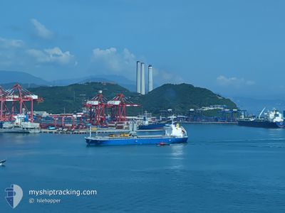
GREEN CREST
Cargo
Current Trip
ID CALABAI
| Time Travelled | 7 days |
|---|---|
| Remaining Time | --- |
| Distance Travelled | 1826.55 nm |
| Remaining Distance | --- |
| AVG Speed | 11.4 Knots |
| MAX Speed | 13.9 Knots |
| AVG Wind | 11.6 knots |
| MAX Wind | 18.9 knots |
| MIN Temp | 27.3°C / 81.14°F |
| MAX Temp | 30.9°C / 87.62°F |
| Dybgang | 7.6 m |
| Position Modtaget | 7 d siden |
Current Position
| Longitude | 100.55318° |
|---|---|
| Latitude | 13.61666° |
| Status | Under way using engine |
| Fart | 4.5 Knots |
| Kurs | 120° |
| Område | Gulf of Thailand |
| Station | T-AIS |
| Position Modtaget | 7 d siden |
Info
Information
The current position of GREEN CREST is in Gulf of Thailand with coordinates 13.61666° / 100.55318° as reported on 2024-05-15 14:27 by AIS to our vessel tracker app. The vessel's current speed is 4.5 Knots
The vessel GREEN CREST (IMO: 9889629, MMSI: 538009002) is a Cargo It's sailing under the flag of [MH] Marshall Is.
In this page you can find informations about the vessels current position, last detected port calls, and current voyage information. If the vessels is not in coverage by AIS you will find the latest position.
The current position of GREEN CREST is detected by our AIS receivers and we are not responsible for the reliability of the data. The last position was recorded while the vessel was in Coverage by the Ais receivers of our vessel tracking app.
The current draught of GREEN CREST as reported by AIS is 7.6 meters
Weather
| Temperature | 29.5°C / 85.1°F |
|---|---|
| Wind Speed | 2 knots |
| Direction | 190° S |
| Pressure | 1006.8 hPa |
| Humidity | 58.7 % |
| Cloud Coverage | 94 % |
Featured Company
Last Port Calls
| Port | Arrival | Departure | Time In Port |
|---|---|---|---|
| 2024-05-12 23:41 | 2024-05-15 15:36 | 2 d | |
| 2024-05-08 04:03 | 2024-05-11 12:40 | 3 d | |
| 2024-04-25 16:56 | 2024-04-28 07:32 | 2 d | |
| 2024-04-03 18:21 | 2024-04-07 09:25 | 3 d | |
| 2024-03-29 09:53 | 2024-03-31 10:00 | 2 d | |
| 2024-03-15 04:04 | 2024-03-19 05:51 | 4 d |
Last Trips
| Origin | Departure | Destination | Arrival | Distance | |
|---|---|---|---|---|---|
| 2024-05-11 19:40 | 2024-05-13 06:41 | 35.47 nm | |||
| 2024-04-28 16:32 | 2024-05-08 11:03 | 2733.33 nm | |||
| 2024-04-07 17:25 | 2024-04-26 01:56 | 2940.41 nm | |||
| 2024-03-31 17:00 | 2024-04-04 02:21 | 472.03 nm | |||
| 2024-03-19 14:51 | 2024-03-29 16:53 | 2546.30 nm |
Events
| Tid | Hændelsen | Detaljer | Position / Dest | Info |
|---|---|---|---|---|
| 2024-05-22 07:44 | STOP Sejllads |
-8.21401 / 117.70900
ID CALABAI
|
Fart: Kurs: 147° |
|
| 2024-05-22 05:54 | STOP Sejllads |
-8.21807 / 117.69621
ID CALABAI
|
Fart: 0.2 kn Kurs: 185° |
|
| 2024-05-15 15:36 | Afsejlet fra sidste havn |
|
13.53055 / 100.60738
ID CALABAI
|
Fart: 5.6 kn Kurs: 126° |
| 2024-05-15 14:32 | Status er ændret | Default Under way using engine |
13.61247 / 100.55995
[TH] BANGKOK
|
Fart: 4.5 kn Kurs: 120° |
| 2024-05-15 14:27 | Status er ændret | Under way using engine Default |
13.61666 / 100.55318
[TH] BANGKOK
|
Fart: 5.4 kn Kurs: 123° |
| 2024-05-15 14:27 | Udenfor Dækning |
13.61666 / 100.55318
Gulf of Thailand
[TH] BANGKOK
|
Fart: 4.5 kn Kurs: 121.1° |
|
| 2024-05-15 14:04 | Status er ændret | Default Under way using engine |
13.65796 / 100.53603
[TH] BANGKOK
|
Fart: 4.7 kn Kurs: 294° |
| 2024-05-15 13:08 | START Sejllads |
13.70257 / 100.57502
[TH] BANGKOK
|
Fart: 6 kn Kurs: 111° |
|
| 2024-05-15 12:56 | Status er ændret | Under way using engine Moored |
13.70266 / 100.57138
[TH] BANGKOK
|
Fart: Kurs: 287° |
| 2024-05-15 11:57 | ETA er ændret | 2024/05/22 03:00 2024/05/22 01:00 |
13.70253 / 100.57131
[TH] BANGKOK
|
Fart: Kurs: 288° |