
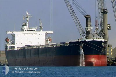
GOOD HOPE MAX
Bulk Carrier
Current Trip
| Time Travelled | 3 h, 34 mins |
|---|---|
| Remaining Time | --- |
| Distance Travelled | 33.88 nm |
| Remaining Distance | --- |
| AVG Speed | 10.8 Knots |
| MAX Speed | 11.7 Knots |
| AVG Wind | 8.6 knots |
| MAX Wind | 12 knots |
| MIN Temp | 13.7°C / 56.66°F |
| MAX Temp | 17.4°C / 63.32°F |
| Dybgang | 7.3 m |
| Position Modtaget | Nu |
Current Position
| Longitude | 35.58827° |
|---|---|
| Latitude | 36.37410° |
| Status | Under way using engine |
| Fart | 11.7 Knots |
| Kurs | 233.8° |
| Område | Mediterranean Sea - Eastern Basin |
| Station | T-AIS |
| Position Modtaget | Nu |
Info
Information
The current position of GOOD HOPE MAX is in Mediterranean Sea - Eastern Basin with coordinates 36.37410° / 35.58827° as reported on 2024-05-05 19:30 by AIS to our vessel tracker app. The vessel's current speed is 11.7 Knots and is heading at the port of GIBRALTAR. The estimated time of arrival as calculated by MyShipTracking vessel tracking app is 2024-05-10 12:00 LT
The vessel GOOD HOPE MAX (IMO: 9304241, MMSI: 232752000) is a Bulk Carrier that was built in 2005 ( 19 år gamle ). It's sailing under the flag of [GB] United Kingdom.
In this page you can find informations about the vessels current position, last detected port calls, and current voyage information. If the vessels is not in coverage by AIS you will find the latest position.
The current position of GOOD HOPE MAX is detected by our AIS receivers and we are not responsible for the reliability of the data. The last position was recorded while the vessel was in Coverage by the Ais receivers of our vessel tracking app.
The current draught of GOOD HOPE MAX as reported by AIS is 7.3 meters
Weather
| Temperature | 16°C / 60.8°F |
|---|---|
| Wind Speed | 8 knots |
| Direction | 34° NE |
| Pressure | 1007.2 hPa |
| Humidity | 81 % |
| Cloud Coverage | 100 % |
Featured Company
Last Port Calls
| Port | Arrival | Departure | Time In Port |
|---|---|---|---|
| 2024-05-01 23:18 | 2024-05-05 15:57 | 3 d | |
| 2024-03-24 16:27 |
Last Trips
| Origin | Departure | Destination | Arrival | Distance | |
|---|---|---|---|---|---|
| 2024-03-24 12:27 | 2024-05-02 02:18 | 4372.83 nm |
Events
| Tid | Hændelsen | Detaljer | Position / Dest | Info |
|---|---|---|---|---|
| 2024-05-05 18:05 | Dybgangen er ændret | 7.3 14.3 |
36.55633 / 35.84305
GIBRALTAR
|
Fart: 11.7 kn Kurs: 228.4° |
| 2024-05-05 18:05 | Destination er ændret | GIBRALTAR ISDEMIR TURKEY |
36.55633 / 35.84305
GIBRALTAR
|
Fart: 11.7 kn Kurs: 228.4° |
| 2024-05-05 18:05 | ETA er ændret | 2024/05/10 12:00 2024/04/19 12:00 |
36.55633 / 35.84305
GIBRALTAR
|
Fart: 11.7 kn Kurs: 228.4° |
| 2024-05-05 18:02 | Status er ændret | Under way using engine Default |
36.56278 / 35.85206
ISDEMIR TURKEY
|
Fart: 11.5 kn Kurs: 228° |
| 2024-05-05 17:56 | Indenfor Dækning |
36.56278 / 35.85206
Mediterranean Sea - Eastern Basin
|
Fart: 11.6 kn Kurs: 229° |
|
| 2024-05-05 15:57 | Afsejlet fra sidste havn |
|
36.73501 / 36.16141
ISDEMIR TURKEY
|
Fart: 5.5 kn Kurs: 264° |
| 2024-05-05 15:55 | START Sejllads |
36.72603 / 36.18963
[TR] ISKENDERUN
|
Fart: 5.5 kn Kurs: 264° |
|
| 2024-05-01 23:23 | STOP Sejllads |
36.72923 / 36.19187
[TR] ISKENDERUN
|
Fart: 0.3 kn Kurs: 52° |
|
| 2024-05-01 23:18 | Skibe i havn |
|
36.72887 / 36.19174
[TR] ISKENDERUN
|
Fart: 6 kn Kurs: 114° |
| 2024-05-01 22:07 | START Sejllads | 4.11 nm, South of DORTYOL |
36.76901 / 36.13352
ISDEMIR TURKEY
|
Fart: 4 kn Kurs: 180° |