
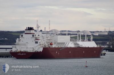
GLOBAL SEALINE
Tanker
Current Trip
USA
| Time Travelled | 48 days |
|---|---|
| Remaining Time | --- |
| Distance Travelled | 12978.48 nm |
| Remaining Distance | --- |
| AVG Speed | 14.1 Knots |
| MAX Speed | 21.4 Knots |
| AVG Wind | 12.6 knots |
| MAX Wind | 29.3 knots |
| MIN Temp | 5.9°C / 42.62°F |
| MAX Temp | 31.8°C / 89.24°F |
| Dybgang | 9.4 m |
| Position Modtaget | Nu |
Current Position
| Longitude | 10.86876° |
|---|---|
| Latitude | 55.52430° |
| Status | Under way using engine |
| Fart | 15.2 Knots |
| Kurs | 338° |
| Område | Kattegat |
| Station | T-AIS |
| Position Modtaget | Nu |
Info
Information
The current position of GLOBAL SEALINE is in Kattegat with coordinates 55.52430° / 10.86876° as reported on 2024-06-10 22:17 by AIS to our vessel tracker app. The vessel's current speed is 15.2 Knots
The vessel GLOBAL SEALINE (IMO: 9880477, MMSI: 538009406) is a Tanker It's sailing under the flag of [MH] Marshall Is.
In this page you can find informations about the vessels current position, last detected port calls, and current voyage information. If the vessels is not in coverage by AIS you will find the latest position.
The current position of GLOBAL SEALINE is detected by our AIS receivers and we are not responsible for the reliability of the data. The last position was recorded while the vessel was in Coverage by the Ais receivers of our vessel tracking app.
The current draught of GLOBAL SEALINE as reported by AIS is 9.4 meters
Weather
| Temperature | 12.2°C / 53.96°F |
|---|---|
| Wind Speed | 10 knots |
| Direction | 305° NW |
| Pressure | 1002.3 hPa |
| Humidity | 77.9 % |
| Cloud Coverage | 100 % |
Featured Company
Most Visited Ports (Last year)
| Port | Arrivals | |
|---|---|---|
| 2 | ||
| 1 | ||
| 1 |
Last Trips
| Origin | Departure | Destination | Arrival | Distance | |
|---|---|---|---|---|---|
| 2024-03-29 08:27 | 2024-04-22 00:14 | 9297.36 nm |
Events
| Tid | Hændelsen | Detaljer | Position / Dest | Info |
|---|---|---|---|---|
| 2024-06-10 17:56 | Ændre havområde | Danish part of the Kattegat Danish part of the Baltic Sea |
54.73948 / 10.78185
Kattegat
|
Fart: 11.5 kn Kurs: 19.8° |
| 2024-06-10 17:20 | Ændre havområde | Danish part of the Baltic Sea German part of the Baltic Sea |
54.63845 / 10.89189
Baltic Sea
|
Fart: 15.6 kn Kurs: 295.8° |
| 2024-06-10 16:29 | Fundet i havområde | German part of the Baltic Sea |
54.59977 / 11.22880
Baltic Sea
|
Fart: 14.7 kn Kurs: 293° |
| 2024-06-10 14:12 | Dybgangen er ændret | 9.4 9 |
54.44229 / 12.12008
USA
|
Fart: 13.7 kn Kurs: 264.5° |
| 2024-06-10 14:12 | ETA er ændret | 2024/06/06 21:01 |
54.44229 / 12.12008
USA
|
Fart: 13.7 kn Kurs: 264.5° |
| 2024-06-10 14:11 | Ændre havområde | Danish part of the Baltic Sea German part of the Baltic Sea |
54.44269 / 12.12767
Baltic Sea
|
Fart: 13.7 kn Kurs: 264.6° |
| 2024-06-10 14:06 | Dybgangen er ændret | 9 9.4 |
54.44442 / 12.15827
USA
|
Fart: 13 kn Kurs: 264.9° |
| 2024-06-10 13:53 | Ændre havområde | German part of the Baltic Sea Danish part of the Baltic Sea |
54.48166 / 12.20676
Baltic Sea
|
Fart: 14.7 kn Kurs: 194.7° |
| 2024-06-10 10:53 | Ændre havområde | Danish part of the Baltic Sea German part of the Baltic Sea |
54.84325 / 12.94051
Baltic Sea
|
Fart: 12.9 kn Kurs: 250.9° |
| 2024-06-10 08:53 | Fundet i havområde | German part of the Baltic Sea |
55.02018 / 13.74676
Baltic Sea
|
Fart: 15.5 kn Kurs: 251.1° |