
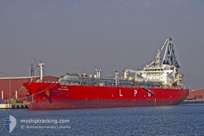
GAS VENUS
Tanker D
Current Trip
TT PTS
| Time Travelled | 10 h, 50 mins |
|---|---|
| Remaining Time | --- |
| Distance Travelled | 124.55 nm |
| Remaining Distance | --- |
| AVG Speed | 16.2 Knots |
| MAX Speed | 16.9 Knots |
| AVG Wind | 13.5 knots |
| MAX Wind | 15 knots |
| MIN Temp | 17.9°C / 64.22°F |
| MAX Temp | 18.1°C / 64.58°F |
| Dybgang | 7.5 m |
| Position Modtaget | 12 d siden |
Current Position
| Longitude | -61.73453° |
|---|---|
| Latitude | 10.57386° |
| Status | Under way using engine |
| Fart | 11.9 Knots |
| Kurs | 323.8° |
| Område | Caribbean Sea |
| Station | T-AIS |
| Position Modtaget | 12 d siden |
Info
Information
The current position of GAS VENUS is in Caribbean Sea with coordinates 10.57386° / -61.73453° as reported on 2024-05-08 17:19 by AIS to our vessel tracker app. The vessel's current speed is 11.9 Knots
The vessel GAS VENUS (IMO: 9774197, MMSI: 373433000) is a Tanker D It's sailing under the flag of [PA] Panama.
In this page you can find informations about the vessels current position, last detected port calls, and current voyage information. If the vessels is not in coverage by AIS you will find the latest position.
The current position of GAS VENUS is detected by our AIS receivers and we are not responsible for the reliability of the data. The last position was recorded while the vessel was in Coverage by the Ais receivers of our vessel tracking app.
The current draught of GAS VENUS as reported by AIS is 7.5 meters
Weather
| Temperature | 18.2°C / 64.76°F |
|---|---|
| Wind Speed | 16 knots |
| Direction | 27° NNE |
| Pressure | 1021.6 hPa |
| Humidity | 67.3 % |
| Cloud Coverage | --- |
Featured Company
Last Port Calls
| Port | Arrival | Departure | Time In Port |
|---|---|---|---|
| 2024-05-19 09:59 | 2024-05-21 01:01 | 1 d | |
| 2024-05-07 03:26 | 2024-05-08 12:02 | 1 d | |
| 2024-04-26 15:59 | 2024-04-26 16:44 | 44 m | |
| 2024-04-16 21:25 | 2024-04-17 19:54 | 22 h | |
| 2024-03-27 05:29 | 2024-03-29 17:51 | 2 d | |
| 2024-03-19 08:32 | 2024-03-21 00:27 | 1 d | |
| 2024-03-18 09:50 | 2024-03-19 01:20 | 15 h | |
| 2024-03-09 14:40 | 2024-03-09 16:12 | 1 h |
Most Visited Ports (Last year)
| Port | Arrivals | |
|---|---|---|
| 7 | ||
| 5 | ||
| 4 | ||
| 3 | ||
| 3 | ||
| 3 |
Last Trips
| Origin | Departure | Destination | Arrival | Distance | |
|---|---|---|---|---|---|
| 2024-05-08 08:02 | 2024-05-19 10:59 | 3265.01 nm | |||
| 2024-04-26 13:44 | 2024-05-06 23:26 | 3495.86 nm | |||
| 2024-04-17 16:54 | 2024-04-26 12:59 | 1129.78 nm | |||
| 2024-03-29 20:51 | 2024-04-16 18:25 | 5636.34 nm | |||
| 2024-03-21 03:27 | 2024-03-27 08:29 | 1080.96 nm | |||
| 2024-03-19 04:20 | 2024-03-19 11:32 | 86.44 nm | |||
| 2024-03-09 19:12 | 2024-03-18 12:50 | 1706.26 nm | |||
| 2024-02-25 20:16 | 2024-03-09 17:40 | 3613.13 nm |
Events
| Tid | Hændelsen | Detaljer | Position / Dest | Info |
|---|---|---|---|---|
| 2024-05-21 01:01 | Afsejlet fra sidste havn |
|
33.15744 / -8.74677
TT PTS
|
Fart: 6.2 kn Kurs: 224° |
| 2024-05-21 00:54 | START Sejllads |
33.12492 / -8.64042
[MA] JORF LASFAR
|
Fart: 6.2 kn Kurs: 224° |
|
| 2024-05-19 10:14 | STOP Sejllads |
33.12893 / -8.62778
[MA] JORF LASFAR
|
Fart: 0.3 kn Kurs: 308° |
|
| 2024-05-19 09:59 | Skibe i havn |
|
33.13020 / -8.63154
[MA] JORF LASFAR
|
Fart: 5.2 kn Kurs: 65° |
| 2024-05-19 09:44 | START Sejllads | 0.86 nm, South West of JORF LASFAR |
33.11977 / -8.64694
TT PTS
|
Fart: 5.2 kn Kurs: 65° |
| 2024-05-18 00:35 | STOP Sejllads | 4.88 nm, West of JORF LASFAR |
33.12057 / -8.72969
TT PTS
|
Fart: 0.3 kn Kurs: 19° |