
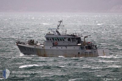
FRENCH WARSHIP EGL
Not available
Current Trip
| Trip Time | 3 days |
|---|---|
| Trip Distance | 649.30 nm |
| AVG Speed | 8.3 Knots |
| MAX Speed | 11.6 Knots |
| Dybgang | 0 m |
| AVG Wind | 11.7 knots |
| MAX Wind | 24.9 knots |
| MIN Temp | 6.6°C / 43.88°F |
| MAX Temp | 13.3°C / 55.94°F |
| Position Modtaget | 17 h, 8 m siden |
Current Position
| Longitude | -4.51610° |
|---|---|
| Latitude | 48.36848° |
| Status | Moored |
| Fart | |
| Kurs | --- |
| Område | Celtic Sea |
| Station | T-AIS |
| Position Modtaget | 17 h, 8 m siden |
Info
Information
The current position of FRENCH WARSHIP EGL is in Celtic Sea with coordinates 48.36848° / -4.51610° as reported on 2024-05-03 08:08 by AIS to our vessel tracker app. The vessel's current speed is 0 Knots and is currently inside the port of BREST.
The vessel FRENCH WARSHIP EGL (MMSI: 227806400) is a Not available It's sailing under the flag of [FR] France.
In this page you can find informations about the vessels current position, last detected port calls, and current voyage information. If the vessels is not in coverage by AIS you will find the latest position.
The current position of FRENCH WARSHIP EGL is detected by our AIS receivers and we are not responsible for the reliability of the data. The last position was recorded while the vessel was in Coverage by the Ais receivers of our vessel tracking app.
Weather
| Temperature | 11.3°C / 52.34°F |
|---|---|
| Wind Speed | 7 knots |
| Direction | 236° SW |
| Pressure | 1012.2 hPa |
| Humidity | 74.8 % |
| Cloud Coverage | 29 % |
Featured Company
Events
| Tid | Hændelsen | Detaljer | Position / Dest | Info |
|---|---|---|---|---|
| 2024-05-03 08:08 | Udenfor Dækning |
48.36848 / -4.51610
Celtic Sea
[FR] BREST
|
Fart: Kurs: 511° |
|
| 2024-05-03 07:04 | Status er ændret | Moored Under way using engine |
48.36850 / -4.51611
[FR] BREST
|
Fart: Kurs: 511° |
| 2024-05-03 06:44 | STOP Sejllads |
48.36771 / -4.51457
[FR] BREST
|
Fart: 0.3 kn Kurs: 511° |
|
| 2024-05-03 06:31 | Skibe i havn |
|
48.36822 / -4.48839
[FR] BREST
|
Fart: 7.6 kn Kurs: 342.4° |
| 2024-05-03 03:11 | START Sejllads | 4.49 nm, South of BREST |
48.30220 / -4.44951
3
|
Fart: 6.5 kn Kurs: 347° |
| 2024-05-03 03:09 | STOP Sejllads | 4.5 nm, South of BREST |
48.30140 / -4.45203
3
|
Fart: 0.2 kn Kurs: 511° |
| 2024-05-03 02:55 | START Sejllads | 4.4 nm, South of BREST |
48.30283 / -4.45379
3
|
Fart: 3.3 kn Kurs: 17.5° |
| 2024-05-03 02:46 | STOP Sejllads | 4.58 nm, South of BREST |
48.30020 / -4.45145
3
|
Fart: 0.3 kn Kurs: 511° |
| 2024-05-03 00:15 | START Sejllads | 4.51 nm, South of BREST |
48.30076 / -4.45413
3
|
Fart: 7.6 kn Kurs: 299.7° |
| 2024-05-03 00:12 | STOP Sejllads | 4.59 nm, South of BREST |
48.29997 / -4.45161
3
|
Fart: 0.3 kn Kurs: 511° |