
INCRA
General Cargo
Current Trip
| Trip Time | 6 days |
|---|---|
| Trip Distance | 1394.36 nm |
| AVG Speed | 9.7 Knots |
| MAX Speed | 14 Knots |
| Dybgang | 6.2 m |
| AVG Wind | 9.9 knots |
| MAX Wind | 23 knots |
| MIN Temp | 13.2°C / 55.76°F |
| MAX Temp | 19.3°C / 66.74°F |
| Position Modtaget | 1 d siden |
Current Position
| Longitude | 22.14899° |
|---|---|
| Latitude | 38.32211° |
| Status | Under way using engine |
| Fart | 9.4 Knots |
| Kurs | 105.8° |
| Område | Ionian Sea |
| Station | T-AIS |
| Position Modtaget | 1 d siden |
Info
Information
The current position of INCRA is in Ionian Sea with coordinates 38.32211° / 22.14899° as reported on 2024-05-11 06:19 by AIS to our vessel tracker app. The vessel's current speed is 9.4 Knots and is currently inside the port of AGIOS NIKOLAOS.
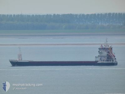
The vessel INCRA (IMO: 9195858, MMSI: 314431000) is a General Cargo that was built in 2000 ( 24 år gamle ). It's sailing under the flag of [BB] Barbados.
In this page you can find informations about the vessels current position, last detected port calls, and current voyage information. If the vessels is not in coverage by AIS you will find the latest position.
The current position of INCRA is detected by our AIS receivers and we are not responsible for the reliability of the data. The last position was recorded while the vessel was in Coverage by the Ais receivers of our vessel tracking app.
The current draught of INCRA as reported by AIS is 6.2 meters
Weather
| Temperature | 17.8°C / 64.04°F |
|---|---|
| Wind Speed | 8 knots |
| Direction | 282° WNW |
| Pressure | 1015.3 hPa |
| Humidity | 68.1 % |
| Cloud Coverage | 3 % |
Featured Company
Last Port Calls
| Port | Arrival | Departure | Time In Port |
|---|---|---|---|
| 2024-05-12 06:43 | |||
| 2024-05-05 07:55 | 2024-05-05 12:42 | 4 h | |
| 2024-04-19 07:21 | 2024-04-26 07:42 | 7 d | |
| 2024-04-15 11:40 | 2024-04-18 12:51 | 3 d | |
| 2024-04-06 15:34 | 2024-04-06 20:50 | 5 h | |
| 2024-03-29 05:32 | 2024-04-02 15:05 | 4 d | |
| 2024-03-25 19:43 | 2024-03-28 21:58 | 3 d | |
| 2024-03-18 15:42 | 2024-03-20 00:29 | 1 d | |
| 2024-03-15 09:16 | 2024-03-17 09:19 | 2 d |
Last Trips
| Origin | Departure | Destination | Arrival | Distance | |
|---|---|---|---|---|---|
| 2024-05-05 14:42 | 2024-05-12 09:43 | 1394.36 nm | |||
| 2024-04-26 09:42 | 2024-05-05 09:55 | 1950.47 nm | |||
| 2024-04-18 14:51 | 2024-04-19 09:21 | 173.69 nm | |||
| 2024-04-06 22:50 | 2024-04-15 13:40 | 1860.42 nm | |||
| 2024-04-02 17:05 | 2024-04-06 17:34 | 898.55 nm | |||
| 2024-03-28 22:58 | 2024-03-29 06:32 | 52.95 nm | |||
| 2024-03-20 00:29 | 2024-03-25 20:43 | 1272.48 nm | |||
| 2024-03-17 10:19 | 2024-03-18 15:42 | 291.41 nm | |||
| 2024-02-24 23:50 | 2024-03-15 10:16 | 2259.26 nm |
Events
| Tid | Hændelsen | Detaljer | Position / Dest | Info |
|---|---|---|---|---|
| 2024-05-12 06:43 | Skibe i havn |
|
38.36167 / 22.68500
[GR] AGIOS NIKOLAOS
|
Fart: Kurs: -1° |
| 2024-05-11 06:23 | Status er ændret | Default Under way using engine |
38.31955 / 22.16080
GRSTN
|
Fart: 9.4 kn Kurs: 105.8° |
| 2024-05-11 06:19 | Udenfor Dækning |
38.32211 / 22.14899
Ionian Sea
GRSTN
|
Fart: 9.4 kn Kurs: 105.8° |
|
| 2024-05-10 18:46 | Status er ændret | Under way using engine Default |
37.93606 / 19.95862
GRSTN
|
Fart: 9.6 kn Kurs: 90° |
| 2024-05-10 18:42 | Status er ændret | Default Under way using engine |
37.93590 / 19.94459
GRSTN
|
Fart: 9.7 kn Kurs: 87.5° |
| 2024-05-10 14:12 | Status er ændret | Under way using engine Default |
37.91795 / 19.02176
GRSTN
|
Fart: 9 kn Kurs: 89° |
| 2024-05-10 14:07 | Status er ændret | Default Under way using engine |
37.91667 / 19.00500
GRSTN
|
Fart: 9.5 kn Kurs: 88° |
| 2024-05-10 13:13 | Status er ændret | Under way using engine Default |
37.91489 / 18.82287
GRSTN
|
Fart: 9 kn Kurs: 89° |
| 2024-05-10 13:07 | Status er ændret | Default Under way using engine |
37.91333 / 18.80500
GRSTN
|
Fart: 8.9 kn Kurs: 89.9° |
| 2024-05-10 11:46 | Ændre havområde | Greek part of the Ionian Sea Italian part of the Ionian Sea |
37.90894 / 18.54708
Ionian Sea
GRSTN
|
Fart: 9.3 kn Kurs: 88.1° |