
FASSA
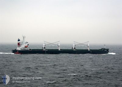
Bulk Carrier
Current Trip
| Time Travelled | 4 days |
|---|---|
| Remaining Time | --- |
| Distance Travelled | 22.18 nm |
| Remaining Distance | 821.88 nm |
| AVG Speed | 5.1 Knots |
| MAX Speed | 8.6 Knots |
| AVG Wind | 14.5 knots |
| MAX Wind | 21 knots |
| MIN Temp | 16.8°C / 62.24°F |
| MAX Temp | 19.9°C / 67.82°F |
| Dybgang | 12.5 m |
| Position Modtaget | 7 d siden |
Current Position
| Longitude | --- |
|---|---|
| Latitude | --- |
| Status | Under way using engine |
| Fart | 9.3 Knots |
| Kurs | 99.1° |
| Område | Mediterranean Sea - Eastern Basin |
| Station | T-AIS |
| Position Modtaget | 7 d siden |
Info
Information
The current position of FASSA is in Mediterranean Sea - Eastern Basin with coordinates 35.90211° / 14.81542° as reported on 2025-12-02 04:02 by AIS to our vessel tracker app. The vessel's current speed is 9.3 Knots and is heading at the port of VALLETTA. The estimated time of arrival as calculated by MyShipTracking vessel tracking app is 2025-12-01 16:30 LT
The vessel FASSA (IMO: 9313503, MMSI: 319192200) is a Bulk Carrier that was built in 2006 ( 19 år gamle ). It's sailing under the flag of [KY] Cayman Is.
In this page you can find informations about the vessels current position, last detected port calls, and current voyage information. If the vessels is not in coverage by AIS you will find the latest position.
The current position of FASSA is detected by our AIS receivers and we are not responsible for the reliability of the data. The last position was recorded while the vessel was in Coverage by the Ais receivers of our vessel tracking app.
The current draught of FASSA as reported by AIS is 12.5 meters
Weather
| Temperature | 18.7°C / 65.66°F |
|---|---|
| Wind Speed | 20 knots |
| Direction | 308° NW |
| Pressure | 1016.1 hPa |
| Humidity | 62.1 % |
| Cloud Coverage | 4 % |
Featured Company
Last Port Calls
| Port | Arrival | Departure | Time In Port |
|---|---|---|---|
| 2025-12-05 03:17 | 2025-12-05 16:13 | 12 h | |
| 2025-11-07 21:14 | 2025-11-11 16:14 | 3 d | |
| 2025-11-01 03:39 | 2025-11-01 20:58 | 17 h | |
| 2025-10-20 07:03 | 2025-10-25 10:26 | 5 d |
Most Visited Ports (Last year)
| Port | Arrivals | |
|---|---|---|
| 3 | ||
| 2 | ||
| 2 | ||
| 1 | ||
| 1 | ||
| 1 |
Last Trips
| Origin | Departure | Destination | Arrival | Distance | |
|---|---|---|---|---|---|
| 2025-11-11 16:14 | 2025-12-05 03:17 | 6747.68 nm | |||
| 2025-11-01 20:58 | 2025-11-07 21:14 | 103.25 nm | |||
| 2025-10-25 10:26 | 2025-11-01 03:39 | 484.73 nm | |||
| 2025-09-16 15:46 | 2025-10-20 07:03 | 7879.37 nm |
Events
| Tid | Hændelsen | Detaljer | Position / Dest | Info |
|---|---|---|---|---|
| 2025-12-05 15:17 | STOP Sejllads | 3.7 nm, North West of EL DEKHEILA |
31.18911 / 29.75410
MTMLA
|
Fart: 0.2 kn Kurs: 302° |
| 2025-12-05 14:13 | Afsejlet fra sidste havn |
|
31.16115 / 29.83867
MTMLA
|
Fart: 2.5 kn Kurs: 262° |
| 2025-12-05 13:53 | START Sejllads |
31.17298 / 29.85713
[EG] ALEXANDRIA
|
Fart: 3.4 kn Kurs: 229° |
|
| 2025-12-05 01:39 | STOP Sejllads |
31.17308 / 29.85982
[EG] ALEXANDRIA
|
Fart: 0.3 kn Kurs: 52° |
|
| 2025-12-05 01:17 | Skibe i havn |
|
31.16421 / 29.84681
[EG] ALEXANDRIA
|
Fart: 5.5 kn Kurs: 64° |
| 2025-12-04 22:33 | START Sejllads | 8.26 nm, North West of EL DEKHEILA |
31.23854 / 29.68658
MTMLA
|
Fart: 3.5 kn Kurs: 60° |
| 2025-12-04 20:49 | STOP Sejllads | 8.42 nm, North West of EL DEKHEILA |
31.23828 / 29.68231
MTMLA
|
Fart: 0.3 kn Kurs: 121° |
| 2025-12-02 04:09 | Status er ændret | Default Under way using engine |
35.89922 / 14.83901
MTMLA
|
Fart: 9.3 kn Kurs: 99.1° |
| 2025-12-02 04:02 | Udenfor Dækning |
35.90211 / 14.81542
Mediterranean Sea - Eastern Basin
|
Fart: 9.3 kn Kurs: 99.1° |
|
| 2025-12-02 03:50 | Status er ændret | Under way using engine At anchor |
35.90841 / 14.78431
MTMLA
|
Fart: 3.9 kn Kurs: 107° |