
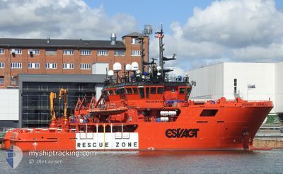
ESVAGT CORNELIA
Search and Rescue vessel
Current Trip
TAMBAR
| Time Travelled | 2 days |
|---|---|
| Remaining Time | --- |
| Distance Travelled | 165.18 nm |
| Remaining Distance | --- |
| AVG Speed | 8.2 Knots |
| MAX Speed | 9.9 Knots |
| AVG Wind | 10.8 knots |
| MAX Wind | 16.3 knots |
| MIN Temp | -3.1°C / 26.42°F |
| MAX Temp | 2.9°C / 37.22°F |
| Dybgang | 4.6 m |
| Position Modtaget | 1 d siden |
Current Position
| Longitude | --- |
|---|---|
| Latitude | --- |
| Status | Under way using engine |
| Fart | 9.4 Knots |
| Kurs | 299.2° |
| Område | North Sea |
| Station | T-AIS |
| Position Modtaget | 1 d siden |
Info
Information
The current position of ESVAGT CORNELIA is in North Sea with coordinates 56.58980° / 4.08952° as reported on 2026-01-04 13:36 by AIS to our vessel tracker app. The vessel's current speed is 9.4 Knots
The vessel ESVAGT CORNELIA (IMO: 9678434, MMSI: 219019218) is a Search and Rescue vessel It's sailing under the flag of [DK] Denmark.
In this page you can find informations about the vessels current position, last detected port calls, and current voyage information. If the vessels is not in coverage by AIS you will find the latest position.
The current position of ESVAGT CORNELIA is detected by our AIS receivers and we are not responsible for the reliability of the data. The last position was recorded while the vessel was in Coverage by the Ais receivers of our vessel tracking app.
The current draught of ESVAGT CORNELIA as reported by AIS is 4.6 meters
Weather
| Temperature | 2.2°C / 35.96°F |
|---|---|
| Wind Speed | 15 knots |
| Direction | 169° S |
| Pressure | 1001 hPa |
| Humidity | 81.4 % |
| Cloud Coverage | 100 % |
Featured Company
Most Visited Ports (Last year)
| Port | Arrivals | |
|---|---|---|
| 7 |
Events
| Tid | Hændelsen | Detaljer | Position / Dest | Info |
|---|---|---|---|---|
| 2026-01-04 13:36 | Udenfor Dækning |
56.58980 / 4.08952
North Sea
TAMBAR
|
Fart: 9.4 kn Kurs: 299.2° |
|
| 2026-01-04 11:49 | Fundet i havområde | Norwegian part of the North Sea |
56.45063 / 4.51345
North Sea
TAMBAR
|
Fart: 9.1 kn Kurs: 303.9° |
| 2026-01-04 08:16 | Indenfor Dækning |
56.19524 / 5.35483
North Sea
TAMBAR
|
Fart: 9 kn Kurs: 296.7° |
|
| 2026-01-04 00:43 | Udenfor Dækning |
55.64710 / 7.10177
North Sea
TAMBAR
|
Fart: 9.1 kn Kurs: 299.5° |
|
| 2026-01-03 18:41 | Afsejlet fra sidste havn |
|
55.45888 / 8.42716
TAMBAR
|
Fart: 8.1 kn Kurs: 296° |
| 2026-01-03 18:35 | START Sejllads |
55.46077 / 8.44233
[DK] ESBJERG
|
Fart: 3.9 kn Kurs: 192° |
|
| 2026-01-03 17:57 | Destination er ændret | TAMBAR DKEBJ |
55.46269 / 8.44212
[DK] ESBJERG
|
Fart: Kurs: 8° |
| 2026-01-03 17:57 | ETA er ændret | 2026/01/04 20:00 2026/01/03 12:00 |
55.46269 / 8.44212
[DK] ESBJERG
|
Fart: Kurs: 8° |
| 2026-01-03 17:56 | Status er ændret | Under way using engine Moored |
55.46269 / 8.44212
[DK] ESBJERG
|
Fart: Kurs: 7° |
| 2026-01-03 12:08 | Status er ændret | Moored Under way using engine |
55.46268 / 8.44210
[DK] ESBJERG
|
Fart: Kurs: 6° |