
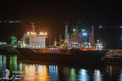
ERICUSA M
Oil/Chemical Tanker
Current Trip
| Time Travelled | 11 days |
|---|---|
| Remaining Time | --- |
| Distance Travelled | 314.09 nm |
| Remaining Distance | 15.88 nm |
| AVG Speed | 11.4 Knots |
| MAX Speed | 14.6 Knots |
| AVG Wind | 10.6 knots |
| MAX Wind | 16 knots |
| MIN Temp | 7.4°C / 45.32°F |
| MAX Temp | 16.6°C / 61.88°F |
| Dybgang | 6.2 m |
| Position Modtaget | 1 m siden |
Current Position
| Longitude | 3.76187° |
|---|---|
| Latitude | 51.93722° |
| Status | At anchor |
| Fart | |
| Kurs | 220° |
| Område | North Sea |
| Station | T-AIS |
| Position Modtaget | 1 m siden |
Info
Information
The current position of ERICUSA M is in North Sea with coordinates 51.93722° / 3.76187° as reported on 2024-05-14 20:52 by AIS to our vessel tracker app. The vessel's current speed is 0 Knots and is heading at the port of ROTTERDAM. The estimated time of arrival as calculated by MyShipTracking vessel tracking app is 2024-05-14 11:00 LT
The vessel ERICUSA M (IMO: 9367372, MMSI: 247433300) is a Oil/Chemical Tanker that was built in 2009 ( 15 år gamle ). It's sailing under the flag of [IT] Italy.
In this page you can find informations about the vessels current position, last detected port calls, and current voyage information. If the vessels is not in coverage by AIS you will find the latest position.
The current position of ERICUSA M is detected by our AIS receivers and we are not responsible for the reliability of the data. The last position was recorded while the vessel was in Coverage by the Ais receivers of our vessel tracking app.
The current draught of ERICUSA M as reported by AIS is 6.2 meters
Weather
| Temperature | 12.7°C / 54.86°F |
|---|---|
| Wind Speed | 2 knots |
| Direction | 355° N |
| Pressure | 1006.3 hPa |
| Humidity | 90 % |
| Cloud Coverage | 100 % |
Featured Company
Last Port Calls
| Port | Arrival | Departure | Time In Port |
|---|---|---|---|
| 2024-05-02 17:10 | 2024-05-03 08:14 | 15 h | |
| 2024-04-28 05:56 | 2024-04-30 00:00 | 1 d | |
| 2024-04-17 18:32 | 2024-04-19 09:26 | 1 d | |
| 2024-04-13 05:02 | 2024-04-14 10:11 | 1 d | |
| 2024-04-03 13:48 | 2024-04-04 19:36 | 1 d | |
| 2024-04-01 15:09 | 2024-04-02 15:14 | 1 d | |
| 2024-03-19 05:12 | 2024-03-20 13:56 | 1 d | |
| 2024-03-15 13:56 | 2024-03-16 15:52 | 1 d | |
| 2024-03-12 04:33 | 2024-03-13 16:52 | 1 d | |
| 2024-03-09 21:55 | 2024-03-11 00:42 | 1 d |
Most Visited Ports (Last year)
| Port | Arrivals | |
|---|---|---|
| 23 | ||
| 11 | ||
| 11 | ||
| 10 | ||
| 3 | ||
| 2 |
Last Trips
| Origin | Departure | Destination | Arrival | Distance | |
|---|---|---|---|---|---|
| 2024-04-30 00:00 | 2024-05-02 17:10 | 288.98 nm | |||
| 2024-04-19 09:26 | 2024-04-28 05:56 | 323.30 nm | |||
| 2024-04-14 10:11 | 2024-04-17 18:32 | 281.08 nm | |||
| 2024-04-04 19:36 | 2024-04-13 05:02 | 1248.63 nm | |||
| 2024-04-02 15:14 | 2024-04-03 13:48 | 281.32 nm | |||
| 2024-03-20 13:56 | 2024-04-01 15:09 | 313.44 nm | |||
| 2024-03-16 15:52 | 2024-03-19 05:12 | 291.65 nm | |||
| 2024-03-13 16:52 | 2024-03-15 13:56 | 298.44 nm | |||
| 2024-03-11 00:42 | 2024-03-12 04:33 | 283.50 nm | |||
| 2024-03-06 01:16 | 2024-03-09 21:55 | 44.35 nm |
Events
| Tid | Hændelsen | Detaljer | Position / Dest | Info |
|---|---|---|---|---|
| 2024-05-14 10:03 | Status er ændret | At anchor Default |
51.93700 / 3.75847
NLRTM
|
Fart: Kurs: 138° |
| 2024-05-14 09:58 | Status er ændret | Default At anchor |
51.93700 / 3.75852
NLRTM
|
Fart: Kurs: 134° |
| 2024-05-14 09:31 | Status er ændret | At anchor Under way using engine |
51.93682 / 3.76048
NLRTM
|
Fart: 1.4 kn Kurs: 187° |
| 2024-05-14 09:28 | STOP Sejllads | 10.5 nm, North West of OUDDORP |
51.93550 / 3.76075
NLRTM
|
Fart: 0.2 kn Kurs: 172° |
| 2024-05-14 05:55 | Ændre havområde | Dutch part of the North Sea Belgian part of the North Sea |
51.78312 / 2.70773
North Sea
NLRTM
|
Fart: 13.1 kn Kurs: 72° |
| 2024-05-14 04:53 | ETA er ændret | 2024/05/14 09:00 2024/05/14 08:00 |
51.62488 / 2.44192
NLRTM
|
Fart: 13.6 kn Kurs: 38° |
| 2024-05-14 04:10 | Fundet i havområde | Belgian part of the North Sea |
51.50018 / 2.27287
North Sea
NLRTM
|
Fart: 13.7 kn Kurs: 41° |
| 2024-05-14 03:44 | ETA er ændret | 2024/05/14 08:00 2024/05/14 10:00 |
51.42542 / 2.16660
NLRTM
|
Fart: 13.6 kn Kurs: 39° |
| 2024-05-14 02:07 | Ændre havområde | French part of the North Sea United Kingdom part of the North Sea |
51.16162 / 1.82710
North Sea
NLRTM
|
Fart: 13.6 kn Kurs: 57° |
| 2024-05-14 01:43 | Ændre havområde | United Kingdom part of the North Sea French part of the North Sea |
51.09953 / 1.72188
North Sea
NLRTM
|
Fart: 13.7 kn Kurs: 43° |