
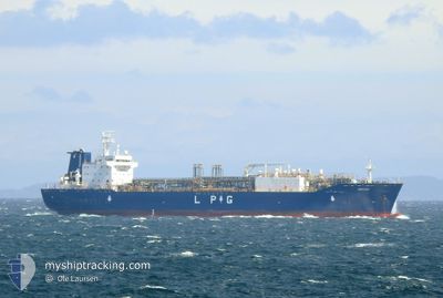
EMPERY
Tanker
Current Trip
| Time Travelled | 5 days |
|---|---|
| Remaining Time | --- |
| Distance Travelled | 1393.16 nm |
| Remaining Distance | --- |
| AVG Speed | 10.3 Knots |
| MAX Speed | 15.6 Knots |
| AVG Wind | 20.2 knots |
| MAX Wind | 34.7 knots |
| MIN Temp | 4.7°C / 40.46°F |
| MAX Temp | 14.4°C / 57.92°F |
| Dybgang | 7.5 m |
| Position Modtaget | 19 h, 10 m siden |
Current Position
| Longitude | --- |
|---|---|
| Latitude | --- |
| Status | Under way using engine |
| Fart | 8 Knots |
| Kurs | 243.3° |
| Område | Celtic Sea |
| Station | T-AIS |
| Position Modtaget | 19 h, 10 m siden |
Info
Information
The current position of EMPERY is in Celtic Sea with coordinates 49.20464° / -5.07601° as reported on 2025-12-10 04:42 by AIS to our vessel tracker app. The vessel's current speed is 8 Knots and is heading at the port of MARCUS HOOK. The estimated time of arrival as calculated by MyShipTracking vessel tracking app is 2025-12-22 18:00 LT
The vessel EMPERY (IMO: 9744910, MMSI: 564011000) is a Tanker It's sailing under the flag of [SG] Singapore.
In this page you can find informations about the vessels current position, last detected port calls, and current voyage information. If the vessels is not in coverage by AIS you will find the latest position.
The current position of EMPERY is detected by our AIS receivers and we are not responsible for the reliability of the data. The last position was recorded while the vessel was in Coverage by the Ais receivers of our vessel tracking app.
The current draught of EMPERY as reported by AIS is 7.5 meters
Weather
| Temperature | 13.4°C / 56.12°F |
|---|---|
| Wind Speed | 16 knots |
| Direction | 170° S |
| Pressure | 1021.7 hPa |
| Humidity | 74.6 % |
| Cloud Coverage | 3 % |
Featured Company
Last Port Calls
| Port | Arrival | Departure | Time In Port |
|---|---|---|---|
| 2025-12-03 23:45 | 2025-12-05 03:30 | 1 d | |
| 2025-11-19 03:44 | 2025-11-20 05:26 | 1 d | |
| 2025-11-01 09:10 | 2025-11-03 10:49 | 2 d | |
| 2025-10-16 12:34 | 2025-10-17 12:28 | 23 h | |
| 2025-10-02 10:34 |
Most Visited Ports (Last year)
| Port | Arrivals | |
|---|---|---|
| 7 | ||
| 5 | ||
| 4 | ||
| 2 | ||
| 1 |
Last Trips
| Origin | Departure | Destination | Arrival | Distance | |
|---|---|---|---|---|---|
| 2025-11-20 05:26 | 2025-12-03 23:45 | 4212.48 nm | |||
| 2025-11-03 10:49 | 2025-11-19 03:44 | 4373.56 nm | |||
| 2025-10-17 12:28 | 2025-11-01 09:10 | 3612.27 nm | |||
| 2025-10-02 10:34 | 2025-10-16 12:34 | 4166.67 nm |
Events
| Tid | Hændelsen | Detaljer | Position / Dest | Info |
|---|---|---|---|---|
| 2025-12-10 04:47 | Status er ændret | Default Under way using engine |
49.19903 / -5.09175
USMAH
|
Fart: 8 kn Kurs: 243.3° |
| 2025-12-10 04:42 | Udenfor Dækning |
49.20464 / -5.07601
Celtic Sea
USMAH
|
Fart: 8 kn Kurs: 243.3° |
|
| 2025-12-10 04:42 | Status er ændret | Under way using engine Default |
49.20481 / -5.07552
USMAH
|
Fart: 7.5 kn Kurs: 237° |
| 2025-12-10 04:39 | Status er ændret | Default Under way using engine |
49.20743 / -5.06815
USMAH
|
Fart: 7.7 kn Kurs: 234.4° |
| 2025-12-10 04:30 | Ændre havområde | French part of the Celtic Sea French part of the English Channel |
49.21635 / -5.04348
Celtic Sea
USMAH
|
Fart: 7.8 kn Kurs: 241.6° |
| 2025-12-10 04:21 | Ændre havområde | French part of the English Channel United Kingdom part of the English Channel |
49.22648 / -5.01483
English Channel
USMAH
|
Fart: 10 kn Kurs: 242.4° |
| 2025-12-10 04:21 | Status er ændret | Under way using engine Default |
49.22648 / -5.01483
USMAH
|
Fart: 10.6 kn Kurs: 247° |
| 2025-12-10 04:07 | Indenfor Dækning |
49.22648 / -5.01483
English Channel
USMAH
|
Fart: 10 kn Kurs: 242.4° |
|
| 2025-12-09 15:11 | Status er ændret | Default Under way using engine |
50.22875 / -1.40361
USMAH
|
Fart: 14 kn Kurs: 255.1° |
| 2025-12-09 15:06 | Udenfor Dækning |
50.23330 / -1.37375
English Channel
USMAH
|
Fart: 14 kn Kurs: 255.1° |