
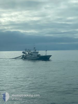
ELISABETH
Trawler
Current Trip
CH16
| Time Travelled | 17 h, 8 mins |
|---|---|
| Remaining Time | --- |
| Distance Travelled | 169.86 nm |
| Remaining Distance | --- |
| AVG Speed | 11.4 Knots |
| MAX Speed | 12.7 Knots |
| AVG Wind | 18.8 knots |
| MAX Wind | 34 knots |
| MIN Temp | 7.8°C / 46.04°F |
| MAX Temp | 12.4°C / 54.32°F |
| Dybgang | 6 m |
| Position Modtaget | 1 m siden |
Current Position
| Longitude | --- |
|---|---|
| Latitude | --- |
| Status | Under way using engine |
| Fart | 11.7 Knots |
| Kurs | 141° |
| Område | North Sea |
| Station | T-AIS |
| Position Modtaget | 1 m siden |
Info
Information
The current position of ELISABETH is in North Sea with coordinates 60.42407° / 5.04740° as reported on 2024-10-06 10:51 by AIS to our vessel tracker app. The vessel's current speed is 11.7 Knots
The vessel ELISABETH (IMO: 9088847, MMSI: 259166000) is a Trawler that was built in 1994 ( 30 år gamle ). It's sailing under the flag of [NO] Norway.
In this page you can find informations about the vessels current position, last detected port calls, and current voyage information. If the vessels is not in coverage by AIS you will find the latest position.
The current position of ELISABETH is detected by our AIS receivers and we are not responsible for the reliability of the data. The last position was recorded while the vessel was in Coverage by the Ais receivers of our vessel tracking app.
The current draught of ELISABETH as reported by AIS is 6 meters
Weather
| Temperature | 12.3°C / 54.14°F |
|---|---|
| Wind Speed | 17 knots |
| Direction | 168° SSE |
| Pressure | 1008.5 hPa |
| Humidity | 78.2 % |
| Cloud Coverage | 100 % |
Featured Company
Last Port Calls
| Port | Arrival | Departure | Time In Port |
|---|---|---|---|
| 2024-10-05 15:33 | 2024-10-05 19:44 | 4 h | |
| 2024-10-03 09:19 | 2024-10-03 21:20 | 12 h | |
| 2024-09-27 05:19 | 2024-09-27 06:51 | 1 h | |
| 2024-09-23 08:54 | 2024-09-23 14:18 | 5 h | |
| 2024-09-20 16:14 | 2024-09-20 17:16 | 1 h | |
| 2024-09-20 13:03 | 2024-09-20 14:56 | 1 h | |
| 2024-09-20 06:43 | 2024-09-20 12:14 | 5 h | |
| 2024-09-11 19:11 | 2024-09-12 00:06 | 4 h | |
| 2024-09-10 21:10 | 2024-09-11 16:15 | 19 h | |
| 2024-09-10 08:45 | 2024-09-10 20:41 | 11 h |
Most Visited Ports (Last year)
| Port | Arrivals | |
|---|---|---|
| 13 | ||
| 10 | ||
| 7 | ||
| 6 | ||
| 5 | ||
| 5 |
Last Trips
| Origin | Departure | Destination | Arrival | Distance | |
|---|---|---|---|---|---|
| 2024-10-03 21:20 | 2024-10-05 15:33 | 350.05 nm | |||
| 2024-09-27 06:51 | 2024-10-03 09:19 | 480.56 nm | |||
| 2024-09-23 14:18 | 2024-09-27 05:19 | 227.46 nm | |||
| 2024-09-20 17:16 | 2024-09-23 08:54 | 567.10 nm | |||
| 2024-09-20 14:56 | 2024-09-20 16:14 | 17.60 nm | |||
| 2024-09-20 12:14 | 2024-09-20 13:03 | 4.29 nm | |||
| 2024-09-12 00:06 | 2024-09-20 06:43 | 1117.50 nm | |||
| 2024-09-11 16:15 | 2024-09-11 19:11 | 25.46 nm | |||
| 2024-09-10 20:41 | 2024-09-10 21:10 | 4.03 nm | |||
| 2024-09-06 19:59 | 2024-09-10 08:45 | 423.09 nm |
Events
| Tid | Hændelsen | Detaljer | Position / Dest | Info |
|---|---|---|---|---|
| 2024-10-06 09:33 | START Sejllads | 4.65 nm, East of STURE |
60.62027 / 5.01752
CH16
|
Fart: 10.9 kn Kurs: 273.9° |
| 2024-10-06 07:23 | STOP Sejllads | 4.77 nm, East of STURE |
60.62027 / 5.02158
CH16
|
Fart: 0.2 kn Kurs: 237° |
| 2024-10-06 04:52 | Ændre havområde | Norwegian part of the North Sea Norwegian part of the Norwegian Sea |
60.98917 / 4.75745
North Sea
|
Fart: 11.2 kn Kurs: 181.7° |
| 2024-10-05 17:44 | Afsejlet fra sidste havn |
|
62.48720 / 6.29038
CH16
|
Fart: 5 kn Kurs: 252° |
| 2024-10-05 17:40 | START Sejllads |
62.48888 / 6.30315
[NO] ELLINGSOY
|
Fart: 5.5 kn Kurs: 246° |
|
| 2024-10-05 13:42 | STOP Sejllads |
62.49127 / 6.30797
[NO] ELLINGSOY
|
Fart: Kurs: 12° |
|
| 2024-10-05 13:33 | Skibe i havn |
|
62.48830 / 6.30022
[NO] ELLINGSOY
|
Fart: 11.2 kn Kurs: 85.5° |
| 2024-10-05 04:18 | Ændre havområde | Norwegian part of the Norwegian Sea Norwegian part of the North Sea |
61.00778 / 3.09105
Norwegian Sea
|
Fart: 14.1 kn Kurs: 36.2° |
| 2024-10-05 04:04 | Fundet i havområde | Norwegian part of the North Sea |
60.96290 / 3.02292
North Sea
|
Fart: 15 kn Kurs: 34.8° |
| 2024-10-05 04:02 | Indenfor Dækning |
60.96290 / 3.02292
North Sea
|
Fart: 15 kn Kurs: 34.8° |