
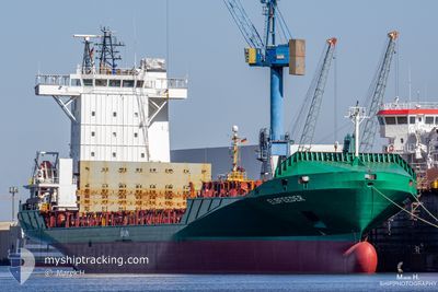
ELBFEEDER
Container Ship
Current Trip
| Time Travelled | 1 day |
|---|---|
| Remaining Time | 35 mins |
| Distance Travelled | 568.16 nm |
| Remaining Distance | 10.86 nm |
| AVG Speed | 15.1 Knots |
| MAX Speed | 20.4 Knots |
| AVG Wind | 8.6 knots |
| MAX Wind | 18.9 knots |
| MIN Temp | 10.8°C / 51.44°F |
| MAX Temp | 13.8°C / 56.84°F |
| Dybgang | 6.7 m |
| Position Modtaget | 1 m siden |
Current Position
| Longitude | 3.90346° |
|---|---|
| Latitude | 51.98399° |
| Status | Under way using engine |
| Fart | 15 Knots |
| Kurs | 78.2° |
| Område | North Sea |
| Station | T-AIS |
| Position Modtaget | 1 m siden |
Info
Information
The current position of ELBFEEDER is in North Sea with coordinates 51.98399° / 3.90346° as reported on 2024-05-06 09:48 by AIS to our vessel tracker app. The vessel's current speed is 15 Knots and is heading at the port of ROTTERDAM. The estimated time of arrival as calculated by MyShipTracking vessel tracking app is 2024-05-06 10:24 LT
The vessel ELBFEEDER (IMO: 9388522, MMSI: 212931000) is a Container Ship that was built in 2008 ( 16 år gamle ). It's sailing under the flag of [CY] Cyprus.
In this page you can find informations about the vessels current position, last detected port calls, and current voyage information. If the vessels is not in coverage by AIS you will find the latest position.
The current position of ELBFEEDER is detected by our AIS receivers and we are not responsible for the reliability of the data. The last position was recorded while the vessel was in Coverage by the Ais receivers of our vessel tracking app.
The current draught of ELBFEEDER as reported by AIS is 6.7 meters
Weather
| Temperature | 13.5°C / 56.3°F |
|---|---|
| Wind Speed | 8 knots |
| Direction | 80° E |
| Pressure | 1007.3 hPa |
| Humidity | 78.5 % |
| Cloud Coverage | 95 % |
Featured Company
Last Port Calls
| Port | Arrival | Departure | Time In Port |
|---|---|---|---|
| 2024-05-04 07:11 | 2024-05-04 18:11 | 11 h | |
| 2024-05-04 05:58 | 2024-05-04 06:05 | 7 m | |
| 2024-05-02 18:48 | 2024-05-03 18:00 | 23 h | |
| 2024-04-29 14:49 | 2024-05-01 02:53 | 1 d | |
| 2024-04-27 08:22 | 2024-04-28 00:14 | 15 h | |
| 2024-04-26 07:02 | 2024-04-26 18:51 | 11 h | |
| 2024-04-26 06:53 | 2024-04-26 07:00 | 7 m | |
| 2024-04-22 18:50 | 2024-04-24 01:04 | 1 d | |
| 2024-04-20 05:27 | 2024-04-20 22:11 | 16 h | |
| 2024-04-20 05:15 | 2024-04-20 05:23 | 7 m |
Most Visited Ports (Last year)
| Port | Arrivals | |
|---|---|---|
| 46 | ||
| 44 | ||
| 28 | ||
| 17 | ||
| 8 | ||
| 7 |
Last Trips
| Origin | Departure | Destination | Arrival | Distance | |
|---|---|---|---|---|---|
| 2024-05-04 07:05 | 2024-05-04 08:11 | 8.57 nm | |||
| 2024-05-03 19:00 | 2024-05-04 06:58 | 161.80 nm | |||
| 2024-05-01 04:53 | 2024-05-02 19:48 | 644.18 nm | |||
| 2024-04-28 01:14 | 2024-04-29 16:49 | 650.10 nm | |||
| 2024-04-26 19:51 | 2024-04-27 09:22 | 169.31 nm | |||
| 2024-04-26 08:00 | 2024-04-26 08:02 | 0.88 nm | |||
| 2024-04-24 03:04 | 2024-04-26 07:53 | 589.07 nm | |||
| 2024-04-20 23:11 | 2024-04-22 20:50 | 596.13 nm | |||
| 2024-04-20 06:23 | 2024-04-20 06:27 | 0.93 nm | |||
| 2024-04-19 18:18 | 2024-04-20 06:15 | 161.82 nm |
Events
| Tid | Hændelsen | Detaljer | Position / Dest | Info |
|---|---|---|---|---|
| 2024-05-06 05:17 | Ændre havområde | Dutch part of the North Sea Belgian part of the North Sea |
51.53183 / 3.12782
North Sea
ROTTERDAM
|
Fart: 15.5 kn Kurs: 42.9° |
| 2024-05-06 03:08 | Ændre havområde | Belgian part of the North Sea French part of the North Sea |
51.31938 / 2.36417
North Sea
ROTTERDAM
|
Fart: 13.7 kn Kurs: 60.1° |
| 2024-05-06 00:44 | Ændre havområde | French part of the North Sea French part of the English Channel |
50.99785 / 1.62635
North Sea
ROTTERDAM
|
Fart: 15.9 kn Kurs: 42.4° |
| 2024-05-05 22:29 | Ændre havområde | French part of the English Channel United Kingdom part of the English Channel |
50.53791 / .99277
English Channel
ROTTERDAM
|
Fart: 16.7 kn Kurs: 71.8° |
| 2024-05-05 17:53 | Status er ændret | Under way using engine Default |
50.28247 / -1.08896
ROTTERDAM
|
Fart: 20.3 kn Kurs: 86° |
| 2024-05-05 16:54 | Status er ændret | Default Under way using engine |
50.27306 / -1.59969
ROTTERDAM
|
Fart: 19.5 kn Kurs: 86.5° |
| 2024-05-05 16:44 | Status er ændret | Under way using engine Default |
50.26857 / -1.69034
ROTTERDAM
|
Fart: 19.5 kn Kurs: 87° |
| 2024-05-05 16:42 | Status er ændret | Default Under way using engine |
50.26804 / -1.70226
ROTTERDAM
|
Fart: 19.6 kn Kurs: 86.1° |
| 2024-05-05 15:36 | Status er ændret | Under way using engine Default |
50.24441 / -2.24201
ROTTERDAM
|
Fart: 18.1 kn Kurs: 87° |
| 2024-05-05 15:34 | Status er ændret | Default Under way using engine |
50.24388 / -2.25607
ROTTERDAM
|
Fart: 17.9 kn Kurs: 85.5° |