
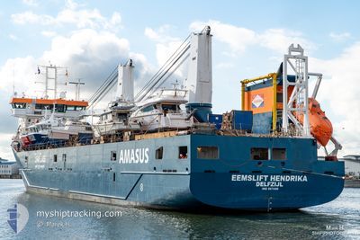
EEMSLIFT HENDRIKA
Cargo
Current Trip
| Time Travelled | 1 day |
|---|---|
| Remaining Time | 18 mins |
| Distance Travelled | 529.15 nm |
| Remaining Distance | 8.22 nm |
| AVG Speed | 14.3 Knots |
| MAX Speed | 15.8 Knots |
| AVG Wind | 14.6 knots |
| MAX Wind | 34 knots |
| MIN Temp | 9.6°C / 49.28°F |
| MAX Temp | 16.6°C / 61.88°F |
| Dybgang | 5.5 m |
| Position Modtaget | 1 m siden |
Current Position
| Longitude | --- |
|---|---|
| Latitude | --- |
| Status | Under way using engine |
| Fart | 14.2 Knots |
| Kurs | 28° |
| Område | Mediterranean Sea - Western Basin |
| Station | T-AIS |
| Position Modtaget | 1 m siden |
Info
Information
The current position of EEMSLIFT HENDRIKA is in Mediterranean Sea - Western Basin with coordinates 43.62084° / 7.25394° as reported on 2025-12-06 05:42 by AIS to our vessel tracker app. The vessel's current speed is 14.2 Knots and is heading at the port of NICE. The estimated time of arrival as calculated by MyShipTracking vessel tracking app is 2025-12-06 07:01 LT
The vessel EEMSLIFT HENDRIKA (IMO: 9671486, MMSI: 244790047) is a Cargo It's sailing under the flag of [NL] Netherlands.
In this page you can find informations about the vessels current position, last detected port calls, and current voyage information. If the vessels is not in coverage by AIS you will find the latest position.
The current position of EEMSLIFT HENDRIKA is detected by our AIS receivers and we are not responsible for the reliability of the data. The last position was recorded while the vessel was in Coverage by the Ais receivers of our vessel tracking app.
The current draught of EEMSLIFT HENDRIKA as reported by AIS is 5.5 meters
Weather
| Temperature | 11.7°C / 53.06°F |
|---|---|
| Wind Speed | 6 knots |
| Direction | 254° WSW |
| Pressure | 1012.7 hPa |
| Humidity | 57 % |
| Cloud Coverage | 26 % |
Featured Company
Last Port Calls
| Port | Arrival | Departure | Time In Port |
|---|---|---|---|
| 2025-12-04 07:31 | 2025-12-04 17:11 | 9 h | |
| 2025-12-02 22:17 | 2025-12-03 12:34 | 14 h | |
| 2025-11-25 20:12 | 2025-11-26 17:06 | 20 h | |
| 2025-11-23 20:55 | 2025-11-24 22:37 | 1 d | |
| 2025-11-22 08:50 | 2025-11-22 20:46 | 11 h | |
| 2025-11-21 06:38 | 2025-11-21 11:13 | 4 h | |
| 2025-11-17 14:36 | 2025-11-17 21:26 | 6 h | |
| 2025-11-15 15:36 | |||
| 2025-11-15 15:33 | |||
| 2025-11-15 09:31 | 2025-11-15 15:11 | 5 h |
Most Visited Ports (Last year)
| Port | Arrivals | |
|---|---|---|
| 11 | ||
| 9 | ||
| 8 | ||
| 7 | ||
| 7 | ||
| 7 |
Last Trips
| Origin | Departure | Destination | Arrival | Distance | |
|---|---|---|---|---|---|
| 2025-12-03 12:34 | 2025-12-04 07:31 | 217.74 nm | |||
| 2025-11-26 17:06 | 2025-12-02 22:17 | 2080.64 nm | |||
| 2025-11-24 22:37 | 2025-11-25 20:12 | 309.25 nm | |||
| 2025-11-22 20:46 | 2025-11-23 20:55 | 318.22 nm | |||
| 2025-11-21 11:13 | 2025-11-22 08:50 | 270.22 nm | |||
| 2025-11-17 21:26 | 2025-11-21 06:38 | 1024.45 nm | |||
| 2025-11-15 15:33 | 2025-11-17 14:36 | 666.84 nm | |||
| 2025-11-15 15:11 | 2025-11-15 15:36 | 3.30 nm | |||
| 2025-11-15 09:13 | 2025-11-15 09:31 | 1.88 nm | |||
| 2025-11-14 10:16 | 2025-11-15 08:50 | 328.56 nm |
Events
| Tid | Hændelsen | Detaljer | Position / Dest | Info |
|---|---|---|---|---|
| 2025-12-06 02:24 | Status er ændret | Under way using engine Default |
43.01048 / 6.56806
NICE
|
Fart: 14.5 kn Kurs: 44° |
| 2025-12-06 02:10 | Status er ændret | Default Under way using engine |
42.97046 / 6.51370
NICE
|
Fart: 14 kn Kurs: 46.5° |
| 2025-12-06 01:17 | Fundet i havområde | French part of the Mediterranean Sea - Western Basin |
42.83483 / 6.30744
Mediterranean Sea - Western Basin
NICE
|
Fart: 14 kn Kurs: 50.9° |
| 2025-12-06 01:17 | Status er ændret | Under way using engine Default |
42.83483 / 6.30744
NICE
|
Fart: 14.4 kn Kurs: 47° |
| 2025-12-06 01:17 | Indenfor Dækning |
42.83483 / 6.30744
Mediterranean Sea - Western Basin
NICE
|
Fart: 14 kn Kurs: 50.9° |
|
| 2025-12-05 15:52 | Status er ændret | Default Under way using engine |
41.86492 / 3.75853
NICE
|
Fart: 12.6 kn Kurs: 60° |
| 2025-12-05 15:46 | Udenfor Dækning |
41.85546 / 3.73519
Mediterranean Sea - Western Basin
NICE
|
Fart: 12.6 kn Kurs: 60° |
|
| 2025-12-05 14:20 | Ændre havområde | Spanish part of the Mediterranean Sea - Western Basin Spanish part of the Balearic Sea |
41.70549 / 3.34445
Mediterranean Sea - Western Basin
NICE
|
Fart: 14.2 kn Kurs: 62.9° |
| 2025-12-05 07:13 | ETA er ændret | 2025/12/06 07:00 |
40.96123 / 1.28317
NICE
|
Fart: 15 kn Kurs: 69.3° |
| 2025-12-05 06:59 | Status er ændret | Under way using engine Default |
40.93767 / 1.21638
NICE
|
Fart: 12.8 kn Kurs: 16° |