
DELPHINUS C
Cargo A
Current Trip
BRIOA>BRSSZ
| Time Travelled | --- |
|---|---|
| Remaining Time | --- |
| Distance Travelled | --- |
| Remaining Distance | --- |
| AVG Speed | --- |
| MAX Speed | --- |
| AVG Wind | --- |
| MAX Wind | --- |
| MIN Temp | --- |
| MAX Temp | --- |
| Dybgang | 11.8 m |
| Position Modtaget | 9 d siden |
Current Position
| Longitude | --- |
|---|---|
| Latitude | --- |
| Status | Under way using engine |
| Fart | 10.7 Knots |
| Kurs | 44° |
| Område | South Atlantic Ocean |
| Station | T-AIS |
| Position Modtaget | 9 d siden |
Info
Information
The current position of DELPHINUS C is in South Atlantic Ocean with coordinates -25.91712° / -48.09421° as reported on 2025-12-07 22:33 by AIS to our vessel tracker app. The vessel's current speed is 10.7 Knots
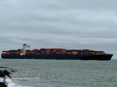
The vessel DELPHINUS C (IMO: 933765200, MMSI: 636018222) is a Cargo A It's sailing under the flag of [LR] Liberia.
In this page you can find informations about the vessels current position, last detected port calls, and current voyage information. If the vessels is not in coverage by AIS you will find the latest position.
The current position of DELPHINUS C is detected by our AIS receivers and we are not responsible for the reliability of the data. The last position was recorded while the vessel was in Coverage by the Ais receivers of our vessel tracking app.
The current draught of DELPHINUS C as reported by AIS is 11.8 meters
Weather
| Temperature | 14.4°C / 57.92°F |
|---|---|
| Wind Speed | 14 knots |
| Direction | 212° SSW |
| Pressure | 1024.3 hPa |
| Humidity | 69.9 % |
| Cloud Coverage | 88 % |
Featured Company
Last Port Calls
| Port | Arrival | Departure | Time In Port |
|---|---|---|---|
| 2025-12-08 18:58 | |||
| 2025-12-06 09:10 | 2025-12-07 16:13 | 1 d | |
| 2025-12-01 02:48 | 2025-12-01 21:58 | 19 h | |
| 2025-11-06 18:53 | 2025-11-07 17:40 | 22 h | |
| 2025-11-02 04:57 | 2025-11-02 17:53 | 12 h | |
| 2025-10-24 08:52 | 2025-10-25 00:27 | 15 h |
Last Trips
| Origin | Departure | Destination | Arrival | Distance | |
|---|---|---|---|---|---|
| 2025-12-07 16:13 | 2025-12-08 18:58 | 194.70 nm | |||
| 2025-12-01 21:58 | 2025-12-06 09:10 | 822.62 nm | |||
| 2025-11-07 17:40 | 2025-12-01 02:48 | 9235.91 nm | |||
| 2025-11-02 17:53 | 2025-11-06 18:53 | 1479.42 nm | |||
| 2025-10-25 00:27 | 2025-11-02 04:57 | 1394.03 nm | |||
| 2025-09-30 05:12 | 2025-10-24 08:52 | 1018.46 nm |
Events
| Tid | Hændelsen | Detaljer | Position / Dest | Info |
|---|---|---|---|---|
| 2025-12-08 23:02 | STOP Sejllads |
-23.92569 / -46.31726
[BR] SANTOS
|
Fart: 0.2 kn Kurs: 271° |
|
| 2025-12-08 21:58 | Skibe i havn |
|
-23.99892 / -46.33240
[BR] SANTOS
|
Fart: 8.5 kn Kurs: 24° |
| 2025-12-08 20:22 | START Sejllads | 11.63 nm, South of SANTOS |
-24.16169 / -46.31443
BRIOA>BRSSZ
|
Fart: 4.2 kn Kurs: 340° |
| 2025-12-08 11:58 | STOP Sejllads | 11.91 nm, South of SANTOS |
-24.16650 / -46.31912
BRIOA>BRSSZ
|
Fart: 0.1 kn Kurs: 56° |
| 2025-12-07 22:41 | Status er ændret | Default Under way using engine |
-25.89986 / -48.07494
BRIOA>BRSSZ
|
Fart: 10.7 kn Kurs: 44° |
| 2025-12-07 22:33 | Status er ændret | Under way using engine Default |
-25.91712 / -48.09421
BRIOA>BRSSZ
|
Fart: 10.8 kn Kurs: 44° |
| 2025-12-07 22:33 | Udenfor Dækning |
-25.91712 / -48.09421
South Atlantic Ocean
BRIOA>BRSSZ
|
Fart: 10.7 kn Kurs: 44° |
|
| 2025-12-07 21:58 | Status er ændret | Default Under way using engine |
-25.99787 / -48.18362
BRIOA>BRSSZ
|
Fart: 12 kn Kurs: 45.5° |
| 2025-12-07 21:42 | Status er ændret | Under way using engine Default |
-26.03491 / -48.22605
BRIOA>BRSSZ
|
Fart: 12 kn Kurs: 51° |
| 2025-12-07 21:42 | Status er ændret | Default Under way using engine |
-26.03593 / -48.22747
BRIOA>BRSSZ
|
Fart: 12 kn Kurs: 48.5° |