
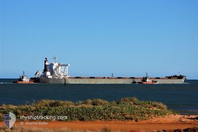
CSK ENTERPRISE
Cargo
Current Trip
| Time Travelled | 2 days |
|---|---|
| Remaining Time | 1 day |
| Distance Travelled | 702.00 nm |
| Remaining Distance | 315.82 nm |
| AVG Speed | 12.4 Knots |
| MAX Speed | 15.1 Knots |
| AVG Wind | 12.1 knots |
| MAX Wind | 22 knots |
| MIN Temp | -0.3°C / 31.46°F |
| MAX Temp | 10.4°C / 50.72°F |
| Dybgang | 18.3 m |
| Position Modtaget | 20 d siden |
Current Position
| Longitude | --- |
|---|---|
| Latitude | --- |
| Status | Under way using engine |
| Fart | 9.8 Knots |
| Kurs | 330.5° |
| Område | Indian Ocean |
| Station | T-AIS |
| Position Modtaget | 20 d siden |
Info
Information
The current position of CSK ENTERPRISE is in Indian Ocean with coordinates -20.11932° / 118.47754° as reported on 2025-12-16 01:20 by AIS to our vessel tracker app. The vessel's current speed is 9.8 Knots and is heading at the port of QINGDAO. The estimated time of arrival as calculated by MyShipTracking vessel tracking app is 2026-01-07 10:11 LT
The vessel CSK ENTERPRISE (IMO: 9816555, MMSI: 563053800) is a Cargo It's sailing under the flag of [SG] Singapore.
In this page you can find informations about the vessels current position, last detected port calls, and current voyage information. If the vessels is not in coverage by AIS you will find the latest position.
The current position of CSK ENTERPRISE is detected by our AIS receivers and we are not responsible for the reliability of the data. The last position was recorded while the vessel was in Coverage by the Ais receivers of our vessel tracking app.
The current draught of CSK ENTERPRISE as reported by AIS is 18.3 meters
Weather
| Temperature | 7.8°C / 46.04°F |
|---|---|
| Wind Speed | 10 knots |
| Direction | 335° NNW |
| Pressure | 1027 hPa |
| Humidity | 62.5 % |
| Cloud Coverage | 61 % |
Featured Company
Last Port Calls
| Port | Arrival | Departure | Time In Port |
|---|---|---|---|
| 2026-01-02 06:04 | 2026-01-03 17:32 | 1 d | |
| 2025-12-14 09:22 | 2025-12-16 07:42 | 1 d | |
| 2025-11-26 22:55 | 2025-11-30 05:17 | 3 d | |
| 2025-11-11 17:53 | 2025-11-13 13:58 | 1 d |
Most Visited Ports (Last year)
| Port | Arrivals | |
|---|---|---|
| 3 | ||
| 2 | ||
| 1 | ||
| 1 | ||
| 1 | ||
| 1 |
Last Trips
| Origin | Departure | Destination | Arrival | Distance | |
|---|---|---|---|---|---|
| 2025-12-16 07:42 | 2026-01-02 06:04 | 3860.30 nm | |||
| 2025-11-30 05:17 | 2025-12-14 09:22 | 3617.17 nm | |||
| 2025-11-13 13:58 | 2025-11-26 22:55 | 3598.64 nm | |||
| 2025-10-24 21:28 | 2025-11-11 17:53 | 3924.66 nm |
Events
| Tid | Hændelsen | Detaljer | Position / Dest | Info |
|---|---|---|---|---|
| 2026-01-05 19:07 | START Sejllads |
31.14944 / 123.47885
AUPHE > CNQIN
|
Fart: 4.1 kn Kurs: 125° |
|
| 2026-01-05 13:07 | STOP Sejllads |
31.16870 / 123.40273
AUPHE > CNQIN
|
Fart: 0.3 kn Kurs: 58° |
|
| 2026-01-03 09:32 | Afsejlet fra sidste havn |
|
39.18116 / 119.03250
AUPHE > CNQIN
|
Fart: 7.8 kn Kurs: 148° |
| 2026-01-03 09:21 | START Sejllads |
39.20150 / 119.02438
[CN] JINGTANG
|
Fart: 5.3 kn Kurs: 193° |
|
| 2026-01-01 22:36 | STOP Sejllads |
39.20878 / 119.02383
[CN] JINGTANG
|
Fart: 0.3 kn Kurs: 51° |
|
| 2026-01-01 22:04 | Skibe i havn |
|
39.18573 / 119.02673
[CN] JINGTANG
|
Fart: 6.1 kn Kurs: 315° |
| 2026-01-01 19:00 | START Sejllads | 20.36 nm, South of JINGTANG |
38.88106 / 119.17664
AUPHE > CNQIN
|
Fart: 3.5 kn Kurs: 1° |
| 2025-12-30 01:44 | STOP Sejllads | 20.93 nm, South of JINGTANG |
38.87138 / 119.17847
AUPHE > CNQIN
|
Fart: Kurs: 47° |