
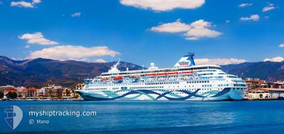
CROWN IRIS
Passengers Ship
Current Trip
| Trip Time | 11 h, 57 mins |
|---|---|
| Trip Distance | 118.32 nm |
| AVG Speed | 10.7 Knots |
| MAX Speed | 12.4 Knots |
| Dybgang | 6.2 m |
| AVG Wind | 8.6 knots |
| MAX Wind | 18 knots |
| MIN Temp | 13.5°C / 56.3°F |
| MAX Temp | 16.5°C / 61.7°F |
| Position Modtaget | 8 h, 5 m siden |
Current Position
| Longitude | --- |
|---|---|
| Latitude | --- |
| Status | Under way using engine |
| Fart | 10.2 Knots |
| Kurs | 263.3° |
| Område | Adriatic Sea |
| Station | T-AIS |
| Position Modtaget | 8 h, 5 m siden |
Info
Information
The current position of CROWN IRIS is in Adriatic Sea with coordinates 40.66214° / 18.00490° as reported on 2025-12-05 06:31 by AIS to our vessel tracker app. The vessel's current speed is 10.2 Knots and is currently inside the port of BRINDISI.
The vessel CROWN IRIS (IMO: 8814744, MMSI: 370610000) is a Passengers Ship that was built in 1992 ( 33 år gamle ). It's sailing under the flag of [PA] Panama.
In this page you can find informations about the vessels current position, last detected port calls, and current voyage information. If the vessels is not in coverage by AIS you will find the latest position.
The current position of CROWN IRIS is detected by our AIS receivers and we are not responsible for the reliability of the data. The last position was recorded while the vessel was in Coverage by the Ais receivers of our vessel tracking app.
The current draught of CROWN IRIS as reported by AIS is 6.2 meters
Weather
| Temperature | 13.8°C / 56.84°F |
|---|---|
| Wind Speed | 8 knots |
| Direction | 358° N |
| Pressure | 1003.4 hPa |
| Humidity | 81.9 % |
| Cloud Coverage | 100 % |
Featured Company
Last Port Calls
| Port | Arrival | Departure | Time In Port |
|---|---|---|---|
| 2025-12-05 07:48 | |||
| 2025-12-04 08:15 | 2025-12-04 20:51 | 12 h | |
| 2025-12-03 07:22 | 2025-12-03 19:10 | 11 h | |
| 2025-12-02 08:09 | 2025-12-02 20:32 | 12 h | |
| 2025-11-30 05:14 | 2025-11-30 13:56 | 8 h | |
| 2025-11-28 12:16 | 2025-11-29 17:54 | 1 d | |
| 2025-11-27 05:11 | 2025-11-27 14:57 | 9 h | |
| 2025-11-25 11:16 | 2025-11-25 21:22 | 10 h | |
| 2025-11-24 15:01 | 2025-11-24 22:16 | 7 h | |
| 2025-11-23 05:14 | 2025-11-23 14:00 | 8 h |
Last Trips
| Origin | Departure | Destination | Arrival | Distance | |
|---|---|---|---|---|---|
| 2025-12-04 20:51 | 2025-12-05 07:48 | 118.32 nm | |||
| 2025-12-03 19:10 | 2025-12-04 08:15 | 102.69 nm | |||
| 2025-12-02 20:32 | 2025-12-03 07:22 | 154.46 nm | |||
| 2025-11-30 13:56 | 2025-12-02 08:09 | 704.73 nm | |||
| 2025-11-29 17:54 | 2025-11-30 05:14 | 148.93 nm | |||
| 2025-11-27 14:57 | 2025-11-28 12:16 | 148.99 nm | |||
| 2025-11-25 21:22 | 2025-11-27 05:11 | 518.24 nm | |||
| 2025-11-24 22:16 | 2025-11-25 11:16 | 165.01 nm | |||
| 2025-11-23 14:00 | 2025-11-24 15:01 | 403.02 nm | |||
| 2025-11-22 18:12 | 2025-11-23 05:14 | 148.24 nm |
Events
| Tid | Hændelsen | Detaljer | Position / Dest | Info |
|---|---|---|---|---|
| 2025-12-05 06:48 | Skibe i havn |
|
40.63865 / 17.94979
[IT] BRINDISI
|
Fart: 10.2 kn Kurs: 263.3° |
| 2025-12-05 06:31 | Udenfor Dækning |
40.66214 / 18.00490
Adriatic Sea
BRINDISI
|
Fart: 10.2 kn Kurs: 263.3° |
|
| 2025-12-05 01:52 | Ændre havområde | Italian part of the Adriatic Sea Albanian part of the Adriatic Sea |
40.32400 / 18.86928
Adriatic Sea
BRINDISI
|
Fart: 9.6 kn Kurs: 302.2° |
| 2025-12-05 00:22 | Status er ændret | Under way using engine Default |
40.19737 / 19.13798
BRINDISI
|
Fart: 9.7 kn Kurs: 300° |
| 2025-12-05 00:21 | Status er ændret | Default Under way using engine |
40.19598 / 19.14110
BRINDISI
|
Fart: 9.7 kn Kurs: 299.5° |
| 2025-12-05 00:20 | Status er ændret | Under way using engine Default |
40.19530 / 19.14264
BRINDISI
|
Fart: 9.7 kn Kurs: 300° |
| 2025-12-05 00:13 | Status er ændret | Default Under way using engine |
40.18505 / 19.16556
BRINDISI
|
Fart: 9.6 kn Kurs: 300.6° |
| 2025-12-05 00:06 | Ændre havområde | Albanian part of the Adriatic Sea Greek part of the Adriatic Sea |
40.17511 / 19.18727
Adriatic Sea
BRINDISI
|
Fart: 9.6 kn Kurs: 300.6° |
| 2025-12-05 00:06 | Status er ændret | Under way using engine Default |
40.17511 / 19.18727
BRINDISI
|
Fart: 9.6 kn Kurs: 301° |
| 2025-12-04 23:53 | Indenfor Dækning |
40.17511 / 19.18727
Adriatic Sea
BRINDISI
|
Fart: 9.6 kn Kurs: 300.6° |