
COSCO ROTTERDAM
Container Ship
Current Trip
| Time Travelled | 1 day |
|---|---|
| Remaining Time | --- |
| Distance Travelled | 37.32 nm |
| Remaining Distance | --- |
| AVG Speed | 11.1 Knots |
| MAX Speed | 18 Knots |
| AVG Wind | 9.5 knots |
| MAX Wind | 13 knots |
| MIN Temp | 18°C / 64.4°F |
| MAX Temp | 20.5°C / 68.9°F |
| Dybgang | 11.8 m |
| Position Modtaget | 54 m siden |
Current Position
| Longitude | --- |
|---|---|
| Latitude | --- |
| Status | At anchor |
| Fart | 0.1 Knots |
| Kurs | 47° |
| Område | Tasman Sea |
| Station | T-AIS |
| Position Modtaget | 54 m siden |
Info
Information
The current position of COSCO ROTTERDAM is in Tasman Sea with coordinates -34.38164° / 151.02951° as reported on 2025-12-12 20:50 by AIS to our vessel tracker app. The vessel's current speed is 0.1 Knots
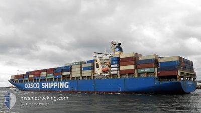
The vessel COSCO ROTTERDAM (IMO: 9221073, MMSI: 235067931) is a Container Ship that was built in 2002 ( 23 år gamle ). It's sailing under the flag of [GB] United Kingdom.
In this page you can find informations about the vessels current position, last detected port calls, and current voyage information. If the vessels is not in coverage by AIS you will find the latest position.
The current position of COSCO ROTTERDAM is detected by our AIS receivers and we are not responsible for the reliability of the data. The last position was recorded while the vessel was in Coverage by the Ais receivers of our vessel tracking app.
The current draught of COSCO ROTTERDAM as reported by AIS is 11.8 meters
Weather
| Temperature | 18.5°C / 65.3°F |
|---|---|
| Wind Speed | 4 knots |
| Direction | 316° NW |
| Pressure | 1011.8 hPa |
| Humidity | 83.6 % |
| Cloud Coverage | 40 % |
Featured Company
Last Port Calls
| Port | Arrival | Departure | Time In Port |
|---|---|---|---|
| 2025-12-07 22:17 | 2025-12-11 16:30 | 3 d | |
| 2025-11-24 11:36 | 2025-11-25 11:04 | 23 h | |
| 2025-11-23 01:18 | 2025-11-23 17:09 | 15 h | |
| 2025-11-09 18:13 | 2025-11-11 01:51 | 1 d | |
| 2025-11-04 22:07 | 2025-11-06 11:58 | 1 d | |
| 2025-10-27 17:38 | 2025-10-30 13:24 | 2 d | |
| 2025-10-13 19:33 | 2025-10-14 17:55 | 22 h | |
| 2025-10-12 12:43 | 2025-10-13 13:46 | 1 d |
Last Trips
| Origin | Departure | Destination | Arrival | Distance | |
|---|---|---|---|---|---|
| 2025-11-25 19:04 | 2025-12-08 09:17 | 4519.34 nm | |||
| 2025-11-24 01:09 | 2025-11-24 19:36 | 20.49 nm | |||
| 2025-11-11 11:51 | 2025-11-23 09:18 | 4327.88 nm | |||
| 2025-11-06 22:58 | 2025-11-10 04:13 | 1119.51 nm | |||
| 2025-10-31 00:24 | 2025-11-05 09:07 | 679.89 nm | |||
| 2025-10-15 01:55 | 2025-10-28 04:38 | 4509.07 nm | |||
| 2025-10-13 21:46 | 2025-10-14 03:33 | 50.16 nm | |||
| 2025-10-01 05:10 | 2025-10-12 20:43 | 4299.12 nm |
Events
| Tid | Hændelsen | Detaljer | Position / Dest | Info |
|---|---|---|---|---|
| 2025-12-12 20:53 | Status er ændret | Default At anchor |
-34.38164 / 151.02946
AU MEL
|
Fart: 0.1 kn Kurs: 47° |
| 2025-12-12 20:50 | Status er ændret | At anchor Default |
-34.38164 / 151.02951
AU MEL
|
Fart: 0.2 kn Kurs: 47° |
| 2025-12-12 20:19 | Status er ændret | Default At anchor |
-34.38167 / 151.02834
AU MEL
|
Fart: 0.3 kn Kurs: 39° |
| 2025-12-12 20:14 | Status er ændret | At anchor Default |
-34.38180 / 151.02970
AU MEL
|
Fart: Kurs: -1° |
| 2025-12-12 19:59 | Status er ændret | Default At anchor |
-34.38167 / 151.02834
AU MEL
|
Fart: 0.1 kn Kurs: 46° |
| 2025-12-12 19:47 | Status er ændret | At anchor Default |
-34.38167 / 151.02967
AU MEL
|
Fart: 0.2 kn Kurs: 48° |
| 2025-12-12 19:05 | Status er ændret | Default At anchor |
-34.38167 / 151.02972
AU MEL
|
Fart: 0.1 kn Kurs: 44° |
| 2025-12-12 18:41 | Status er ændret | At anchor Default |
-34.38181 / 151.02976
AU MEL
|
Fart: 0.4 kn Kurs: 40° |
| 2025-12-12 18:38 | Status er ændret | Default At anchor |
-34.38178 / 151.02983
AU MEL
|
Fart: 0.1 kn Kurs: 43° |
| 2025-12-12 18:29 | Status er ændret | At anchor Default |
-34.38164 / 151.03000
AU MEL
|
Fart: Kurs: 43° |