
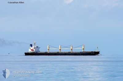
COS LUCKY
Bulk Carrier
Current Trip
CEBU
| Time Travelled | 35 days |
|---|---|
| Remaining Time | --- |
| Distance Travelled | 4528.51 nm |
| Remaining Distance | --- |
| AVG Speed | 11.1 Knots |
| MAX Speed | 15.5 Knots |
| AVG Wind | 7.9 knots |
| MAX Wind | 26.9 knots |
| MIN Temp | 17.3°C / 63.14°F |
| MAX Temp | 34.1°C / 93.38°F |
| Dybgang | 11.8 m |
| Position Modtaget | 7 d siden |
Current Position
| Longitude | 122.28490° |
|---|---|
| Latitude | 25.48021° |
| Status | Under way using engine |
| Fart | 10 Knots |
| Kurs | 357.5° |
| Område | Eastern China Sea |
| Station | T-AIS |
| Position Modtaget | 7 d siden |
Info
Information
The current position of COS LUCKY is in Eastern China Sea with coordinates 25.48021° / 122.28490° as reported on 2024-06-08 07:56 by AIS to our vessel tracker app. The vessel's current speed is 10 Knots
The vessel COS LUCKY (IMO: 9253492, MMSI: 563023600) is a Bulk Carrier that was built in 2003 ( 21 år gamle ). It's sailing under the flag of [SG] Singapore.
In this page you can find informations about the vessels current position, last detected port calls, and current voyage information. If the vessels is not in coverage by AIS you will find the latest position.
The current position of COS LUCKY is detected by our AIS receivers and we are not responsible for the reliability of the data. The last position was recorded while the vessel was in Coverage by the Ais receivers of our vessel tracking app.
The current draught of COS LUCKY as reported by AIS is 11.8 meters
Weather
| Temperature | 23.3°C / 73.94°F |
|---|---|
| Wind Speed | 5 knots |
| Direction | 83° E |
| Pressure | 1006.9 hPa |
| Humidity | 80.2 % |
| Cloud Coverage | 61 % |
Featured Company
Most Visited Ports (Last year)
| Port | Arrivals | |
|---|---|---|
| 2 | ||
| 2 | ||
| 1 | ||
| 1 | ||
| 1 | ||
| 1 |
Last Trips
| Origin | Departure | Destination | Arrival | Distance |
|---|
Events
| Tid | Hændelsen | Detaljer | Position / Dest | Info |
|---|---|---|---|---|
| 2024-06-15 15:21 | STOP Sejllads | 2.44 nm, East of TAICANG |
31.65091 / 121.24106
CEBU
|
Fart: 0.2 kn Kurs: 302° |
| 2024-06-15 05:07 | START Sejllads |
31.17068 / 122.68221
CEBU
|
Fart: 3.9 kn Kurs: 145° |
|
| 2024-06-09 18:15 | STOP Sejllads |
31.18028 / 122.67792
CEBU
|
Fart: Kurs: 172° |
|
| 2024-06-08 07:57 | Status er ændret | Default Under way using engine |
25.48302 / 122.28490
CEBU
|
Fart: 10 kn Kurs: 357.5° |
| 2024-06-08 07:56 | Udenfor Dækning |
25.48021 / 122.28490
Eastern China Sea
|
Fart: 10 kn Kurs: 357.5° |
|
| 2024-06-08 07:51 | Status er ændret | Under way using engine Default |
25.46660 / 122.28542
CEBU
|
Fart: 10 kn Kurs: 0° |
| 2024-06-08 07:36 | Indenfor Dækning |
25.47132 / 122.28534
Eastern China Sea
|
Fart: 10.1 kn Kurs: 357.9° |
|
| 2024-06-08 06:54 | Status er ændret | Default Under way using engine |
25.30500 / 122.26833
CEBU
|
Fart: 9.6 kn Kurs: 9.2° |
| 2024-06-08 06:36 | Udenfor Dækning |
25.25495 / 122.26286
Eastern China Sea
|
Fart: 9.6 kn Kurs: 9.2° |
|
| 2024-06-08 06:20 | Status er ændret | Under way using engine Default |
25.21313 / 122.25749
CEBU
|
Fart: 10 kn Kurs: 2° |