
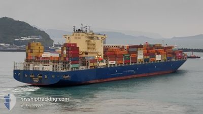
CMA CGM AMAZON
Cargo A
Current Trip
| Time Travelled | 3 days |
|---|---|
| Remaining Time | 5 days |
| Distance Travelled | 1609.81 nm |
| Remaining Distance | 2776.69 nm |
| AVG Speed | 19.6 Knots |
| MAX Speed | 21.1 Knots |
| AVG Wind | 15.5 knots |
| MAX Wind | 20.8 knots |
| MIN Temp | 17.1°C / 62.78°F |
| MAX Temp | 23.4°C / 74.12°F |
| Dybgang | 11.1 m |
| Position Modtaget | 7 h, 54 m siden |
Current Position
| Longitude | -20.89076° |
|---|---|
| Latitude | 15.59401° |
| Status | Under way using engine |
| Fart | 20.3 Knots |
| Kurs | 204.7° |
| Område | North Atlantic Ocean |
| Station | T-AIS |
| Position Modtaget | 7 h, 54 m siden |
Info
Information
The current position of CMA CGM AMAZON is in North Atlantic Ocean with coordinates 15.59401° / -20.89076° as reported on 2024-04-27 12:32 by AIS to our vessel tracker app. The vessel's current speed is 20.3 Knots and is heading at the port of SANTOS. The estimated time of arrival as calculated by MyShipTracking vessel tracking app is 2024-05-03 10:16 LT
The vessel CMA CGM AMAZON (IMO: 9706308, MMSI: 215499000) is a Cargo A It's sailing under the flag of [MT] Malta.
In this page you can find informations about the vessels current position, last detected port calls, and current voyage information. If the vessels is not in coverage by AIS you will find the latest position.
The current position of CMA CGM AMAZON is detected by our AIS receivers and we are not responsible for the reliability of the data. The last position was recorded while the vessel was in Coverage by the Ais receivers of our vessel tracking app.
The current draught of CMA CGM AMAZON as reported by AIS is 11.1 meters
Weather
| Temperature | 23.4°C / 74.12°F |
|---|---|
| Wind Speed | 16 knots |
| Direction | 19° NNE |
| Pressure | 1010.2 hPa |
| Humidity | 85.6 % |
| Cloud Coverage | 15 % |
Featured Company
Last Port Calls
| Port | Arrival | Departure | Time In Port |
|---|---|---|---|
| 2024-04-23 05:15 | 2024-04-24 09:58 | 1 d | |
| 2024-04-19 18:04 | 2024-04-20 19:19 | 1 d | |
| 2024-04-17 22:11 | 2024-04-18 19:55 | 21 h | |
| 2024-04-15 16:58 | 2024-04-16 03:28 | 10 h | |
| 2024-04-04 05:38 | 2024-04-06 13:53 | 2 d | |
| 2024-04-03 16:27 | 2024-04-03 17:24 | 57 m | |
| 2024-04-02 05:26 | 2024-04-02 06:14 | 47 m | |
| 2024-03-19 14:17 | 2024-03-21 16:38 | 2 d | |
| 2024-03-16 00:29 | 2024-03-16 19:38 | 19 h | |
| 2024-03-07 07:58 | 2024-03-15 08:57 | 8 d |
Most Visited Ports (Last year)
| Port | Arrivals | |
|---|---|---|
| 5 | ||
| 5 | ||
| 4 | ||
| 3 | ||
| 3 | ||
| 3 |
Last Trips
| Origin | Departure | Destination | Arrival | Distance | |
|---|---|---|---|---|---|
| 2024-04-20 21:19 | 2024-04-23 06:15 | 38.43 nm | |||
| 2024-04-18 21:55 | 2024-04-19 20:04 | 7.59 nm | |||
| 2024-04-16 04:28 | 2024-04-18 00:11 | 140.92 nm | |||
| 2024-04-06 10:53 | 2024-04-15 17:58 | 4278.75 nm | |||
| 2024-04-03 14:24 | 2024-04-04 02:38 | 187.34 nm | |||
| 2024-04-02 03:14 | 2024-04-03 13:27 | 2.84 nm | |||
| 2024-03-21 16:38 | 2024-04-02 02:26 | 4413.68 nm | |||
| 2024-03-16 20:38 | 2024-03-19 14:17 | 80.29 nm | |||
| 2024-03-15 09:57 | 2024-03-16 01:29 | 8.19 nm | |||
| 2024-03-05 04:35 | 2024-03-07 08:58 | 64.27 nm |
Events
| Tid | Hændelsen | Detaljer | Position / Dest | Info |
|---|---|---|---|---|
| 2024-04-27 12:52 | Status er ændret | Default Under way using engine |
15.45211 / -20.95568
BRSSZ
|
Fart: 20.3 kn Kurs: 204.7° |
| 2024-04-27 12:32 | Udenfor Dækning |
15.59401 / -20.89076
North Atlantic Ocean
BRSSZ
|
Fart: 20.3 kn Kurs: 204.7° |
|
| 2024-04-27 12:31 | Ændre havområde | Cape Verdean part of the North Atlantic Ocean Western Saharan part of the North Atlantic Ocean |
15.59918 / -20.88835
North Atlantic Ocean
BRSSZ
|
Fart: 20.3 kn Kurs: 204.3° |
| 2024-04-27 12:31 | Status er ændret | Under way using engine Default |
15.59918 / -20.88835
BRSSZ
|
Fart: 20.3 kn Kurs: 205° |
| 2024-04-27 12:14 | Indenfor Dækning |
15.59918 / -20.88835
North Atlantic Ocean
BRSSZ
|
Fart: 20.3 kn Kurs: 204.3° |
|
| 2024-04-25 21:10 | Status er ændret | Default Under way using engine |
27.19761 / -14.46502
BRSSZ
|
Fart: 19.3 kn Kurs: 215.2° |
| 2024-04-25 21:05 | Ændre havområde | Western Saharan part of the North Atlantic Ocean Spanish (Canary Islands) part of the North Atlantic Ocean |
27.22010 / -14.44713
North Atlantic Ocean
BRSSZ
|
Fart: 19.3 kn Kurs: 215.2° |
| 2024-04-25 21:05 | Status er ændret | Under way using engine Default |
27.22010 / -14.44713
BRSSZ
|
Fart: 19.2 kn Kurs: 216° |
| 2024-04-25 21:05 | Udenfor Dækning |
27.22010 / -14.44713
North Atlantic Ocean
BRSSZ
|
Fart: 19.3 kn Kurs: 215.2° |
|
| 2024-04-25 20:54 | Indenfor Dækning |
27.22010 / -14.44713
North Atlantic Ocean
BRSSZ
|
Fart: 19.3 kn Kurs: 215.2° |