
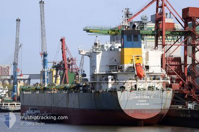
CHRISTIANA P
Bulk Carrier
Current Trip
| Time Travelled | 20 days |
|---|---|
| Remaining Time | 17 days |
| Distance Travelled | 4680.47 nm |
| Remaining Distance | 4664.67 nm |
| AVG Speed | 10.2 Knots |
| MAX Speed | 12.3 Knots |
| AVG Wind | 10.6 knots |
| MAX Wind | 22.9 knots |
| MIN Temp | 16.6°C / 61.88°F |
| MAX Temp | 29.4°C / 84.92°F |
| Dybgang | 13.1 m |
| Position Modtaget | 3 d siden |
Current Position
| Longitude | 20.00795° |
|---|---|
| Latitude | -35.10081° |
| Status | Under way using engine |
| Fart | 11.6 Knots |
| Kurs | 96.3° |
| Område | Indian Ocean |
| Station | T-AIS |
| Position Modtaget | 3 d siden |
Info
Information
The current position of CHRISTIANA P is in Indian Ocean with coordinates -35.10081° / 20.00795° as reported on 2024-05-14 14:48 by AIS to our vessel tracker app. The vessel's current speed is 11.6 Knots and is heading at the port of SINGAPORE. The estimated time of arrival as calculated by MyShipTracking vessel tracking app is 2024-06-04 02:40 LT
The vessel CHRISTIANA P (IMO: 9580508, MMSI: 352559000) is a Bulk Carrier that was built in 2011 ( 13 år gamle ). It's sailing under the flag of [PA] Panama.
In this page you can find informations about the vessels current position, last detected port calls, and current voyage information. If the vessels is not in coverage by AIS you will find the latest position.
The current position of CHRISTIANA P is detected by our AIS receivers and we are not responsible for the reliability of the data. The last position was recorded while the vessel was in Coverage by the Ais receivers of our vessel tracking app.
The current draught of CHRISTIANA P as reported by AIS is 13.1 meters
Weather
| Temperature | 22.5°C / 72.5°F |
|---|---|
| Wind Speed | 18 knots |
| Direction | 190° S |
| Pressure | 1019 hPa |
| Humidity | 76.9 % |
| Cloud Coverage | 19 % |
Featured Company
Last Port Calls
| Port | Arrival | Departure | Time In Port |
|---|---|---|---|
| 2024-04-24 06:21 | 2024-04-27 07:56 | 3 d | |
| 2024-03-21 05:16 | 2024-03-25 08:09 | 4 d |
Most Visited Ports (Last year)
| Port | Arrivals | |
|---|---|---|
| 2 | ||
| 1 | ||
| 1 | ||
| 1 | ||
| 1 | ||
| 1 |
Last Trips
| Origin | Departure | Destination | Arrival | Distance | |
|---|---|---|---|---|---|
| 2024-03-25 13:39 | 2024-04-24 03:21 | 7912.47 nm | |||
| 2024-01-31 05:27 | 2024-03-21 10:46 | 6109.03 nm |
Events
| Tid | Hændelsen | Detaljer | Position / Dest | Info |
|---|---|---|---|---|
| 2024-05-14 14:53 | Status er ændret | Default Under way using engine |
-35.10207 / 20.02949
SGSIN
|
Fart: 11.6 kn Kurs: 96.3° |
| 2024-05-14 14:48 | Udenfor Dækning |
-35.10081 / 20.00795
Indian Ocean
SGSIN
|
Fart: 11.6 kn Kurs: 96.3° |
|
| 2024-05-14 14:47 | Fundet i havområde | South African part of the Indian Ocean |
-35.10051 / 20.00261
Indian Ocean
SGSIN
|
Fart: 11.8 kn Kurs: 91.9° |
| 2024-05-14 14:47 | Status er ændret | Under way using engine Default |
-35.10051 / 20.00261
SGSIN
|
Fart: 11.5 kn Kurs: 94° |
| 2024-05-14 14:18 | Status er ændret | Default Under way using engine |
-35.09430 / 19.89290
SGSIN
|
Fart: 11.4 kn Kurs: 100.6° |
| 2024-05-14 14:13 | Status er ændret | Under way using engine Default |
-35.09252 / 19.87172
SGSIN
|
Fart: 11.5 kn Kurs: 100° |
| 2024-05-14 14:00 | Indenfor Dækning |
-35.09286 / 19.87428
South Atlantic Ocean
SGSIN
|
Fart: 11.5 kn Kurs: 99.2° |
|
| 2024-05-14 10:41 | Status er ændret | Default Under way using engine |
-34.97588 / 19.09612
SGSIN
|
Fart: 10.7 kn Kurs: 111.2° |
| 2024-05-14 10:39 | Status er ændret | Under way using engine Default |
-34.97422 / 19.09043
SGSIN
|
Fart: 10.6 kn Kurs: 114° |
| 2024-05-14 10:39 | Udenfor Dækning |
-34.97422 / 19.09043
South Atlantic Ocean
SGSIN
|
Fart: 10.7 kn Kurs: 111.2° |