
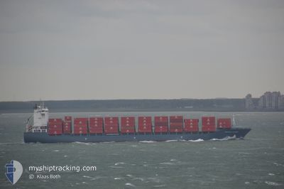
CHIQUITA CENTURY
Container Ship
Current Trip
| Time Travelled | 6 days |
|---|---|
| Remaining Time | --- |
| Distance Travelled | 2193.53 nm |
| Remaining Distance | --- |
| AVG Speed | 14.5 Knots |
| MAX Speed | 18.4 Knots |
| AVG Wind | 10.9 knots |
| MAX Wind | 21.8 knots |
| MIN Temp | 22.9°C / 73.22°F |
| MAX Temp | 30.2°C / 86.36°F |
| Dybgang | 9 m |
| Position Modtaget | 6 d siden |
Current Position
| Longitude | -82.33932° |
|---|---|
| Latitude | 9.42321° |
| Status | Under way using engine |
| Fart | 7.5 Knots |
| Kurs | 37.1° |
| Område | Caribbean Sea |
| Station | T-AIS |
| Position Modtaget | 6 d siden |
Info
Information
The current position of CHIQUITA CENTURY is in Caribbean Sea with coordinates 9.42321° / -82.33932° as reported on 2024-06-09 10:42 by AIS to our vessel tracker app. The vessel's current speed is 7.5 Knots and is heading at the port of MOIN. The estimated time of arrival as calculated by MyShipTracking vessel tracking app is 2024-06-05 13:00 LT
The vessel CHIQUITA CENTURY (IMO: 9339595, MMSI: 636092995) is a Container Ship that was built in 2008 ( 16 år gamle ). It's sailing under the flag of [LR] Liberia.
In this page you can find informations about the vessels current position, last detected port calls, and current voyage information. If the vessels is not in coverage by AIS you will find the latest position.
The current position of CHIQUITA CENTURY is detected by our AIS receivers and we are not responsible for the reliability of the data. The last position was recorded while the vessel was in Coverage by the Ais receivers of our vessel tracking app.
The current draught of CHIQUITA CENTURY as reported by AIS is 9 meters
Weather
| Temperature | 23.8°C / 74.84°F |
|---|---|
| Wind Speed | 9 knots |
| Direction | 187° S |
| Pressure | 1022.3 hPa |
| Humidity | 76.2 % |
| Cloud Coverage | 6 % |
Featured Company
Last Port Calls
| Port | Arrival | Departure | Time In Port |
|---|---|---|---|
| 2024-06-09 01:11 | 2024-06-09 03:58 | 2 h | |
| 2024-05-20 01:32 | 2024-05-22 22:29 | 2 d | |
| 2024-05-18 20:41 | 2024-05-19 07:50 | 11 h | |
| 2024-05-03 15:35 | |||
| 2024-04-14 18:02 | 2024-04-17 20:55 | 3 d | |
| 2024-04-13 15:21 | 2024-04-14 03:16 | 11 h |
Most Visited Ports (Last year)
| Port | Arrivals | |
|---|---|---|
| 18 | ||
| 10 | ||
| 10 | ||
| 1 |
Last Trips
| Origin | Departure | Destination | Arrival | Distance | |
|---|---|---|---|---|---|
| 2024-05-22 22:29 | 2024-06-09 01:11 | 5069.82 nm | |||
| 2024-05-19 07:50 | 2024-05-20 01:32 | 127.54 nm | |||
| 2024-05-03 15:35 | 2024-05-18 20:41 | 4879.32 nm | |||
| 2024-04-14 03:16 | 2024-04-14 18:02 | 124.50 nm | |||
| 2024-03-29 09:37 | 2024-04-13 15:21 | 4884.81 nm |
Events
| Tid | Hændelsen | Detaljer | Position / Dest | Info |
|---|---|---|---|---|
| 2024-06-09 11:17 | Status er ændret | Default Under way using engine |
9.51198 / -82.28007
CRMOB
|
Fart: 7.5 kn Kurs: 37.1° |
| 2024-06-09 10:42 | Udenfor Dækning |
9.42321 / -82.33932
Caribbean Sea
|
Fart: 7.5 kn Kurs: 37.1° |
|
| 2024-06-09 09:31 | Status er ændret | Under way using engine Moored |
9.25728 / -82.34137
CRMOB
|
Fart: 6.1 kn Kurs: 142.1° |
| 2024-06-09 09:12 | Status er ændret | Moored Default |
9.26911 / -82.37543
CRMOB
|
Fart: 5.5 kn Kurs: 142° |
| 2024-06-09 09:02 | START Sejllads | 0.6 nm, South East of ALMIRANTE |
9.28211 / -82.38567
CRMOB
|
Fart: 5.5 kn Kurs: 142° |
| 2024-06-09 09:02 | Indenfor Dækning |
9.26911 / -82.37543
Caribbean Sea
|
Fart: 6.1 kn Kurs: 142.1° |
|
| 2024-06-09 08:58 | Afsejlet fra sidste havn |
|
9.28211 / -82.38567
CRMOB
|
Fart: Kurs: 284° |
| 2024-06-09 06:45 | STOP Sejllads |
9.28726 / -82.38954
[PA] ALMIRANTE
|
Fart: Kurs: 284° |
|
| 2024-06-09 06:11 | Skibe i havn |
|
9.28706 / -82.38937
[PA] ALMIRANTE
|
Fart: 3.1 kn Kurs: 333° |
| 2024-06-09 05:47 | Udenfor Dækning |
9.27226 / -82.38100
Caribbean Sea
[PA] ALMIRANTE
|
Fart: 3.9 kn Kurs: 349.1° |