
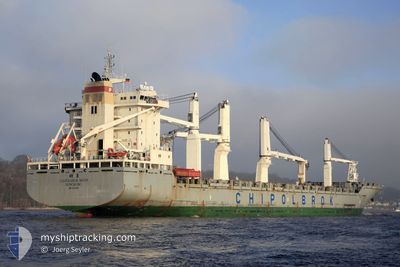
CHIPOLBROK MOON
General Cargo
Current Trip
| Time Travelled | 4 days |
|---|---|
| Remaining Time | 8 h, 17 mins |
| Distance Travelled | 591.86 nm |
| Remaining Distance | 113.94 nm |
| AVG Speed | 11.5 Knots |
| MAX Speed | 15.3 Knots |
| AVG Wind | 12.7 knots |
| MAX Wind | 25 knots |
| MIN Temp | 10.2°C / 50.36°F |
| MAX Temp | 19.2°C / 66.56°F |
| Dybgang | 11.2 m |
| Position Modtaget | 2025-11-10 16:30 |
Current Position
| Longitude | --- |
|---|---|
| Latitude | --- |
| Status | Under way using engine |
| Fart | 7.1 Knots |
| Kurs | 30.5° |
| Område | Eastern China Sea |
| Station | T-AIS |
| Position Modtaget | 2025-11-10 16:30 |
Info
Information
The current position of CHIPOLBROK MOON is in Eastern China Sea with coordinates 25.79777° / 121.37184° as reported on 2025-11-10 16:30 by AIS to our vessel tracker app. The vessel's current speed is 7.1 Knots and is heading at the port of TAIPEI. The estimated time of arrival as calculated by MyShipTracking vessel tracking app is 2025-12-12 03:01 LT
The vessel CHIPOLBROK MOON (IMO: 9272216, MMSI: 477160100) is a General Cargo that was built in 2004 ( 21 år gamle ). It's sailing under the flag of [HK] Hong Kong.
In this page you can find informations about the vessels current position, last detected port calls, and current voyage information. If the vessels is not in coverage by AIS you will find the latest position.
The current position of CHIPOLBROK MOON is detected by our AIS receivers and we are not responsible for the reliability of the data. The last position was recorded while the vessel was in Coverage by the Ais receivers of our vessel tracking app.
The current draught of CHIPOLBROK MOON as reported by AIS is 11.2 meters
Weather
| Temperature | 19.2°C / 66.56°F |
|---|---|
| Wind Speed | 24 knots |
| Direction | 42° NE |
| Pressure | 1021.5 hPa |
| Humidity | 62.8 % |
| Cloud Coverage | --- |
Featured Company
Most Visited Ports (Last year)
| Port | Arrivals | |
|---|---|---|
| 4 | ||
| 2 | ||
| 2 | ||
| 2 | ||
| 2 | ||
| 2 |
Last Trips
| Origin | Departure | Destination | Arrival | Distance | |
|---|---|---|---|---|---|
| 2025-11-29 07:08 | 2025-12-02 21:19 | 747.18 nm | |||
| 2025-11-18 15:25 | 2025-11-24 22:00 | 1198.42 nm | |||
| 2025-11-15 00:14 | 2025-11-16 00:55 | 222.12 nm | |||
| 2025-11-10 18:36 | 2025-11-14 06:33 | 511.68 nm | |||
| 2025-09-27 17:24 | 2025-11-10 10:00 | 10920.71 nm |
Events
| Tid | Hændelsen | Detaljer | Position / Dest | Info |
|---|---|---|---|---|
| 2025-12-10 03:09 | START Sejllads | 20.69 nm, South East of CHANGSHA |
32.16057 / 121.55327
TW TPE
|
Fart: 6.7 kn Kurs: 102° |
| 2025-12-08 05:25 | STOP Sejllads | 20.45 nm, South East of CHANGSHA |
32.16124 / 121.54590
TW TPE
|
Fart: 0.2 kn Kurs: 113° |
| 2025-12-07 20:28 | START Sejllads |
31.31403 / 122.68001
TW TPE
|
Fart: 3.1 kn Kurs: 49° |
|
| 2025-12-07 11:01 | STOP Sejllads |
31.31197 / 122.67986
TW TPE
|
Fart: 0.3 kn Kurs: 318° |
|
| 2025-12-07 01:01 | Afsejlet fra sidste havn |
|
31.60564 / 121.27709
TW TPE
|
Fart: 9.6 kn Kurs: 115° |
| 2025-12-07 00:53 | START Sejllads |
31.62478 / 121.24876
[CN] TAICANG
|
Fart: 9.6 kn Kurs: 115° |
|
| 2025-12-02 13:19 | STOP Sejllads |
31.62724 / 121.24172
[CN] TAICANG
|
Fart: Kurs: 136° |
|
| 2025-12-02 13:19 | Skibe i havn |
|
31.62724 / 121.24172
[CN] TAICANG
|
Fart: 0.7 kn Kurs: 145° |
| 2025-12-02 12:29 | START Sejllads | 2.42 nm, South East of TAICANG |
31.64418 / 121.23710
TW TPE
|
Fart: 3.9 kn Kurs: 275° |
| 2025-12-02 02:15 | STOP Sejllads | 3.21 nm, South East of TAICANG |
31.64160 / 121.25276
TW TPE
|
Fart: 0.3 kn Kurs: 121° |