
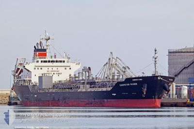
CHEMSTAR RIVER
Tanker
Current Trip
| Time Travelled | 2 days |
|---|---|
| Remaining Time | --- |
| Distance Travelled | 642.46 nm |
| Remaining Distance | --- |
| AVG Speed | 13.6 Knots |
| MAX Speed | 15.6 Knots |
| AVG Wind | 6.9 knots |
| MAX Wind | 15.8 knots |
| MIN Temp | 24.4°C / 75.92°F |
| MAX Temp | 29.9°C / 85.82°F |
| Dybgang | 9.9 m |
| Position Modtaget | 2024-03-22 06:43 |
Current Position
| Longitude | -87.41940° |
|---|---|
| Latitude | 10.53450° |
| Status | Under way using engine |
| Fart | 13.8 Knots |
| Kurs | 293° |
| Område | North Pacific Ocean |
| Station | T-AIS |
| Position Modtaget | 2024-03-22 06:43 |
Info
Information
The current position of CHEMSTAR RIVER is in North Pacific Ocean with coordinates 10.53450° / -87.41940° as reported on 2024-03-22 06:43 by AIS to our vessel tracker app. The vessel's current speed is 13.8 Knots and is heading at the port of CRISTOBAL.
The vessel CHEMSTAR RIVER (IMO: 9758026, MMSI: 353052000) is a Tanker It's sailing under the flag of [PA] Panama.
In this page you can find informations about the vessels current position, last detected port calls, and current voyage information. If the vessels is not in coverage by AIS you will find the latest position.
The current position of CHEMSTAR RIVER is detected by our AIS receivers and we are not responsible for the reliability of the data. The last position was recorded while the vessel was in Coverage by the Ais receivers of our vessel tracking app.
The current draught of CHEMSTAR RIVER as reported by AIS is 9.9 meters
Weather
| Temperature | 29.4°C / 84.92°F |
|---|---|
| Wind Speed | 13 knots |
| Direction | 67° ENE |
| Pressure | 1010.8 hPa |
| Humidity | 76.8 % |
| Cloud Coverage | 71 % |
Featured Company
Most Visited Ports (Last year)
| Port | Arrivals | |
|---|---|---|
| 4 | ||
| 3 | ||
| 2 | ||
| 2 | ||
| 2 | ||
| 1 |
Last Trips
Events
| Tid | Hændelsen | Detaljer | Position / Dest | Info |
|---|---|---|---|---|
| 2024-05-04 16:22 | Afsejlet fra sidste havn |
|
23.77173 / 120.14346
PA CTB
|
Fart: 6 kn Kurs: 234° |
| 2024-05-04 16:02 | START Sejllads |
23.78099 / 120.17024
[TW] MAILIAO
|
Fart: 4 kn Kurs: 26° |
|
| 2024-05-03 22:52 | Skibe i havn |
|
23.78130 / 120.15765
[TW] MAILIAO
|
Fart: 6.1 kn Kurs: 56° |
| 2024-05-02 08:32 | START Sejllads | 20.15 nm, South of ZHOUSHAN |
29.63687 / 122.27604
PA CTB
|
Fart: 4.3 kn Kurs: 62° |
| 2024-05-02 00:04 | STOP Sejllads | 20.31 nm, South of ZHOUSHAN |
29.63351 / 122.27236
PA CTB
|
Fart: 0.2 kn Kurs: 7° |
| 2024-04-30 23:22 | START Sejllads | 5.15 nm, South East of NANTONG |
31.88919 / 120.89452
PA CTB
|
Fart: 3.4 kn Kurs: 192° |
| 2024-04-30 07:34 | STOP Sejllads | 5.24 nm, South East of NANTONG |
31.89014 / 120.89964
PA CTB
|
Fart: 0.2 kn Kurs: 351° |
| 2024-04-30 03:48 | START Sejllads | 5.54 nm, North of ZHANGJIAGANG |
32.06283 / 120.44881
PA CTB
|
Fart: 4.5 kn Kurs: 241° |
| 2024-04-29 09:08 | STOP Sejllads | 5.55 nm, North of ZHANGJIAGANG |
32.06370 / 120.44657
PA CTB
|
Fart: 0.1 kn Kurs: 63° |
| 2024-04-29 06:16 | START Sejllads | 5.02 nm, North West of CHANGZHOU |
32.02858 / 119.95034
PA CTB
|
Fart: 5.6 kn Kurs: 217° |