
CAPTAIN ADAM 1
Cargo
Current Trip
| Time Travelled | 9 h, 35 mins |
|---|---|
| Remaining Time | --- |
| Distance Travelled | 0.83 nm |
| Remaining Distance | --- |
| AVG Speed | --- |
| MAX Speed | --- |
| AVG Wind | 10.5 knots |
| MAX Wind | 11.3 knots |
| MIN Temp | 21.2°C / 70.16°F |
| MAX Temp | 22.1°C / 71.78°F |
| Dybgang | 6.3 m |
| Position Modtaget | 2024-04-18 09:15 |
Current Position
| Longitude | 28.67250° |
|---|---|
| Latitude | 44.13946° |
| Status | Under way using engine |
| Fart | 6.2 Knots |
| Kurs | 163.3° |
| Område | Black Sea |
| Station | T-AIS |
| Position Modtaget | 2024-04-18 09:15 |
Info
Information
The current position of CAPTAIN ADAM 1 is in Black Sea with coordinates 44.13946° / 28.67250° as reported on 2024-04-18 09:15 by AIS to our vessel tracker app. The vessel's current speed is 6.2 Knots and is heading at the port of SULINA.
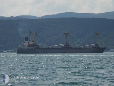
The vessel CAPTAIN ADAM 1 (MMSI: 677022000) is a Cargo It's sailing under the flag of [TZ] Tanzania.
In this page you can find informations about the vessels current position, last detected port calls, and current voyage information. If the vessels is not in coverage by AIS you will find the latest position.
The current position of CAPTAIN ADAM 1 is detected by our AIS receivers and we are not responsible for the reliability of the data. The last position was recorded while the vessel was in Coverage by the Ais receivers of our vessel tracking app.
The current draught of CAPTAIN ADAM 1 as reported by AIS is 6.3 meters
Weather
| Temperature | 12.7°C / 54.86°F |
|---|---|
| Wind Speed | 4 knots |
| Direction | 166° SSE |
| Pressure | 1016.8 hPa |
| Humidity | 75 % |
| Cloud Coverage | 88 % |
Featured Company
Last Trips
| Origin | Departure | Destination | Arrival | Distance | |
|---|---|---|---|---|---|
| 2024-04-26 17:16 | 2024-05-16 15:48 | 62.21 nm | |||
| 2024-04-18 12:38 | 2024-04-24 11:28 | 100.09 nm | |||
| 2024-03-01 17:29 | 2024-04-06 12:39 | 388.30 nm |
Events
| Tid | Hændelsen | Detaljer | Position / Dest | Info |
|---|---|---|---|---|
| 2024-05-21 15:43 | STOP Sejllads | 1.21 nm, South East of KILIYA |
45.42734 / 29.28025
RO SUL
|
Fart: Kurs: -1° |
| 2024-05-21 15:24 | START Sejllads | 0.56 nm, South East of KILIYA |
45.43151 / 29.26389
RO SUL
|
Fart: 4.6 kn Kurs: -1° |
| 2024-05-21 15:24 | Afsejlet fra sidste havn |
|
45.43151 / 29.26389
RO SUL
|
Fart: 1 kn Kurs: -1° |
| 2024-05-16 12:49 | STOP Sejllads |
45.43460 / 29.26458
[UA] KILIYA
|
Fart: Kurs: -1° |
|
| 2024-05-16 12:48 | Skibe i havn |
|
45.43460 / 29.26458
[UA] KILIYA
|
Fart: 1.8 kn Kurs: -1° |