
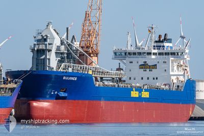
BULKNES
Self Discharging Bulk Carrier
Current Trip
| Time Travelled | 12 days |
|---|---|
| Remaining Time | --- |
| Distance Travelled | 1596.00 nm |
| Remaining Distance | 92.27 nm |
| AVG Speed | 9.8 Knots |
| MAX Speed | 14.6 Knots |
| AVG Wind | 23.4 knots |
| MAX Wind | 32.3 knots |
| MIN Temp | 1.6°C / 34.88°F |
| MAX Temp | 11.4°C / 52.52°F |
| Dybgang | 10.4 m |
| Position Modtaget | 22 h, 26 m siden |
Current Position
| Longitude | --- |
|---|---|
| Latitude | --- |
| Status | Under way using engine |
| Fart | 11.3 Knots |
| Kurs | 167° |
| Område | North Sea |
| Station | T-AIS |
| Position Modtaget | 22 h, 26 m siden |
Info
Information
The current position of BULKNES is in North Sea with coordinates 56.21666° / 6.12683° as reported on 2025-12-07 09:40 by AIS to our vessel tracker app. The vessel's current speed is 11.3 Knots and is heading at the port of HAMBURG. The estimated time of arrival as calculated by MyShipTracking vessel tracking app is 2025-12-07 23:00 LT
The vessel BULKNES (IMO: 9384370, MMSI: 305425000) is a Self Discharging Bulk Carrier that was built in 2009 ( 16 år gamle ). It's sailing under the flag of [AG] Antigua Barbuda.
In this page you can find informations about the vessels current position, last detected port calls, and current voyage information. If the vessels is not in coverage by AIS you will find the latest position.
The current position of BULKNES is detected by our AIS receivers and we are not responsible for the reliability of the data. The last position was recorded while the vessel was in Coverage by the Ais receivers of our vessel tracking app.
The current draught of BULKNES as reported by AIS is 10.4 meters
Weather
| Temperature | 9.7°C / 49.46°F |
|---|---|
| Wind Speed | 26 knots |
| Direction | 233° SW |
| Pressure | 1006.6 hPa |
| Humidity | 91.5 % |
| Cloud Coverage | 100 % |
Featured Company
Last Port Calls
| Port | Arrival | Departure | Time In Port |
|---|---|---|---|
| 2025-11-25 05:21 | 2025-11-25 22:02 | 16 h | |
| 2025-11-15 10:24 | 2025-11-16 12:27 | 1 d | |
| 2025-11-11 22:02 | 2025-11-12 16:51 | 18 h | |
| 2025-11-08 00:46 | 2025-11-08 17:15 | 16 h | |
| 2025-11-02 06:35 | 2025-11-02 22:45 | 16 h | |
| 2025-10-28 23:59 | 2025-10-29 04:29 | 4 h | |
| 2025-10-27 07:56 | 2025-10-28 02:16 | 18 h | |
| 2025-10-21 13:05 | 2025-10-22 10:47 | 21 h | |
| 2025-10-21 12:31 | 2025-10-21 12:43 | 11 m | |
| 2025-10-18 02:21 | 2025-10-18 12:23 | 10 h |
Last Trips
| Origin | Departure | Destination | Arrival | Distance | |
|---|---|---|---|---|---|
| 2025-11-16 12:27 | 2025-11-25 05:21 | 1501.25 nm | |||
| 2025-11-12 16:51 | 2025-11-15 10:24 | 691.95 nm | |||
| 2025-11-08 17:15 | 2025-11-11 22:02 | 944.97 nm | |||
| 2025-11-02 22:45 | 2025-11-08 00:46 | 1069.47 nm | |||
| 2025-10-29 04:29 | 2025-11-02 06:35 | 785.81 nm | |||
| 2025-10-28 02:16 | 2025-10-28 23:59 | 254.60 nm | |||
| 2025-10-22 10:47 | 2025-10-27 07:56 | 1090.76 nm | |||
| 2025-10-21 12:43 | 2025-10-21 13:05 | 0.49 nm | |||
| 2025-10-18 12:23 | 2025-10-21 12:31 | 544.64 nm | |||
| 2025-10-15 07:24 | 2025-10-18 02:21 | 585.39 nm |
Events
| Tid | Hændelsen | Detaljer | Position / Dest | Info |
|---|---|---|---|---|
| 2025-12-07 09:46 | Status er ændret | Default Under way using engine |
56.19717 / 6.13967
DEHAM
|
Fart: 11.3 kn Kurs: 167° |
| 2025-12-07 09:40 | Udenfor Dækning |
56.21666 / 6.12683
North Sea
DEHAM
|
Fart: 11.3 kn Kurs: 167° |
|
| 2025-12-07 09:19 | Status er ændret | Under way using engine Default |
56.28050 / 6.11233
DEHAM
|
Fart: 11 kn Kurs: 172° |
| 2025-12-07 09:12 | Status er ændret | Default Under way using engine |
56.30333 / 6.10500
DEHAM
|
Fart: 11.3 kn Kurs: 165° |
| 2025-12-07 09:08 | Status er ændret | Under way using engine Default |
56.31466 / 6.10150
DEHAM
|
Fart: 11 kn Kurs: 165° |
| 2025-12-07 09:08 | Indenfor Dækning |
56.31466 / 6.10150
North Sea
DEHAM
|
Fart: 11.3 kn Kurs: 165° |
|
| 2025-12-07 09:08 | Ændre havområde | Danish part of the North Sea Norwegian part of the North Sea |
56.31466 / 6.10150
North Sea
DEHAM
|
Fart: 11.3 kn Kurs: 165° |
| 2025-12-07 04:18 | Status er ændret | Default Under way using engine |
57.10500 / 5.72500
DEHAM
|
Fart: 8.6 kn Kurs: 170° |
| 2025-12-07 04:16 | Udenfor Dækning |
57.10933 / 5.72433
North Sea
DEHAM
|
Fart: 8.6 kn Kurs: 170° |
|
| 2025-12-07 03:50 | Status er ændret | Under way using engine Default |
57.16983 / 5.69850
DEHAM
|
Fart: 8 kn Kurs: 165° |