
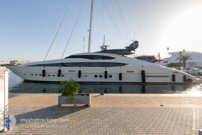
STEALTH
Yacht
Current Trip
CHUB CAY BAHAMAS
| Time Travelled | 17 h, 33 mins |
|---|---|
| Remaining Time | --- |
| Distance Travelled | 18.21 nm |
| Remaining Distance | --- |
| AVG Speed | 13.6 Knots |
| MAX Speed | 14.4 Knots |
| AVG Wind | 4.4 knots |
| MAX Wind | 5.4 knots |
| MIN Temp | 28.1°C / 82.58°F |
| MAX Temp | 28.4°C / 83.12°F |
| Dybgang | 2.7 m |
| Position Modtaget | 16 h, 2 m siden |
Current Position
| Longitude | -79.74887° |
|---|---|
| Latitude | 25.99334° |
| Status | Moored |
| Fart | 12.9 Knots |
| Kurs | 118.8° |
| Område | North Atlantic Ocean |
| Station | T-AIS |
| Position Modtaget | 16 h, 2 m siden |
Info
Information
The current position of STEALTH is in North Atlantic Ocean with coordinates 25.99334° / -79.74887° as reported on 2024-06-06 12:17 by AIS to our vessel tracker app. The vessel's current speed is 12.9 Knots
The vessel STEALTH (IMO: 1011288, MMSI: 319214000) is a Yacht that was built in 2010 ( 14 år gamle ). It's sailing under the flag of [KY] Cayman Is.
In this page you can find informations about the vessels current position, last detected port calls, and current voyage information. If the vessels is not in coverage by AIS you will find the latest position.
The current position of STEALTH is detected by our AIS receivers and we are not responsible for the reliability of the data. The last position was recorded while the vessel was in Coverage by the Ais receivers of our vessel tracking app.
The current draught of STEALTH as reported by AIS is 2.7 meters
Weather
| Temperature | 28.3°C / 82.94°F |
|---|---|
| Wind Speed | 4 knots |
| Direction | 132° SE |
| Pressure | 1011.7 hPa |
| Humidity | 71.1 % |
| Cloud Coverage | 93 % |
Featured Company
Last Port Calls
| Port | Arrival | Departure | Time In Port |
|---|---|---|---|
| 2024-06-06 10:36 | 2024-06-06 10:46 | 10 m | |
| 2024-05-31 22:11 | 2024-06-06 10:34 | 5 d | |
| 2024-04-09 00:12 | 2024-05-31 22:07 | ||
| 2024-04-08 23:53 | 2024-04-09 00:00 | 7 m |
Most Visited Ports (Last year)
| Port | Arrivals | |
|---|---|---|
| 6 | ||
| 6 | ||
| 4 | ||
| 2 | ||
| 2 | ||
| 2 |
Last Trips
| Origin | Departure | Destination | Arrival | Distance | |
|---|---|---|---|---|---|
| 2024-06-06 06:34 | 2024-06-06 06:36 | 0.15 nm | |||
| 2024-05-31 18:07 | 2024-05-31 18:11 | 0.23 nm | |||
| 2024-04-08 20:00 | 2024-04-08 20:12 | 1.19 nm | |||
| 2024-03-16 09:01 | 2024-04-08 19:53 | 772.35 nm |
Events
| Tid | Hændelsen | Detaljer | Position / Dest | Info |
|---|---|---|---|---|
| 2024-06-06 12:17 | Udenfor Dækning |
25.99334 / -79.74887
North Atlantic Ocean
|
Fart: 12.9 kn Kurs: 118.8° |
|
| 2024-06-06 10:46 | Afsejlet fra sidste havn |
|
26.09353 / -80.10882
CHUB CAY BAHAMAS
|
Fart: 6.3 kn Kurs: 197° |
| 2024-06-06 10:41 | START Sejllads |
26.09508 / -80.11744
[US] PORT EVERGLADES
|
Fart: 3.1 kn Kurs: 197° |
|
| 2024-06-06 10:36 | STOP Sejllads |
26.09688 / -80.11839
[US] PORT EVERGLADES
|
Fart: 0.3 kn Kurs: 197° |
|
| 2024-06-06 10:36 | Skibe i havn |
|
26.09696 / -80.11842
[US] PORT EVERGLADES
|
Fart: 0.8 kn Kurs: 197° |
| 2024-06-06 10:34 | Afsejlet fra sidste havn |
|
26.09904 / -80.11844
CHUB CAY BAHAMAS
|
Fart: 6.5 kn Kurs: 197° |
| 2024-06-06 10:16 | START Sejllads |
26.11986 / -80.10908
[US] FORT LAUDERDALE
|
Fart: 6.3 kn Kurs: 197° |
|
| 2024-06-06 10:13 | STOP Sejllads |
26.12192 / -80.10921
[US] FORT LAUDERDALE
|
Fart: 0.3 kn Kurs: 197° |
|
| 2024-06-06 10:07 | Destination er ændret | CHUB CAY BAHAMAS SUNRISE |
26.12827 / -80.10887
[US] FORT LAUDERDALE
|
Fart: 5.2 kn Kurs: 197° |
| 2024-06-06 10:02 | START Sejllads |
26.13601 / -80.10879
[US] FORT LAUDERDALE
|
Fart: 7.1 kn Kurs: 197° |