
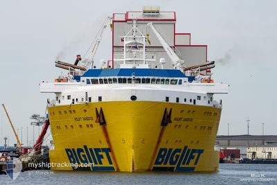
BIGLIFT BARENTSZ
Cargo
Current Trip
| Time Travelled | 40 days |
|---|---|
| Remaining Time | --- |
| Distance Travelled | 10622.21 nm |
| Remaining Distance | --- |
| AVG Speed | 11.5 Knots |
| MAX Speed | 16.2 Knots |
| AVG Wind | 11 knots |
| MAX Wind | 27.9 knots |
| MIN Temp | 14.3°C / 57.74°F |
| MAX Temp | 31.4°C / 88.52°F |
| Dybgang | 5.8 m |
| Position Modtaget | 3 h, 19 m siden |
Current Position
| Longitude | -16.51408° |
|---|---|
| Latitude | 25.10695° |
| Status | Under way using engine |
| Fart | 10 Knots |
| Kurs | 26.7° |
| Område | North Atlantic Ocean |
| Station | T-AIS |
| Position Modtaget | 3 h, 19 m siden |
Info
Information
The current position of BIGLIFT BARENTSZ is in North Atlantic Ocean with coordinates 25.10695° / -16.51408° as reported on 2024-05-10 21:42 by AIS to our vessel tracker app. The vessel's current speed is 10 Knots and is heading at the port of HAUGESUND. The estimated time of arrival as calculated by MyShipTracking vessel tracking app is 2024-05-21 06:00 LT
The vessel BIGLIFT BARENTSZ (IMO: 9710464, MMSI: 244830430) is a Cargo It's sailing under the flag of [NL] Netherlands.
In this page you can find informations about the vessels current position, last detected port calls, and current voyage information. If the vessels is not in coverage by AIS you will find the latest position.
The current position of BIGLIFT BARENTSZ is detected by our AIS receivers and we are not responsible for the reliability of the data. The last position was recorded while the vessel was in Coverage by the Ais receivers of our vessel tracking app.
The current draught of BIGLIFT BARENTSZ as reported by AIS is 5.8 meters
Weather
| Temperature | 19.9°C / 67.82°F |
|---|---|
| Wind Speed | 19 knots |
| Direction | 37° NE |
| Pressure | 1015.4 hPa |
| Humidity | 84.8 % |
| Cloud Coverage | 3 % |
Featured Company
Last Port Calls
| Port | Arrival | Departure | Time In Port |
|---|---|---|---|
| 2024-03-20 01:09 | 2024-03-31 04:17 | 11 d |
Last Trips
| Origin | Departure | Destination | Arrival | Distance | |
|---|---|---|---|---|---|
| 2024-02-04 09:38 | 2024-03-20 08:09 | 2860.80 nm |
Events
| Tid | Hændelsen | Detaljer | Position / Dest | Info |
|---|---|---|---|---|
| 2024-05-10 21:49 | Status er ændret | Default Under way using engine |
25.12333 / -16.50500
NOHAU
|
Fart: 10 kn Kurs: 26.7° |
| 2024-05-10 21:42 | Status er ændret | Under way using engine Default |
25.10695 / -16.51408
NOHAU
|
Fart: 10 kn Kurs: 27° |
| 2024-05-10 21:42 | Udenfor Dækning |
25.10695 / -16.51408
North Atlantic Ocean
NOHAU
|
Fart: 10 kn Kurs: 26.7° |
|
| 2024-05-10 21:34 | Indenfor Dækning |
25.10695 / -16.51408
North Atlantic Ocean
NOHAU
|
Fart: 10 kn Kurs: 26.7° |
|
| 2024-05-10 14:54 | Status er ændret | Default Under way using engine |
24.10500 / -17.05167
NOHAU
|
Fart: 9.5 kn Kurs: 26.8° |
| 2024-05-10 14:47 | Udenfor Dækning |
24.08990 / -17.06007
North Atlantic Ocean
NOHAU
|
Fart: 9.5 kn Kurs: 26.8° |
|
| 2024-05-10 14:39 | Status er ændret | Under way using engine Default |
24.07170 / -17.06990
NOHAU
|
Fart: 9 kn Kurs: 28° |
| 2024-05-10 14:21 | Indenfor Dækning |
24.07170 / -17.06990
North Atlantic Ocean
NOHAU
|
Fart: 9.5 kn Kurs: 27.1° |
|
| 2024-05-10 07:59 | Status er ændret | Default Under way using engine |
23.02167 / -17.62833
NOHAU
|
Fart: 10.7 kn Kurs: 26.2° |
| 2024-05-10 07:56 | Udenfor Dækning |
23.01622 / -17.63182
North Atlantic Ocean
NOHAU
|
Fart: 10.7 kn Kurs: 26.2° |