
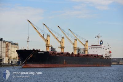
BEATRICE
Bulk Carrier
Current Trip
| Time Travelled | 9 days |
|---|---|
| Remaining Time | --- |
| Distance Travelled | 136.92 nm |
| Remaining Distance | --- |
| AVG Speed | 8.5 Knots |
| MAX Speed | 8.5 Knots |
| AVG Wind | 6 knots |
| MAX Wind | 12.1 knots |
| MIN Temp | 12.3°C / 54.14°F |
| MAX Temp | 28.2°C / 82.76°F |
| Dybgang | 5.2 m |
| Position Modtaget | 2024-03-20 18:44 |
Current Position
| Longitude | 129.08678° |
|---|---|
| Latitude | 34.57747° |
| Status | Under way using engine |
| Fart | 12.5 Knots |
| Kurs | 216.1° |
| Område | Japan Sea |
| Station | T-AIS |
| Position Modtaget | 2024-03-20 18:44 |
Info
Information
The current position of BEATRICE is in Japan Sea with coordinates 34.57747° / 129.08678° as reported on 2024-03-20 18:44 by AIS to our vessel tracker app. The vessel's current speed is 12.5 Knots and is heading at the port of TAICANG.
The vessel BEATRICE (IMO: 9430818, MMSI: 538005795) is a Bulk Carrier that was built in 2009 ( 15 år gamle ). It's sailing under the flag of [MH] Marshall Is.
In this page you can find informations about the vessels current position, last detected port calls, and current voyage information. If the vessels is not in coverage by AIS you will find the latest position.
The current position of BEATRICE is detected by our AIS receivers and we are not responsible for the reliability of the data. The last position was recorded while the vessel was in Coverage by the Ais receivers of our vessel tracking app.
The current draught of BEATRICE as reported by AIS is 5.2 meters
Weather
| Temperature | 21.7°C / 71.06°F |
|---|---|
| Wind Speed | 6 knots |
| Direction | 126° SE |
| Pressure | 1015 hPa |
| Humidity | 55 % |
| Cloud Coverage | --- |
Featured Company
Events
| Tid | Hændelsen | Detaljer | Position / Dest | Info |
|---|---|---|---|---|
| 2024-05-09 09:15 | STOP Sejllads | 4.73 nm, South East of NANJING |
32.16731 / 118.85434
CN TAC
|
Fart: Kurs: 239° |
| 2024-05-09 06:57 | START Sejllads | 0.12 nm, South of YIZHENG |
32.24718 / 119.15724
CN TAC
|
Fart: 7 kn Kurs: 274° |
| 2024-05-07 07:12 | STOP Sejllads | 1.22 nm, South East of YIZHENG |
32.23542 / 119.17440
CN TAC
|
Fart: 0.3 kn Kurs: 296° |
| 2024-05-07 00:04 | START Sejllads | 4.08 nm, South East of JIANGSU HANTONG |
32.06084 / 119.93880
CN TAC
|
Fart: 6.2 kn Kurs: 318° |
| 2024-05-05 12:50 | STOP Sejllads | 4.5 nm, South East of JIANGSU HANTONG |
32.05526 / 119.94392
CN TAC
|
Fart: 0.2 kn Kurs: 330° |
| 2024-05-05 06:44 | START Sejllads | 3.18 nm, North West of NANTONG |
32.00667 / 120.80724
CN TAC
|
Fart: 6.7 kn Kurs: 285° |
| 2024-05-05 06:32 | Afsejlet fra sidste havn |
|
32.00667 / 120.80724
CN TAC
|
Fart: 1.1 kn Kurs: 304° |