
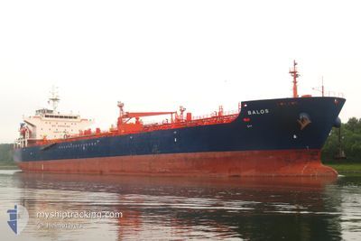
BALOS
Oil/Chemical Tanker
Current Trip
| Time Travelled | 8 days |
|---|---|
| Remaining Time | 15 h, 7 mins |
| Distance Travelled | 1223.53 nm |
| Remaining Distance | 193.19 nm |
| AVG Speed | 10.9 Knots |
| MAX Speed | 13.4 Knots |
| AVG Wind | 7.5 knots |
| MAX Wind | 27 knots |
| MIN Temp | 10°C / 50°F |
| MAX Temp | 20.2°C / 68.36°F |
| Dybgang | 7.5 m |
| Position Modtaget | 1 d siden |
Current Position
| Longitude | --- |
|---|---|
| Latitude | --- |
| Status | Under way using engine |
| Fart | 12.3 Knots |
| Kurs | 55.8° |
| Område | Black Sea |
| Station | T-AIS |
| Position Modtaget | 1 d siden |
Info
Information
The current position of BALOS is in Black Sea with coordinates 41.49847° / 29.85744° as reported on 2025-12-04 23:12 by AIS to our vessel tracker app. The vessel's current speed is 12.3 Knots and is heading at the port of NOVOROSSIYSK. The estimated time of arrival as calculated by MyShipTracking vessel tracking app is 2025-12-06 19:57 LT
The vessel BALOS (IMO: 9323560, MMSI: 636013645) is a Oil/Chemical Tanker that was built in 2008 ( 17 år gamle ). It's sailing under the flag of [LR] Liberia.
In this page you can find informations about the vessels current position, last detected port calls, and current voyage information. If the vessels is not in coverage by AIS you will find the latest position.
The current position of BALOS is detected by our AIS receivers and we are not responsible for the reliability of the data. The last position was recorded while the vessel was in Coverage by the Ais receivers of our vessel tracking app.
The current draught of BALOS as reported by AIS is 7.5 meters
Weather
| Temperature | 14.6°C / 58.28°F |
|---|---|
| Wind Speed | 18 knots |
| Direction | 88° E |
| Pressure | 1013.4 hPa |
| Humidity | 87.2 % |
| Cloud Coverage | 100 % |
Featured Company
Events
| Tid | Hændelsen | Detaljer | Position / Dest | Info |
|---|---|---|---|---|
| 2025-12-04 23:16 | Status er ændret | Default Under way using engine |
41.50660 / 29.87338
RUNVS
|
Fart: 12.3 kn Kurs: 55.8° |
| 2025-12-04 23:12 | Udenfor Dækning |
41.49847 / 29.85744
Black Sea
RUNVS
|
Fart: 12.3 kn Kurs: 55.8° |
|
| 2025-12-04 20:08 | Ændre havområde | Turkish part of the Black Sea Turkish part of the Sea of Marmara |
41.23143 / 29.14812
Black Sea
RUNVS
|
Fart: 6.5 kn Kurs: 41.3° |
| 2025-12-04 16:55 | START Sejllads | 7.9 nm, South of YESILKOY |
40.83019 / 28.87954
RUNVS
|
Fart: 3.1 kn Kurs: 359° |
| 2025-12-04 12:34 | STOP Sejllads | 7.9 nm, South East of YESILKOY |
40.83922 / 28.90758
RUNVS
|
Fart: 0.3 kn Kurs: 72° |
| 2025-12-04 12:15 | START Sejllads | 7.67 nm, South East of YESILKOY |
40.83928 / 28.89643
RUNVS
|
Fart: 3.1 kn Kurs: 87° |
| 2025-12-04 03:52 | ETA er ændret | 2025/12/08 03:00 2025/12/07 03:00 |
40.84355 / 28.92983
RUNVS
|
Fart: 0.1 kn Kurs: 73° |
| 2025-12-04 03:51 | STOP Sejllads | 8.12 nm, South of BAKIRKOY |
40.84353 / 28.92980
RUNVS
|
Fart: 0.3 kn Kurs: 73° |
| 2025-12-04 03:46 | ETA er ændret | 2025/12/07 03:00 2025/12/03 03:00 |
40.84322 / 28.92571
RUNVS
|
Fart: 3.2 kn Kurs: 87° |
| 2025-12-04 03:44 | Destination er ændret | RUNVS TRBZC |
40.84355 / 28.92307
RUNVS
|
Fart: 4.1 kn Kurs: 92° |