
AUTO WAY
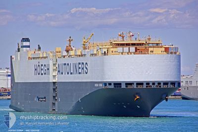
Vehicles Carrier
Current Trip
| Trip Time | 2 days |
|---|---|
| Trip Distance | 776.85 nm |
| AVG Speed | 12 Knots |
| MAX Speed | 17.6 Knots |
| Dybgang | 8.8 m |
| AVG Wind | 18.8 knots |
| MAX Wind | 33 knots |
| MIN Temp | 5.5°C / 41.9°F |
| MAX Temp | 12.3°C / 54.14°F |
| Position Modtaget | 4 m siden |
Current Position
| Longitude | --- |
|---|---|
| Latitude | --- |
| Status | Moored |
| Fart | |
| Kurs | 64° |
| Område | North Atlantic Ocean |
| Station | T-AIS |
| Position Modtaget | 4 m siden |
Info
Information
The current position of AUTO WAY is in North Atlantic Ocean with coordinates 42.23291° / -8.74969° as reported on 2025-12-21 06:33 by AIS to our vessel tracker app. The vessel's current speed is 0 Knots and is currently inside the port of VIGO.
The vessel AUTO WAY (IMO: 9303558, MMSI: 257824000) is a Vehicles Carrier that was built in 2006 ( 19 år gamle ). It's sailing under the flag of [NO] Norway.
In this page you can find informations about the vessels current position, last detected port calls, and current voyage information. If the vessels is not in coverage by AIS you will find the latest position.
The current position of AUTO WAY is detected by our AIS receivers and we are not responsible for the reliability of the data. The last position was recorded while the vessel was in Coverage by the Ais receivers of our vessel tracking app.
The current draught of AUTO WAY as reported by AIS is 8.8 meters
Weather
| Temperature | 7.5°C / 45.5°F |
|---|---|
| Wind Speed | 10 knots |
| Direction | 305° NW |
| Pressure | 1005.8 hPa |
| Humidity | 70.9 % |
| Cloud Coverage | 99 % |
Featured Company
Last Port Calls
| Port | Arrival | Departure | Time In Port |
|---|---|---|---|
| 2025-12-21 06:16 | |||
| 2025-12-16 15:51 | 2025-12-18 05:27 | 1 d | |
| 2025-12-13 01:36 | 2025-12-15 00:57 | 1 d | |
| 2025-12-10 06:08 | 2025-12-11 03:11 | 21 h | |
| 2025-11-26 00:01 | 2025-11-27 01:37 | 1 d | |
| 2025-11-23 22:48 | 2025-11-24 20:23 | 21 h | |
| 2025-11-20 09:23 | 2025-11-21 07:53 | 22 h | |
| 2025-11-17 11:09 | 2025-11-18 03:22 | 16 h | |
| 2025-11-13 22:46 | 2025-11-14 21:07 | 22 h | |
| 2025-11-09 19:11 | 2025-11-10 20:30 | 1 d |
Last Trips
| Origin | Departure | Destination | Arrival | Distance | |
|---|---|---|---|---|---|
| 2025-12-18 05:27 | 2025-12-21 06:16 | 776.85 nm | |||
| 2025-12-15 00:57 | 2025-12-16 15:51 | 548.20 nm | |||
| 2025-12-11 03:11 | 2025-12-13 01:36 | 402.80 nm | |||
| 2025-11-27 01:37 | 2025-12-10 06:08 | 3666.48 nm | |||
| 2025-11-24 20:23 | 2025-11-26 00:01 | 402.68 nm | |||
| 2025-11-21 07:53 | 2025-11-23 22:48 | 962.52 nm | |||
| 2025-11-18 03:22 | 2025-11-20 09:23 | 593.61 nm | |||
| 2025-11-14 21:07 | 2025-11-17 11:09 | 976.50 nm | |||
| 2025-11-10 20:30 | 2025-11-13 22:46 | 774.71 nm | |||
| 2025-11-07 23:36 | 2025-11-09 19:11 | 554.95 nm |
Events
| Tid | Hændelsen | Detaljer | Position / Dest | Info |
|---|---|---|---|---|
| 2025-12-21 05:40 | Status er ændret | Moored Under way using engine |
42.23293 / -8.74969
[ES] VIGO
|
Fart: 0.1 kn Kurs: 63° |
| 2025-12-21 05:21 | STOP Sejllads |
42.23538 / -8.74736
[ES] VIGO
|
Fart: 0.3 kn Kurs: 53° |
|
| 2025-12-21 05:16 | Skibe i havn |
|
42.23606 / -8.75027
[ES] VIGO
|
Fart: 2.9 kn Kurs: 127° |
| 2025-12-21 04:41 | Status er ændret | Under way using engine Default |
42.23085 / -8.83469
ES VGO
|
Fart: 5 kn Kurs: 91° |
| 2025-12-21 04:26 | Status er ændret | Default Under way using engine |
42.23211 / -8.86281
ES VGO
|
Fart: 5.8 kn Kurs: 89.4° |
| 2025-12-21 04:19 | Ændre havområde | Spanish part of the North Atlantic Ocean United Kingdom part of the Celtic Sea |
42.23268 / -8.87734
North Atlantic Ocean
ES VGO
|
Fart: 6.2 kn Kurs: 93.9° |
| 2025-12-21 04:17 | Status er ændret | Under way using engine Default |
42.23328 / -8.88344
ES VGO
|
Fart: 7.2 kn Kurs: 160° |
| 2025-12-21 04:13 | Indenfor Dækning |
42.23268 / -8.87734
North Atlantic Ocean
ES VGO
|
Fart: 6.2 kn Kurs: 93.9° |
|
| 2025-12-19 11:44 | Status er ændret | Default Under way using engine |
50.54190 / -5.74387
ES VGO
|
Fart: 13.7 kn Kurs: 218.4° |
| 2025-12-19 11:43 | Udenfor Dækning |
50.54351 / -5.74193
Celtic Sea
ES VGO
|
Fart: 13.7 kn Kurs: 218.4° |