
AUMICHAKIAD
Pleasure Craft
Current Trip
| Time Travelled | 2 days |
|---|---|
| Remaining Time | --- |
| Distance Travelled | 271.47 nm |
| Remaining Distance | --- |
| AVG Speed | 11.2 Knots |
| MAX Speed | 11.9 Knots |
| AVG Wind | 15.5 knots |
| MAX Wind | 18 knots |
| MIN Temp | 25.9°C / 78.62°F |
| MAX Temp | 27.3°C / 81.14°F |
| Dybgang | 0 m |
| Position Modtaget | 1 d siden |
Current Position
| Longitude | --- |
|---|---|
| Latitude | --- |
| Status | Under way using engine |
| Fart | 11.3 Knots |
| Kurs | 286.7° |
| Område | Caribbean Sea |
| Station | T-AIS |
| Position Modtaget | 1 d siden |
Info
Information
The current position of AUMICHAKIAD is in Caribbean Sea with coordinates 18.43249° / -65.50162° as reported on 2025-12-11 22:14 by AIS to our vessel tracker app. The vessel's current speed is 11.3 Knots and is heading at the port of ANTIRIO.
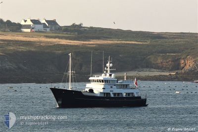
The vessel AUMICHAKIAD (MMSI: 248820000) is a Pleasure Craft It's sailing under the flag of [MT] Malta.
In this page you can find informations about the vessels current position, last detected port calls, and current voyage information. If the vessels is not in coverage by AIS you will find the latest position.
The current position of AUMICHAKIAD is detected by our AIS receivers and we are not responsible for the reliability of the data. The last position was recorded while the vessel was in Coverage by the Ais receivers of our vessel tracking app.
Weather
| Temperature | 27.3°C / 81.14°F |
|---|---|
| Wind Speed | 16 knots |
| Direction | 104° ESE |
| Pressure | 1014.6 hPa |
| Humidity | 73 % |
| Cloud Coverage | 3 % |
Featured Company
Last Port Calls
| Port | Arrival | Departure | Time In Port |
|---|---|---|---|
| 2025-12-09 14:54 | 2025-12-10 20:19 | 1 d | |
| 2025-12-08 16:18 | 2025-12-08 16:34 | 15 m | |
| 2025-12-07 10:53 | 2025-12-07 13:53 | 3 h | |
| 2025-12-01 16:05 | 2025-12-07 10:32 | 5 d | |
| 2025-11-24 19:46 | 2025-11-24 19:51 | 4 m | |
| 2025-11-24 12:33 | 2025-11-24 19:38 | 7 h | |
| 2025-11-23 11:55 | 2025-11-23 17:40 | 5 h | |
| 2025-11-06 12:36 | 2025-11-23 11:30 | 16 d |
Most Visited Ports (Last year)
| Port | Arrivals | |
|---|---|---|
| 4 | ||
| 4 | ||
| 1 | ||
| 1 | ||
| 1 | ||
| 1 |
Last Trips
| Origin | Departure | Destination | Arrival | Distance | |
|---|---|---|---|---|---|
| 2025-12-08 12:34 | 2025-12-09 10:54 | 23.55 nm | |||
| 2025-12-07 09:53 | 2025-12-08 12:18 | 96.83 nm | |||
| 2025-12-07 06:32 | 2025-12-07 06:53 | 1.26 nm | |||
| 2025-11-24 15:51 | 2025-12-01 12:05 | 111.08 nm | |||
| 2025-11-24 15:38 | 2025-11-24 15:46 | 1.55 nm | |||
| 2025-11-23 13:40 | 2025-11-24 08:33 | 3.70 nm | |||
| 2025-11-23 07:30 | 2025-11-23 07:55 | 4.27 nm | |||
| 2025-08-23 07:34 | 2025-11-06 08:36 | 1179.60 nm |
Events
| Tid | Hændelsen | Detaljer | Position / Dest | Info |
|---|---|---|---|---|
| 2025-12-11 22:14 | Udenfor Dækning |
18.43249 / -65.50162
Caribbean Sea
|
Fart: 11.3 kn Kurs: 286.7° |
|
| 2025-12-11 18:16 | Fundet i havområde | Puerto Rican part of the Caribbean Sea |
18.08817 / -64.82224
Caribbean Sea
|
Fart: 11.5 kn Kurs: 303.9° |
| 2025-12-11 18:16 | Indenfor Dækning |
18.08817 / -64.82224
Caribbean Sea
|
Fart: 11.5 kn Kurs: 303.9° |
|
| 2025-12-10 22:11 | Udenfor Dækning |
15.93512 / -61.68024
Caribbean Sea
|
Fart: 11.2 kn Kurs: 251.8° |
|
| 2025-12-10 21:33 | Indenfor Dækning |
15.98876 / -61.57129
Caribbean Sea
|
Fart: 11.5 kn Kurs: 228.5° |
|
| 2025-12-10 20:19 | Afsejlet fra sidste havn |
|
15.98876 / -61.57129
.
|
Fart: Kurs: 273° |
| 2025-12-10 15:26 | Udenfor Dækning |
16.22085 / -61.53023
Caribbean Sea
[GP] POINTE A PITRE
|
Fart: Kurs: 107.8° |
|
| 2025-12-10 15:26 | Indenfor Dækning |
16.22085 / -61.53023
Caribbean Sea
[GP] POINTE A PITRE
|
Fart: Kurs: 107.8° |
|
| 2025-12-10 05:44 | Udenfor Dækning |
16.22083 / -61.53023
Caribbean Sea
[GP] POINTE A PITRE
|
Fart: Kurs: 107° |
|
| 2025-12-10 05:15 | Indenfor Dækning |
16.22085 / -61.53022
Caribbean Sea
[GP] POINTE A PITRE
|
Fart: Kurs: 107° |