
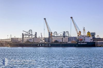
MANTA ZUHAL
Bulk Carrier
Current Trip
| Time Travelled | 6 days |
|---|---|
| Remaining Time | --- |
| Distance Travelled | 1441.99 nm |
| Remaining Distance | --- |
| AVG Speed | 8.8 Knots |
| MAX Speed | 13.6 Knots |
| AVG Wind | 15.4 knots |
| MAX Wind | 27.8 knots |
| MIN Temp | 9.8°C / 49.64°F |
| MAX Temp | 19.2°C / 66.56°F |
| Dybgang | 9.4 m |
| Position Modtaget | 2 d siden |
Current Position
| Longitude | -10.54710° |
|---|---|
| Latitude | 37.23387° |
| Status | Under way using engine |
| Fart | 9.6 Knots |
| Kurs | 281° |
| Område | North Atlantic Ocean |
| Station | T-AIS |
| Position Modtaget | 2 d siden |
Info
Information
The current position of MANTA ZUHAL is in North Atlantic Ocean with coordinates 37.23387° / -10.54710° as reported on 2024-04-28 03:22 by AIS to our vessel tracker app. The vessel's current speed is 9.6 Knots and is heading at the port of BOSTON. The estimated time of arrival as calculated by MyShipTracking vessel tracking app is 2024-05-09 00:05 LT
The vessel MANTA ZUHAL (IMO: 9374351, MMSI: 538007835) is a Bulk Carrier that was built in 2008 ( 16 år gamle ). It's sailing under the flag of [MH] Marshall Is.
In this page you can find informations about the vessels current position, last detected port calls, and current voyage information. If the vessels is not in coverage by AIS you will find the latest position.
The current position of MANTA ZUHAL is detected by our AIS receivers and we are not responsible for the reliability of the data. The last position was recorded while the vessel was in Coverage by the Ais receivers of our vessel tracking app.
The current draught of MANTA ZUHAL as reported by AIS is 9.4 meters
Weather
| Temperature | 15.9°C / 60.62°F |
|---|---|
| Wind Speed | 12 knots |
| Direction | 295° WNW |
| Pressure | 1027.1 hPa |
| Humidity | 73.1 % |
| Cloud Coverage | 90 % |
Featured Company
Last Port Calls
| Port | Arrival | Departure | Time In Port |
|---|---|---|---|
| 2024-04-20 09:22 | 2024-04-24 04:51 | 3 d | |
| 2024-04-05 08:51 | 2024-04-15 09:06 | 10 d | |
| 2024-03-15 05:30 | 2024-03-18 04:51 | 2 d | |
| 2024-03-13 06:24 | 2024-03-13 07:20 | 55 m | |
| 2024-02-29 18:08 | 2024-03-04 22:24 | 4 d | |
| 2024-02-06 18:26 |
Most Visited Ports (Last year)
| Port | Arrivals | |
|---|---|---|
| 4 | ||
| 3 | ||
| 2 | ||
| 2 | ||
| 1 | ||
| 1 |
Last Trips
| Origin | Departure | Destination | Arrival | Distance | |
|---|---|---|---|---|---|
| 2024-04-15 12:06 | 2024-04-20 11:22 | 1318.23 nm | |||
| 2024-03-18 00:51 | 2024-04-05 11:51 | 4915.90 nm | |||
| 2024-03-13 03:20 | 2024-03-15 01:30 | 169.00 nm | |||
| 2024-03-04 17:24 | 2024-03-13 02:24 | 170.87 nm | |||
| 2024-02-06 21:26 | 2024-02-29 13:08 | 5242.64 nm |
Events
| Tid | Hændelsen | Detaljer | Position / Dest | Info |
|---|---|---|---|---|
| 2024-04-28 03:30 | Status er ændret | Default Under way using engine |
37.23929 / -10.57710
USBOS
|
Fart: 9.6 kn Kurs: 281° |
| 2024-04-28 03:22 | Status er ændret | Under way using engine Default |
37.23387 / -10.54710
USBOS
|
Fart: 9.6 kn Kurs: 282° |
| 2024-04-28 03:22 | Udenfor Dækning |
37.23387 / -10.54710
North Atlantic Ocean
USBOS
|
Fart: 9.6 kn Kurs: 281° |
|
| 2024-04-28 03:04 | Status er ændret | Default Under way using engine |
37.22418 / -10.49200
USBOS
|
Fart: 9.8 kn Kurs: 283° |
| 2024-04-28 02:56 | Status er ændret | Under way using engine Default |
37.21942 / -10.46528
USBOS
|
Fart: 10 kn Kurs: 281° |
| 2024-04-28 02:49 | Status er ændret | Default Under way using engine |
37.21587 / -10.44515
USBOS
|
Fart: 9 kn Kurs: 283° |
| 2024-04-28 02:19 | Status er ændret | Under way using engine Default |
37.19777 / -10.34983
USBOS
|
Fart: 9.2 kn Kurs: 281° |
| 2024-04-28 02:19 | Indenfor Dækning |
37.19777 / -10.34983
North Atlantic Ocean
USBOS
|
Fart: 9 kn Kurs: 283° |
|
| 2024-04-27 21:55 | Status er ændret | Default Under way using engine |
37.04068 / -9.52400
USBOS
|
Fart: 9.6 kn Kurs: 280° |
| 2024-04-27 21:50 | Udenfor Dækning |
37.03865 / -9.50733
North Atlantic Ocean
USBOS
|
Fart: 9.6 kn Kurs: 280° |