
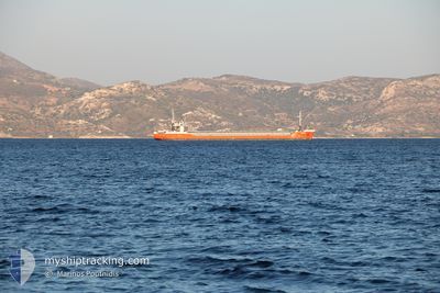
ARAMIS
General Cargo
Current Trip
| Time Travelled | 23 h, 2 mins |
|---|---|
| Remaining Time | --- |
| Distance Travelled | 53.65 nm |
| Remaining Distance | --- |
| AVG Speed | 6.2 Knots |
| MAX Speed | 7.3 Knots |
| AVG Wind | 3.3 knots |
| MAX Wind | 5 knots |
| MIN Temp | 6.7°C / 44.06°F |
| MAX Temp | 10.8°C / 51.44°F |
| Dybgang | 3.2 m |
| Position Modtaget | 2 d siden |
Current Position
| Longitude | --- |
|---|---|
| Latitude | --- |
| Status | Under way using engine |
| Fart | 5.1 Knots |
| Kurs | 260° |
| Område | Mediterranean Sea - Western Basin |
| Station | T-AIS |
| Position Modtaget | 2 d siden |
Info
Information
The current position of ARAMIS is in Mediterranean Sea - Western Basin with coordinates 42.99190° / 7.25245° as reported on 2025-12-05 05:03 by AIS to our vessel tracker app. The vessel's current speed is 5.1 Knots
The vessel ARAMIS (IMO: 9281592, MMSI: 277551000) is a General Cargo that was built in 2003 ( 22 år gamle ). It's sailing under the flag of [LT] Lithuania.
In this page you can find informations about the vessels current position, last detected port calls, and current voyage information. If the vessels is not in coverage by AIS you will find the latest position.
The current position of ARAMIS is detected by our AIS receivers and we are not responsible for the reliability of the data. The last position was recorded while the vessel was in Coverage by the Ais receivers of our vessel tracking app.
The current draught of ARAMIS as reported by AIS is 3.2 meters
Weather
| Temperature | 6.8°C / 44.24°F |
|---|---|
| Wind Speed | 4 knots |
| Direction | 358° N |
| Pressure | 1017 hPa |
| Humidity | 87.8 % |
| Cloud Coverage | 87 % |
Featured Company
Last Port Calls
| Port | Arrival | Departure | Time In Port |
|---|---|---|---|
| 2025-12-06 07:01 | 2025-12-06 08:16 | 1 h | |
| 2025-12-06 06:01 | 2025-12-06 06:37 | 36 m | |
| 2025-12-01 07:12 | 2025-12-01 22:29 | 15 h | |
| 2025-11-21 09:05 | 2025-11-24 21:55 | 3 d | |
| 2025-11-19 21:27 | 2025-11-20 21:00 | 23 h | |
| 2025-11-19 08:04 | |||
| 2025-11-19 07:33 | |||
| 2025-11-19 07:33 | |||
| 2025-11-18 20:36 | |||
| 2025-11-13 17:16 | 2025-11-14 05:12 | 11 h |
Most Visited Ports (Last year)
| Port | Arrivals | |
|---|---|---|
| 23 | ||
| 18 | ||
| 4 | ||
| 3 | ||
| 2 | ||
| 2 |
Last Trips
| Origin | Departure | Destination | Arrival | Distance | |
|---|---|---|---|---|---|
| 2025-12-06 06:37 | 2025-12-06 07:01 | 0.26 nm | |||
| 2025-12-01 22:29 | 2025-12-06 06:01 | 733.80 nm | |||
| 2025-11-24 21:55 | 2025-12-01 07:12 | 756.98 nm | |||
| 2025-11-20 21:00 | 2025-11-21 09:05 | 64.75 nm | |||
| 2025-11-19 08:04 | 2025-11-19 21:27 | 69.44 nm | |||
| 2025-11-14 05:12 | 2025-11-19 07:33 | 86.35 nm | |||
| 2025-11-14 05:12 | 2025-11-18 20:36 | 85.13 nm | |||
| 2025-11-13 16:56 | 2025-11-13 17:16 | 0.78 nm | |||
| 2025-11-12 14:37 | 2025-11-13 16:24 | 233.95 nm | |||
| 2025-11-06 08:22 | 2025-11-12 08:20 | 1163.75 nm |
Events
| Tid | Hændelsen | Detaljer | Position / Dest | Info |
|---|---|---|---|---|
| 2025-12-07 04:25 | START Sejllads |
44.11666 / 4.71333
FRFOS
|
Fart: 6 kn Kurs: 350° |
|
| 2025-12-06 17:46 | STOP Sejllads |
44.09333 / 4.72167
FRFOS
|
Fart: Kurs: -1° |
|
| 2025-12-06 13:31 | START Sejllads |
43.82667 / 4.63667
FRFOS
|
Fart: 5 kn Kurs: 332° |
|
| 2025-12-06 12:52 | STOP Sejllads |
43.82333 / 4.64167
FRFOS
|
Fart: Kurs: -1° |
|
| 2025-12-06 07:21 | START Sejllads | 0.53 nm, West of SAINT LOUIS DU RHONE |
43.38661 / 4.79703
FRFOS
|
Fart: 6.9 kn Kurs: 298° |
| 2025-12-06 07:16 | Afsejlet fra sidste havn |
|
43.38661 / 4.79703
FRFOS
|
Fart: 2.1 kn Kurs: 316° |
| 2025-12-06 06:01 | STOP Sejllads |
43.38353 / 4.80834
[FR] SAINT LOUIS DU RHONE
|
Fart: 0.1 kn Kurs: 148° |
|
| 2025-12-06 06:01 | Skibe i havn |
|
43.38353 / 4.80834
[FR] SAINT LOUIS DU RHONE
|
Fart: 1.6 kn Kurs: 147° |
| 2025-12-06 05:37 | Afsejlet fra sidste havn |
|
43.38625 / 4.82187
FRFOS
|
Fart: 4.4 kn Kurs: 264° |
| 2025-12-06 05:01 | Skibe i havn |
|
43.39297 / 4.91840
[FR] FOS
|
Fart: 8.5 kn Kurs: 298° |